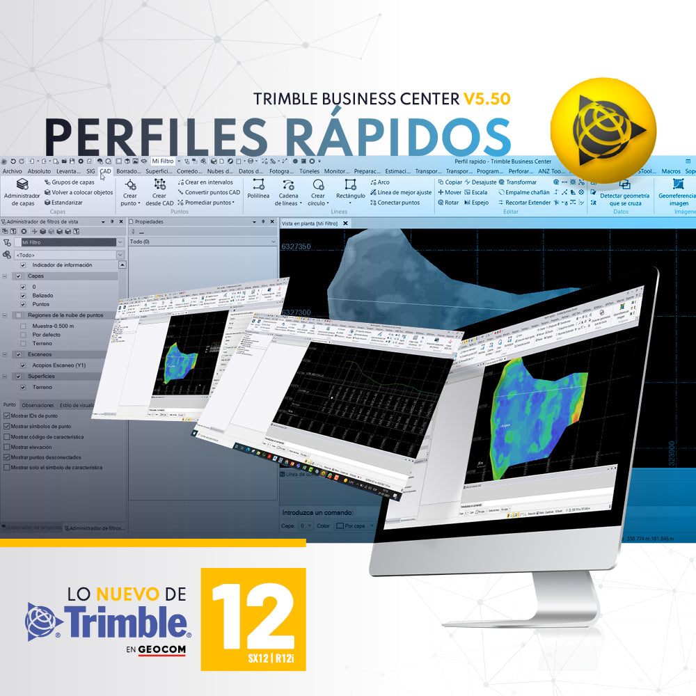
QUICK PROFILES WITH TRIMBLE BUSINESS CENTER v5.50
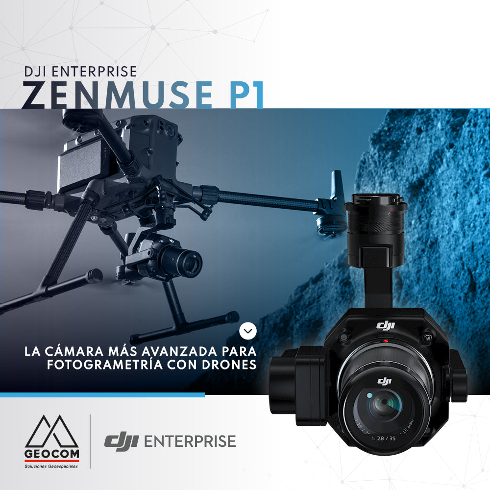
DJI Zenmuse P1, the most advanced drone photogrammetry camera

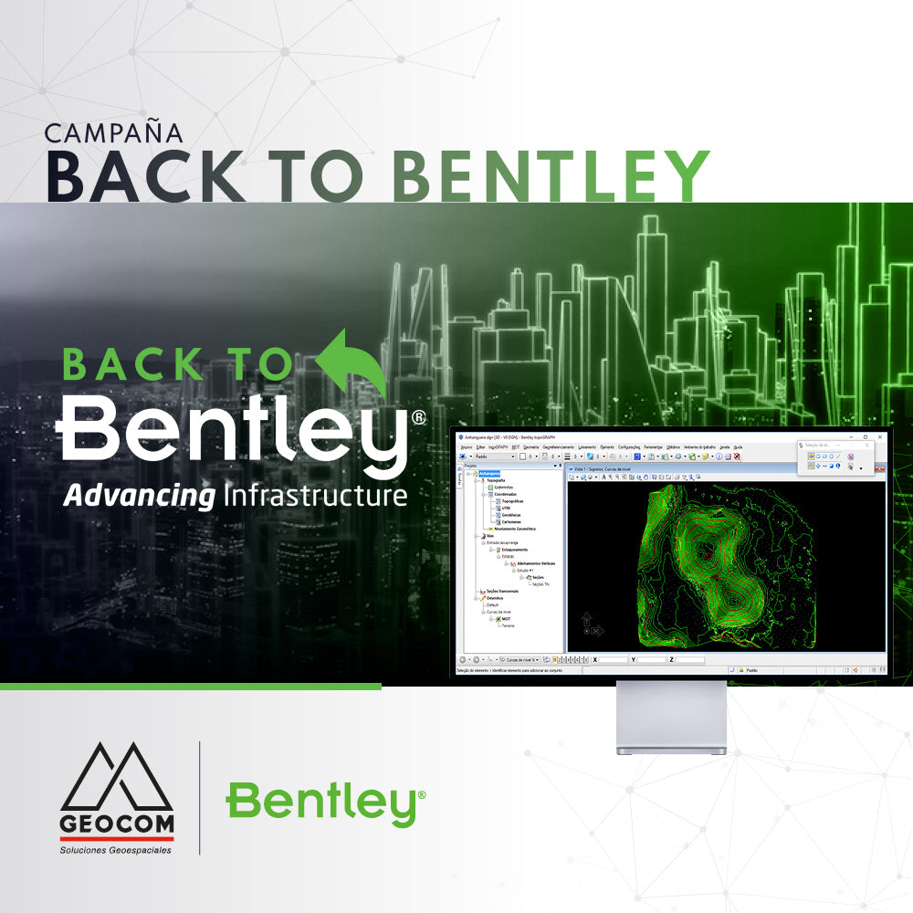
RE-ENROLL IN BENTLEY SYSTEMS' SELECT PLAN AT NO COST
Bentley launched the Back to Bentley campaign so users like you can return to your Select plan without any reinstallation costs.
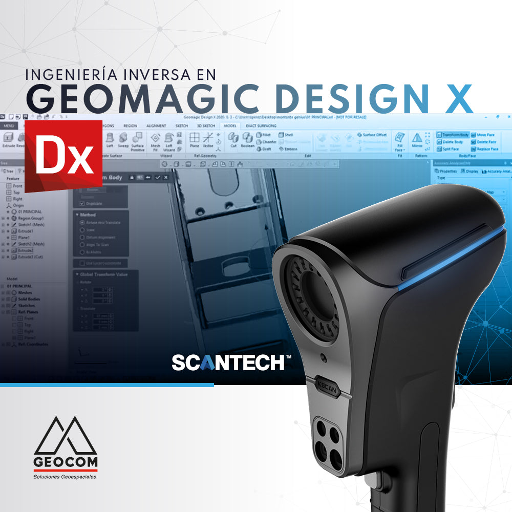
SCANTECH KSCAN20 | REVERSE ENGINEERING IN GEOMAGIC DESIGN X
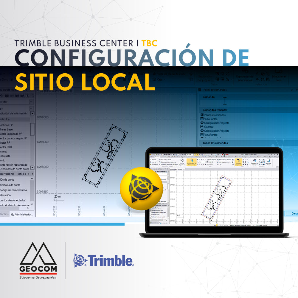
Trimble Business Center (TBC) Local Site Settings

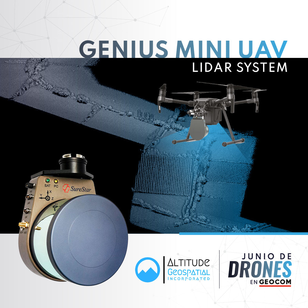
Seafloor Hydrone | Tailings Dam Floor Surveys
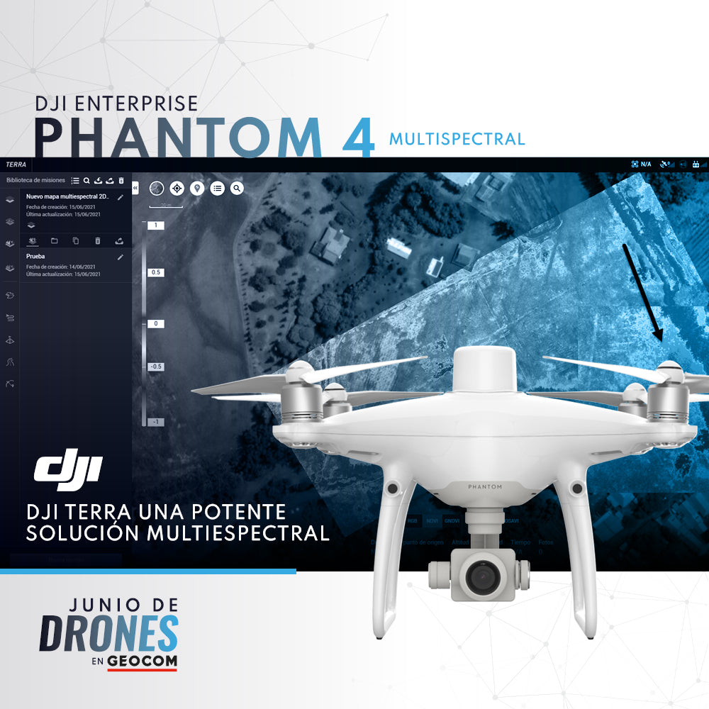
P4 Multispectral + DJI Terra: A Powerful Multispectral Solution
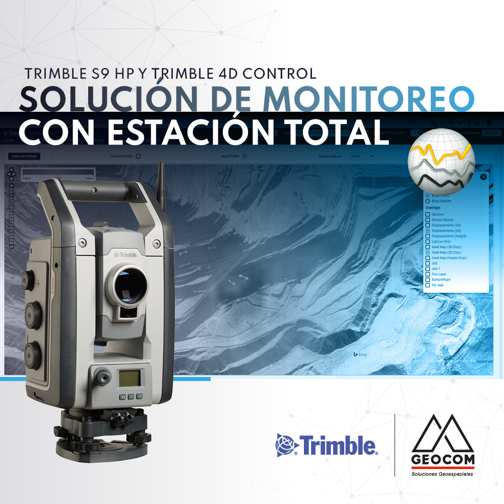
Monitoring solution with total station | Trimble S9 HP and Trimble 4D Control
If you are looking to automate precise total station observations for monitoring projects, we recommend the Trimble S9 HP + Trimble 4D Control (T4D) solution.
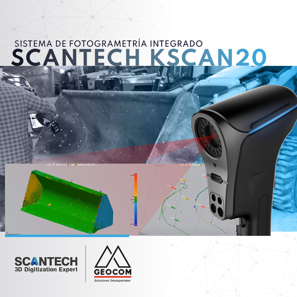
KScan20 | Integrated Photogrammetry System
Kscan20 has an integrated photogrammetry module, which allows us to optimize and obtain better results when capturing large components.

Trimble MX7 | Mobile Mapping Solutions for Telecommunications
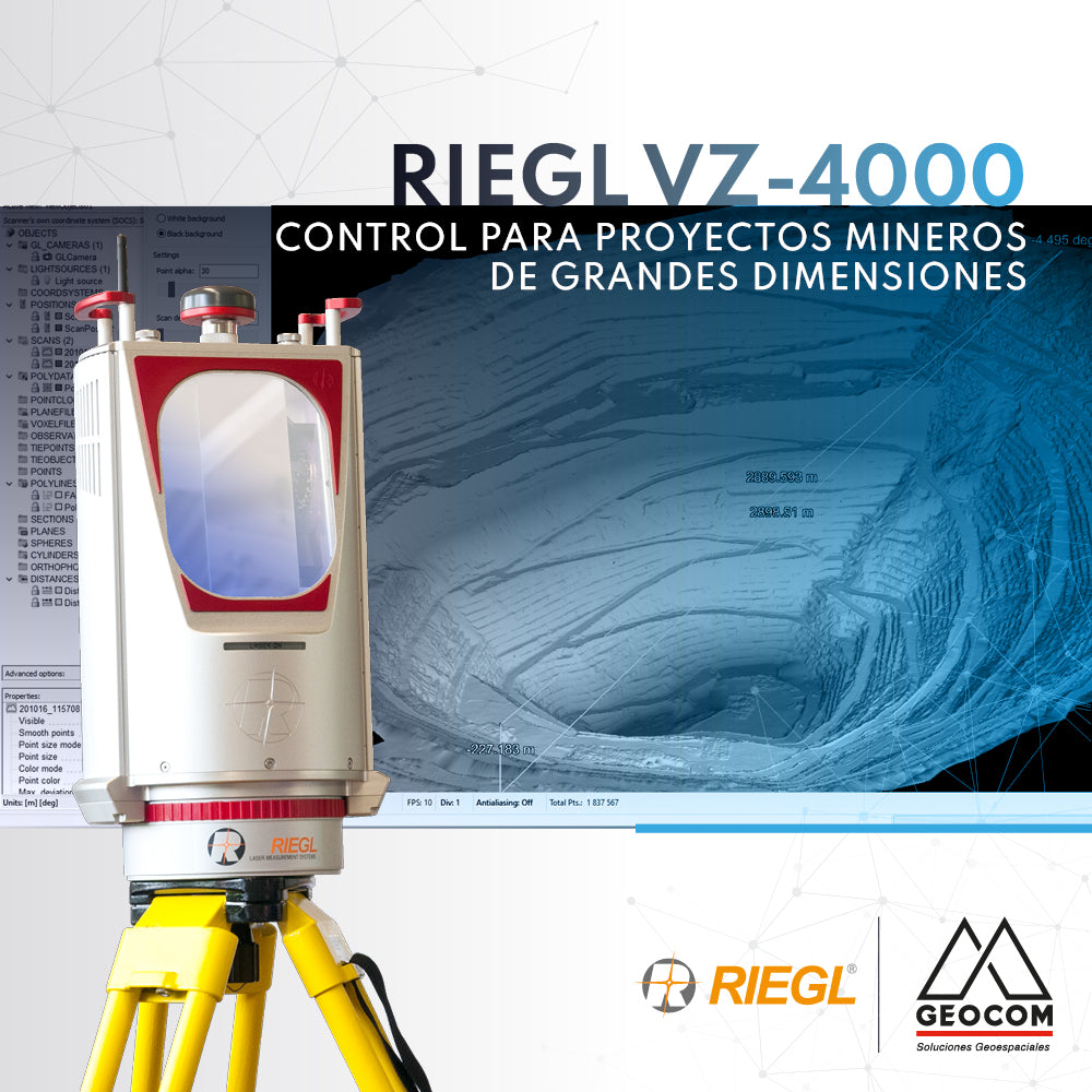
RIEGL VZ-4000 | Control for Large-Scale Mining Projects