

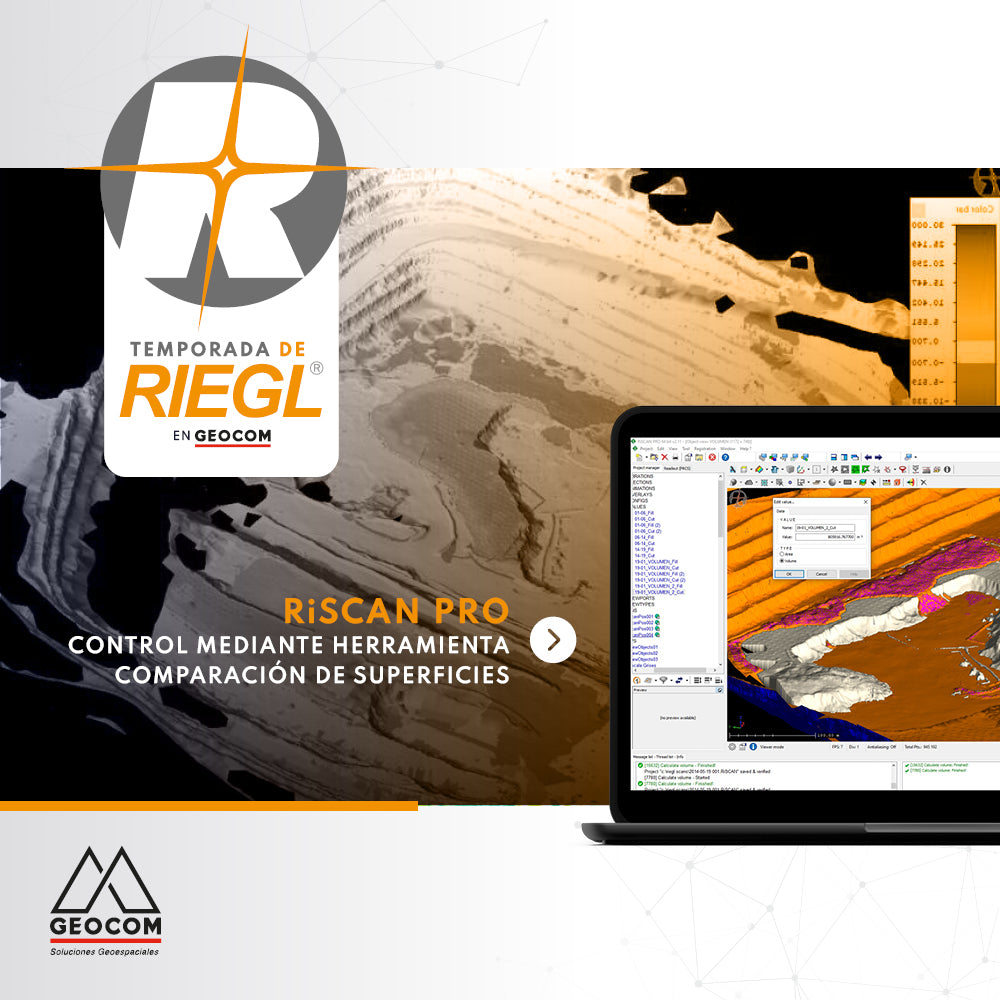
RiscanPro Software – Surface comparison tool control
Geospatial control is a very important task for reviewing the operational progress of a work area, as is comparing the current topography with respect to a design surface.
Escáner LáserEscáner Láser MóvilEscáner MóvilMineríaNoticiaNoticia GEOCOMRIEGLTBCTrimbleTrimble Business CenterWebinarWebinar GEOCOM

RIEGL Mobile Scanning System + TBC
Geospatial capture tools are currently very diverse. One of them is the Mobile Laser Scanner (MLS), which allows for high productivity in the field.
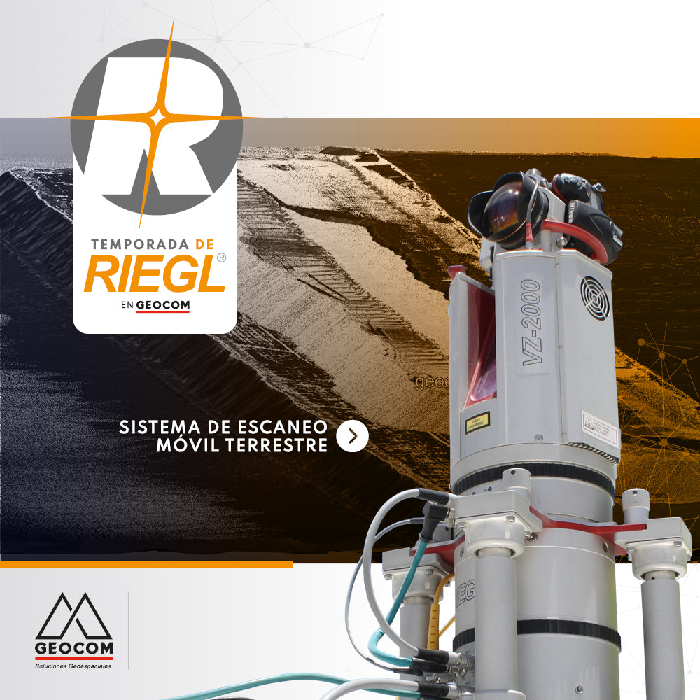
RIEGL - Terrestrial Mobile Scanning System
The Terrestrial Mobile Scanning Systems presented by RIEGL allow the capture of massive geospatial data with high accuracy from zones or areas of interest.
GEOCOMGNSSGNSS TrimbleNoticia GEOCOMReceptor GNSSRTKSoluciones GeoespacialestopografíaTrimbleTrimble R12iTrimble SX12WebinarWebinar GEOCOM

Integrated surveying is a methodology that combines satellite observation from Trimble R12i with terrestrial observation from SX12 in a common free station, which offers great flexibility when setting up the scanning total station.