


Trimble MX7 | Mobile Mapping Solutions for Telecommunications
Thanks to its 360° photography system, Trimble MX7 enables fast and safe visual inspection of large expanses of terrain.

Trimble Mx7 | Mobile Mapping System
Generating a cadastral survey or asset inventory in this day and age is an extremely complex task. This is due to the need to capture data in high-traffic areas or over large expanses.
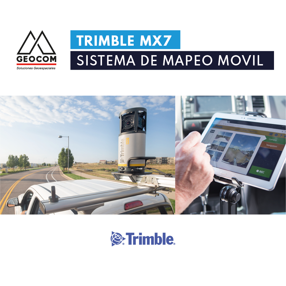
Capture field data faster and more efficiently, then extract features in the Trimble software platform.