News

Novedades de Trimble Access v2021.20

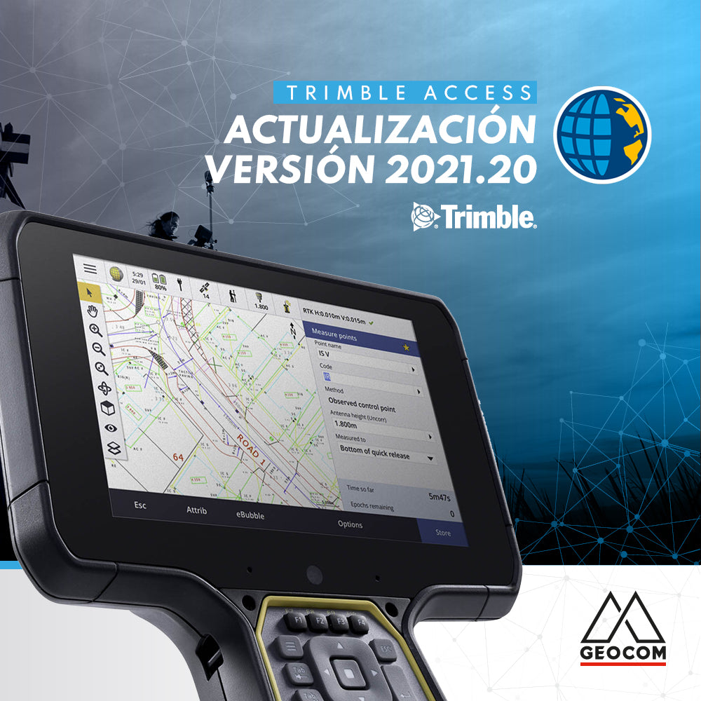
What's new in Trimble Access v2021.20

Trimble Access™ version 2021.20 is now available, offering new features and functionalities!

Read more

Lo nuevo en Actualización v5.60 TBC

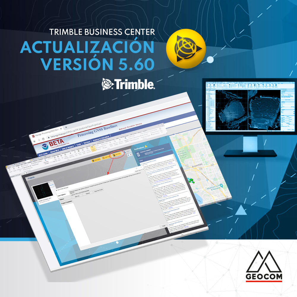
What's new in Update v5.60 TBC

Trimble Business Center (TBC) v5.60 was released on November 15, 2021. Below are the main new features of this version:

Read more

BIM, realidad aumentada y proyectos de vialidad

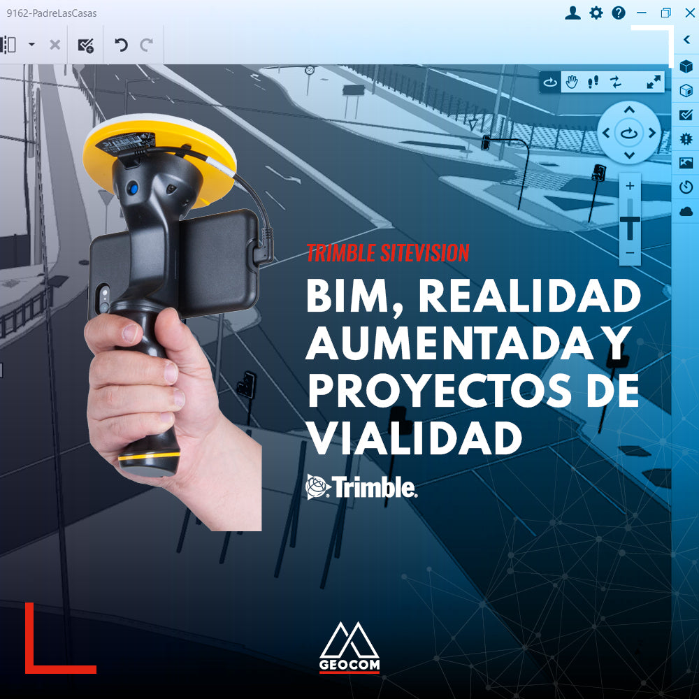
BIM, Augmented Reality, and Roadway Projects

The BIM methodology is already a reality in the lifecycle of many infrastructure projects in our country due to its various benefits. Discover them in this new Geocom news article.

Read more

CONCURSO FOTOGRÁFICO CALENDARIO GEOCOM 2022

GEOCOM 2022 CALENDAR PHOTO CONTEST

We want your photographs to be part of our next GEOCOM 2022 calendar, which is why we are looking for the best images of our Geospatial Solutions in the field.

Read more

Cambios en servicios Trimble RTX y Trimble xFill

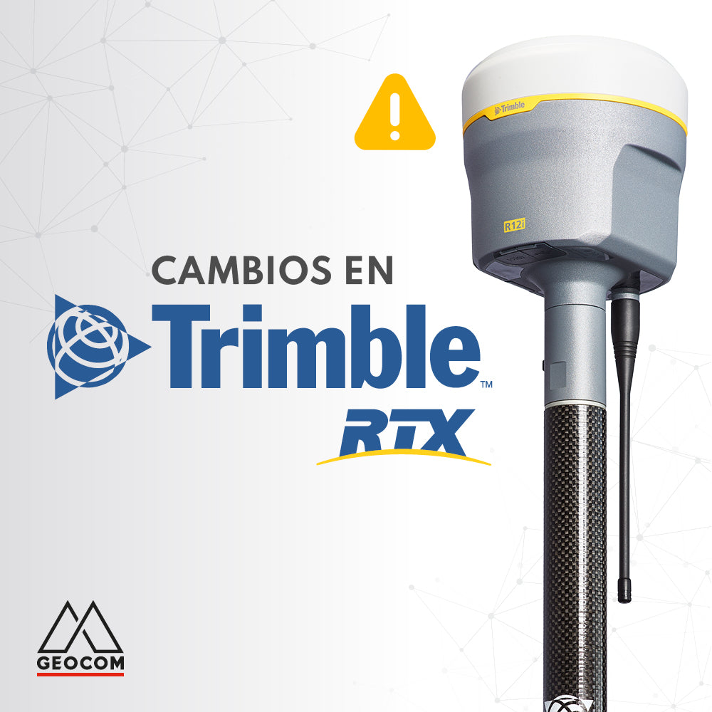
Changes to Trimble RTX and Trimble xFill services

Trimble RTX is undergoing some changes. The frequency and baud rate will change as follows:

Region: Latin America | Name: RTXAL | Frequency: 1545.285 MHz | Baud rate: 2400 bps

This change must be made before September 30.

Read more

Experiencia robótica en labores subterráneas con Trimble SX10

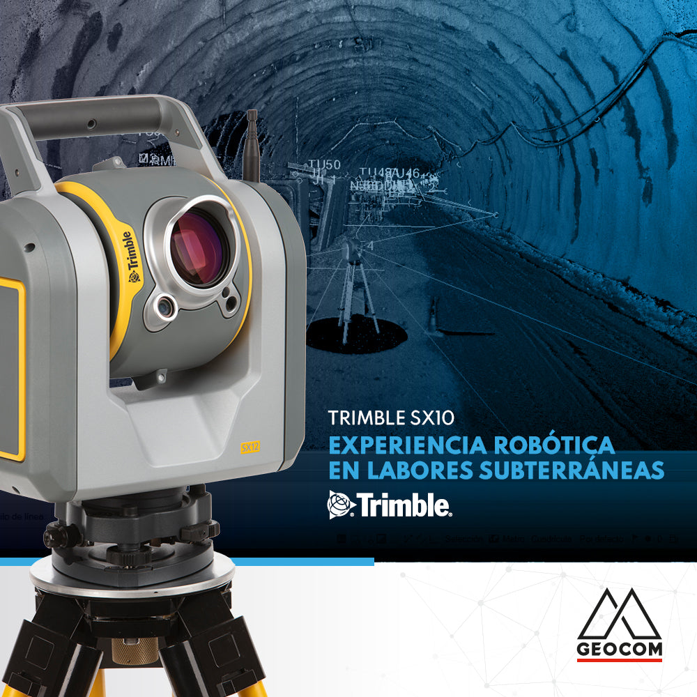
Robotic experience in underground work with Trimble SX10

The use of robotics in underground work combined with cyclical observations in a trisection to orient the equipment, allows us to apply techniques for an accurate result.

Read more

Conoce las últimas novedades de eMotion 3.20

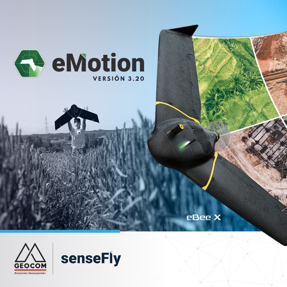
Learn about the latest eMotion 3.20 features

eMotion is the advanced, reliable, and intuitive multi-platform that supports our eBee X from flight planning to PPK trajectory processing.

Read more

RIEGL Sistema de escaneo móvil + TBC

RIEGL Mobile Scanning System + TBC

Geospatial capture tools are currently very diverse. One of them is the Mobile Laser Scanner (MLS), which allows for high productivity in the field.

Read more

AJUSTE LIBRE EN TRIMBLE BUSINESS CENTER

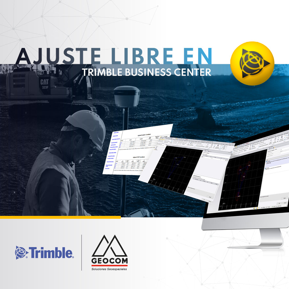
FREE ADJUSTMENT IN TRIMBLE BUSINESS CENTER

Trimble Business Center incorporates free adjustment of geodetic networks using the inner constraints approach, which allows the network to be evaluated by its internal geometry (observations)...

Read more

RIEGL - Sistema de Escaneo Móvil Terrestre

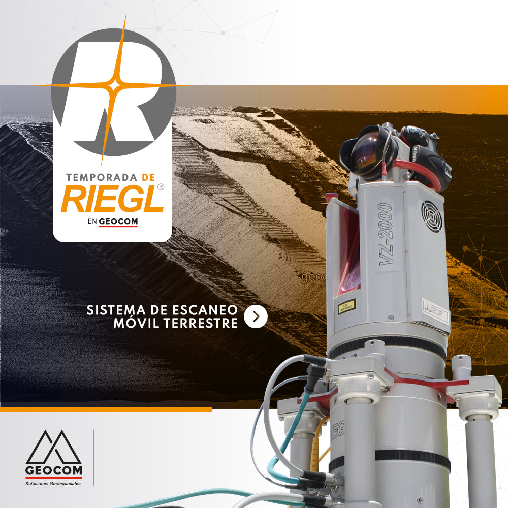
RIEGL - Terrestrial Mobile Scanning System

The Terrestrial Mobile Scanning Systems presented by RIEGL allow the capture of massive geospatial data with high accuracy from zones or areas of interest.

Read more

Puntería automática en estaciones totales Trimble

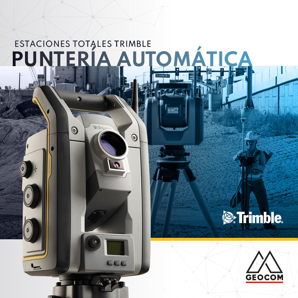
Trimble Total Stations Auto-Targeting

The implementation of automatic aiming technologies in Trimble total stations aims to increase the productivity and automation of land observations.

Read more

DJI Zenmuse P1, la cámara más avanzada para fotogrametría con drones

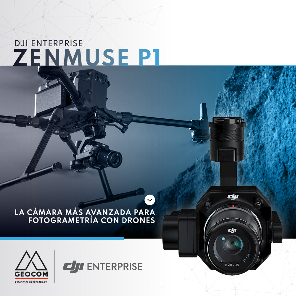
DJI Zenmuse P1, the most advanced drone photogrammetry camera

Due to its full-frame sensor and 45 MP resolution, the Zenmuse P1 is the camera that delivers the best results when performing a photogrammetric survey with commercial drones.

Read more

Topografía integrada

Integrated topography

Integrated surveying is a methodology that combines satellite observation from Trimble R12i with terrestrial observation from SX12 in a common free station, which offers great flexibility when setting up the scanning total station.

Read more

SCANTECH KSCAN20 | INGENIERÍA INVERSA EN GEOMAGIC DESIGN X

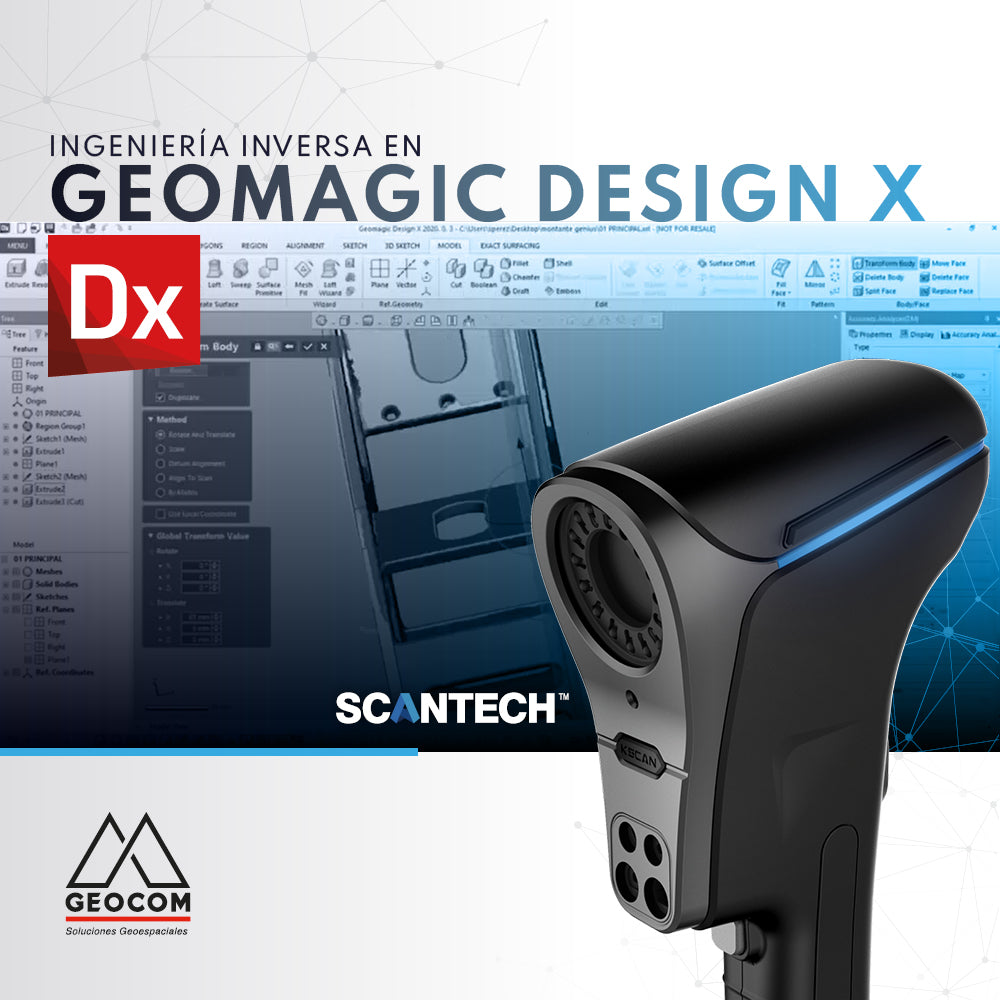
SCANTECH KSCAN20 | REVERSE ENGINEERING IN GEOMAGIC DESIGN X

Reverse engineering is the most efficient and effective way to generate a faithful digital equivalent of a scanned item.

Read more

Configuración de sitio local de Trimble Business Center (TBC)

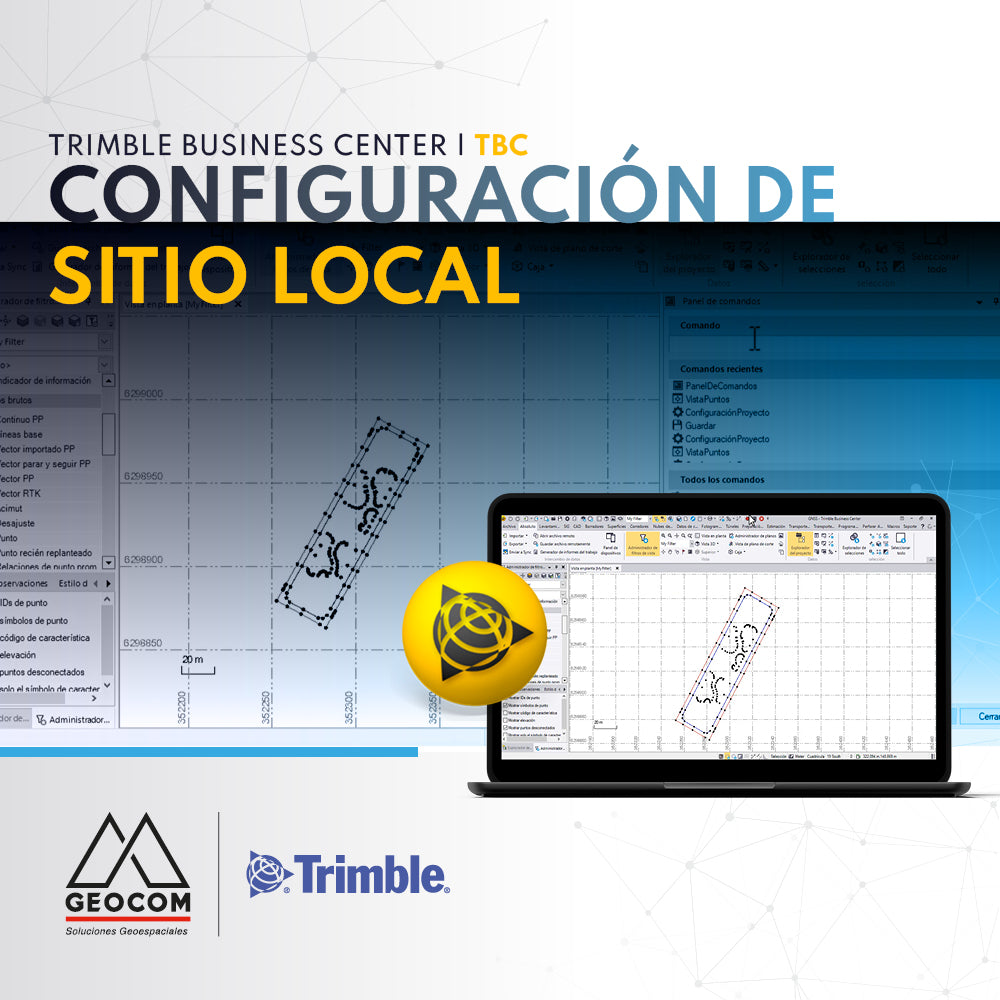
Trimble Business Center (TBC) Local Site Settings

Trimble Business Center (TBC) local site setup provides the user with the ground scale factor for the calculation and display of ground distances.

Read more