News

Nuevo modo de vuelo inteligente POI para DJI Mavic 3 Enterprise

New POI intelligent flight mode for DJI Mavic 3 Enterprise

DJI recently launched the new intelligent flight mode, POI (Point of Interest), which allows the Mavic 3 Enterprise drone to quickly orbit a central point of interest, with the aim of collecting 360° view photographs of the target.

Read more

Integración de dron y ecosonda para levantamientos batimétricos

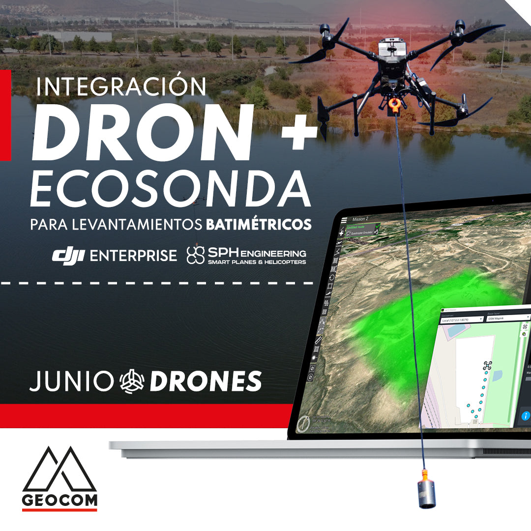
Drone and echo sounder integration for bathymetric surveys

With SPH Engineering, it is possible to mount an echosounder on a drone or UAV (unmanned aerial vehicle), thus allowing bathymetric surveys to be carried out more efficiently and with several advantages over traditional methods.

Read more

Trimble GNSS y su combinación con DJI

Trimble GNSS and its combination with DJI

The georeferencing of photogrammetric products is a key aspect for their use in different applications, allowing for the maintenance of a unique reference that enables robust and accurate multi-temporal analysis.

Read more

Aplicaciones LiDAR RIEGL en Drones

RIEGL LiDAR Applications on Drones

RIEGL offers a range of possibilities in the drone LiDAR segment, highlighting the miniVUX-3UAV, VUX-120, and VUX-160 sensors, which deliver a higher level of productivity and performance.

Read more

Promoción | Comienza el año agendando anticipadamente tu mantención anual

Promotion | Start the year by scheduling your annual maintenance in advance

20% OFF.* Annual maintenance in advance

40% OFF.* First maintenance for Trimble total stations

Read more

La revolución de los drones en labores de inspección

The drone revolution in inspection tasks

For inspection work, due to their robustness, stability, and operational safety, the Matrice 300 RTK and Matrice 30 Series drones stand out, as they offer optimized development for this type of function.

Read more

Una comparación entre Phantom 4 RTK y Zenmuse L1 en zonas boscosas

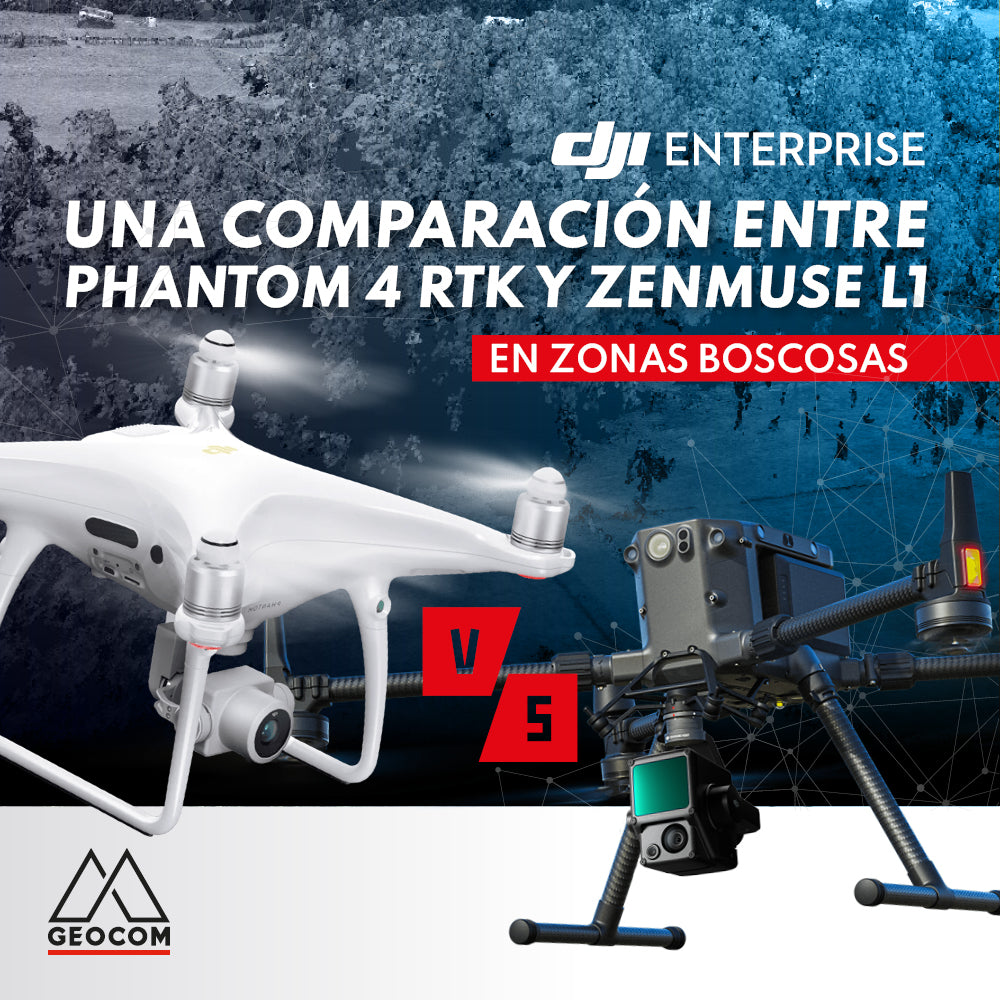
A comparison between Phantom 4 RTK and Zenmuse L1 in wooded areas

A comparison of photogrammetry and LiDAR in their ability to represent terrain in an area of abundant vegetation, with the aim of analyzing the main strengths and weaknesses of each technique under these conditions.

Read more

Conoce las novedades de la última versión de DJI Terra 3.3.0

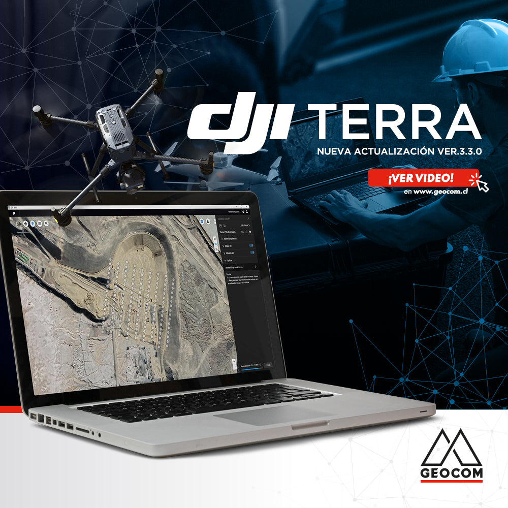
Learn about the new features in the latest version of DJI Terra 3.3.0

A new update was released at the end of January that includes interesting improvements for a much smoother and more optimized processing experience. Find out more details below:

Read more

Nueva actualización | senseFly eMotion 3.19

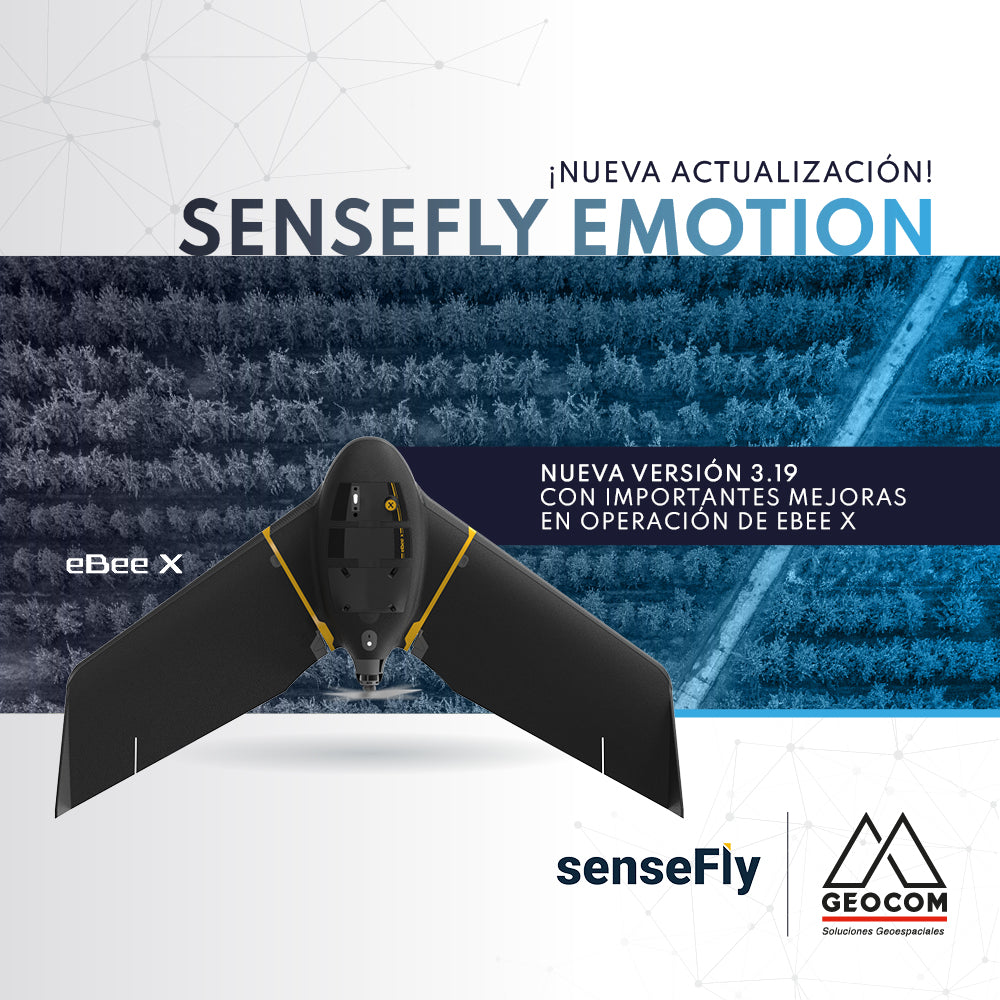
New update | senseFly eMotion 3.19

The new version 3.19 of senseFly's eMotion software is now available, bringing significant improvements to eBee X operation.

Read more

Promoción SenseFly eBee X - GEOCOM

SenseFly eBee X Promotion

We invite you to upgrade your equipment with a new eBee X premium fixed-wing drone.

Get a US$ 5,000 discount on the purchase of an eBee X.

Read more

SENSORES TÉRMICOS: INSPECCIÓN EN TIEMPO REAL

UAS News | THERMAL SENSORS: REAL-TIME INSPECTION

Currently, remote sensing monitoring at the local scale is increasing exponentially. This is due to great technological advances in recent years and the emergence of unmanned aerial systems as working tools in photogrammetric surveys and/or real-time visual inspection, along with their ability to carry a variety of sensors.

Read more

Software DJI Terra

DJI Terra Software

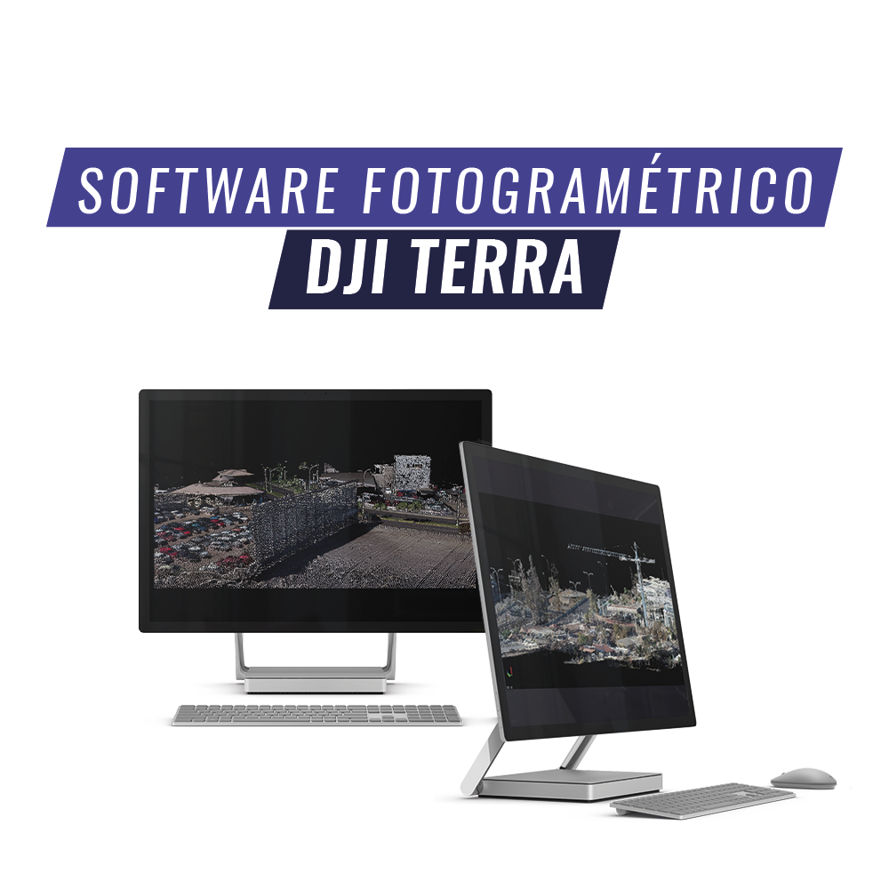
DJI Terra is an AI-powered mapping and processing platform that enables capture, analysis, and visualization. Its all-in-one solution helps industry users improve the efficiency of an entire workflow.

Read more

Dron Phantom 4 Multispectral DJI Enterprise

Phantom 4 Multispectral Drone DJI Enterprise

The new DJI Phantom 4 MULTISPECTRAL is the best equipment for Precision Agriculture, it is lightweight, portable, and easy to use, and is equipped with a 6-band multispectral camera, each of which has a 2 MP resolution.

Read more

REFERENCIACIÓN DIRECTA EN FOTOGRAMETRÍA AÉREA CON DRONES

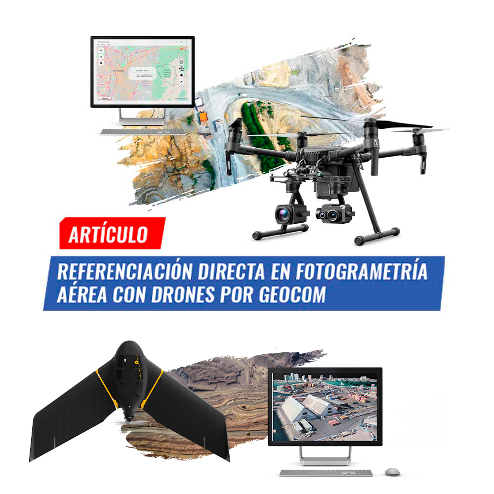
Direct Georeferencing in aerial photogrammetry with drones by GEOCOM

Photogrammetry has contributed greatly to data acquisition for topographic representation at various scales. Clearly, UAS (Unmanned Aerial Systems), better known as drones.

Read more