


5 Construction Errors a Topographic Airborne GPR Could Have Prevented
Are you going to work on a large construction or excavation project? If so, you shouldn't forget an important step in this process: utility mapping. This involves identifying the exact location of all underground utility infrastructure, such as gas lines, water pipes, electrical lines, and communication lines, among others, to avoid accidentally damaging them in the process and prevent being responsible for a large and costly disaster.
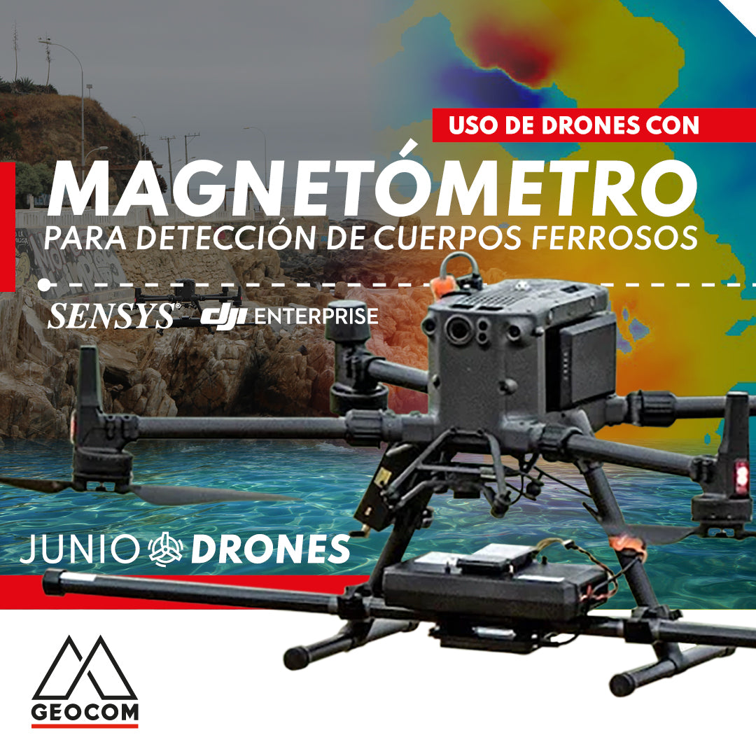
Use of drones with magnetometers for ferrous body detection
The integration of the magnetometer with the M300 is carried out by SPH Engineering, which includes a SENSYS magnetometer (R3 or R4 model depending on the number of sensors), a radar altimeter to measure precise height above different surfaces, an onboard computer called SkyHub, and the advanced planning software UgCS.