

![[Webinar Trimble ] GNSS accesible y a tu medida](http://www.geocom.cl/cdn/shop/articles/vlcsnap-2026-05-14-16h37m40s802baja_911f8566-5669-4215-8e96-152f08decd0f.jpg?v=1781790448&width=2000)
[Webinar Trimble ] GNSS accesible y a tu medida
![[Webinar GEOCOM ] Del mundo real al entorno digital](http://www.geocom.cl/cdn/shop/articles/6ntwmxqpr1gup2xj_6e532050-4b16-4903-9c3d-a36d6c720559.webp?v=1779974628&width=4096)
[Webinar GEOCOM ] Del mundo real al entorno digital
![[WEBINAR GEOCOM] Gaussian Splatting en DJI Terra](http://www.geocom.cl/cdn/shop/articles/software-dji-terra-fotogrametria-escritorio-profesional_308b4d0e-850d-43c1-b56d-a8890ad826e3.jpg?v=1778186099&width=1600)
[GEOCOM WEBINAR] Gaussian Splatting in DJI Terra
THURSDAY, MAY 07 | 11:00 AM (GMT-4) | ZOOM & YOUTUBE LIVE
In this webinar developed by GEOCOM's UAS area, we will explore the implementation of Gaussian Splatting in DJI Terra software.
![[Webinar GEOCOM] Inspección en minería subterránea](http://www.geocom.cl/cdn/shop/articles/post_Webinar_Inspeccion_mineriasubterranea_9a552cde-0b0b-4c8e-b6d1-fb7fca479132.jpg?v=1776803064&width=1080)
[GEOCOM Webinar] Underground Mining Inspection
Watch the webinar recording!
Discover how drones inspect inaccessible areas quickly and safely, reducing risks. Learn about success stories, workflows, and real data analysis.
![[Webinar GEOCOM] Inspección de infraestructura con Twinspect](http://www.geocom.cl/cdn/shop/articles/post_Webinar_Inspeccion_infraestructura_Twinspect.jpg?v=1776799897&width=1080)
[Webinar GEOCOM] Infrastructure inspection with Twinspect
NOW AVAILABLE!
Based on real-world cases, such as detailed bridge inspections, the complete workflow will be showcased, from aerial image capture to AI-powered detection of existing damage.
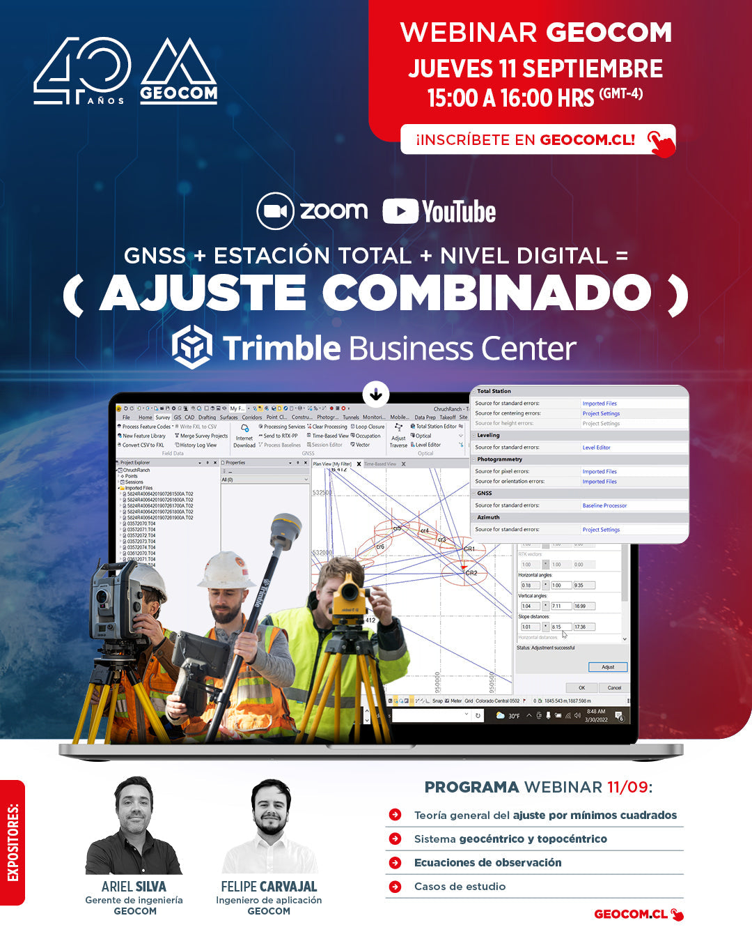
GEOCOM Webinar | GNSS + Total Station + Digital Level = Combined Adjustment in TBC
NOW AVAILABLE! | ZOOM & YOUTUBE LIVE
Satellite observations can be combined with terrestrial observations in a single project, achieving high effectiveness in the precise determination of coordinates for engineering works.
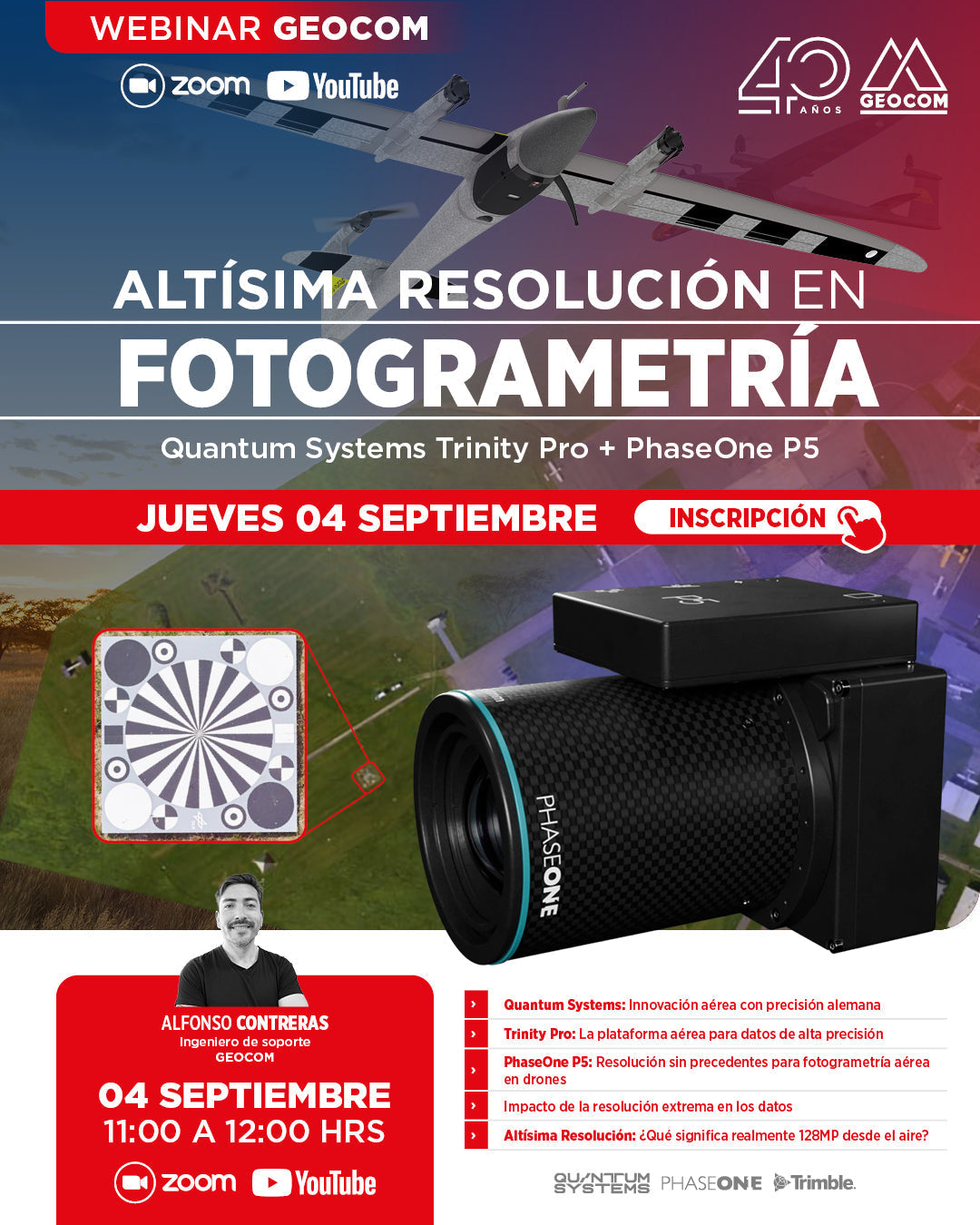
GEOCOM Webinar | Ultra-high resolution in photogrammetry: Trinity Pro + PhaseOne P5
NOW AVAILABLE! | ZOOM & YOUTUBE LIVE
In this webinar, we will discover how the combination of the Trinity Pro, one of the most advanced VTOL drones on the market, and the 128-megapixel PhaseOne P5 camera, marks the beginning of a new geospatial trend associated with high resolution.

Geocom Webinar | DJI Matrice 400
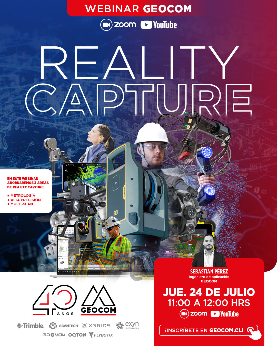
GEOCOM WEBINAR | Reality Capture
NOW AVAILABLE | YOUTUBE LIVE
In this webinar, we will address 3 areas of Reality Capture: Metrology, High Precision, and Multi-SLAM.
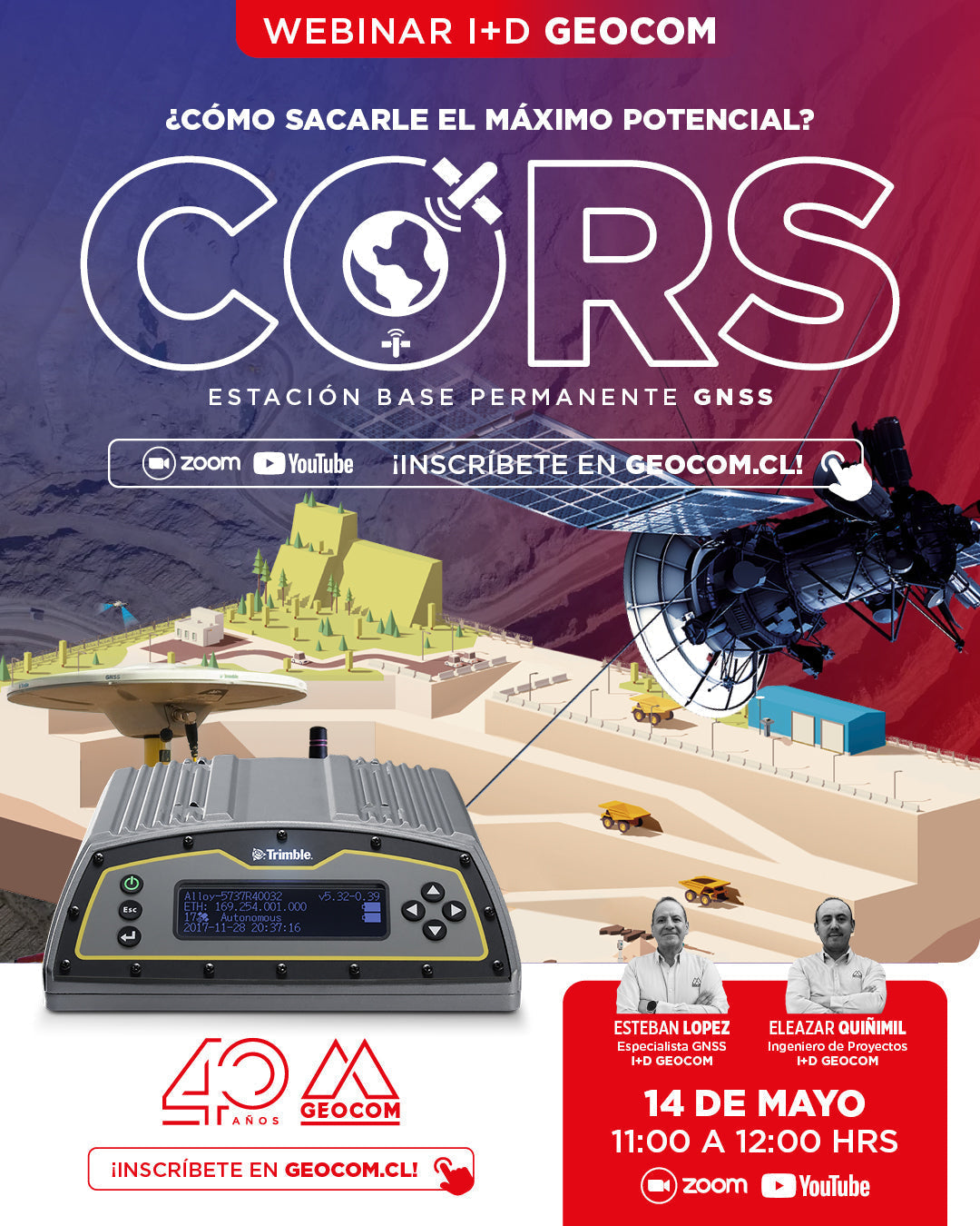
R&D WEBINAR | CORS/GNSS: How to unlock its full potential?
NOW AVAILABLE!
CORS, reference station, or base station. Regardless of what we call it, its importance in the present and future of high-precision GNSS positioning is undeniable.
WEBINAR GEOCOM | Smart Aerial Inspection with SkyVisor
NOW AVAILABLE!
In this webinar, we will thoroughly review the features and functionalities of SKYVISOR software, with practical examples from photovoltaic plants and wind turbines.

WEBINAR | An Introduction to Multi-SLAM and Gaussian Splatting
NOW AVAILABLE!
We invite you to this webinar, a GEOCOM proposal to explain the latest advances in XGRIDS, where we will explore innovative technologies that are transforming 3D capture and reconstruction.
Webinar | DJI Matrice 4 Series: The Beginning of a New Era in Drones?
NOW AVAILABLE!
We invite you to this new Webinar developed by GEOCOM's UAS area, where we will explore in detail the advanced capabilities of this new DJI drone and the impact it will have on the industry.
Webinar | Advanced 3D Reconstructions in TBC Aerial Photogrammetry
THURSDAY, JUNE 06 | 11:00 AM | VIA ZOOM & YOUTUBE LIVE
We invite you to this new Webinar developed by GEOCOM's UAS area, where we will explore photogrammetric fundamentals, experiences with DJI drones, and detail all the new features of Trimble Business Center Aerial Photogrammetry in its latest version.
Webinar | DJI Zenmuse L2: Revolutionizing the level of detail in LiDAR capture
NOW AVAILABLE! | Web & YouTube
We invite you to this new GEOCOM Webinar, which will be presented by the UAS area in conjunction with our client ABSS, who has extensive experience using the L1 LiDAR sensor and now also the new Zenmuse L2.