

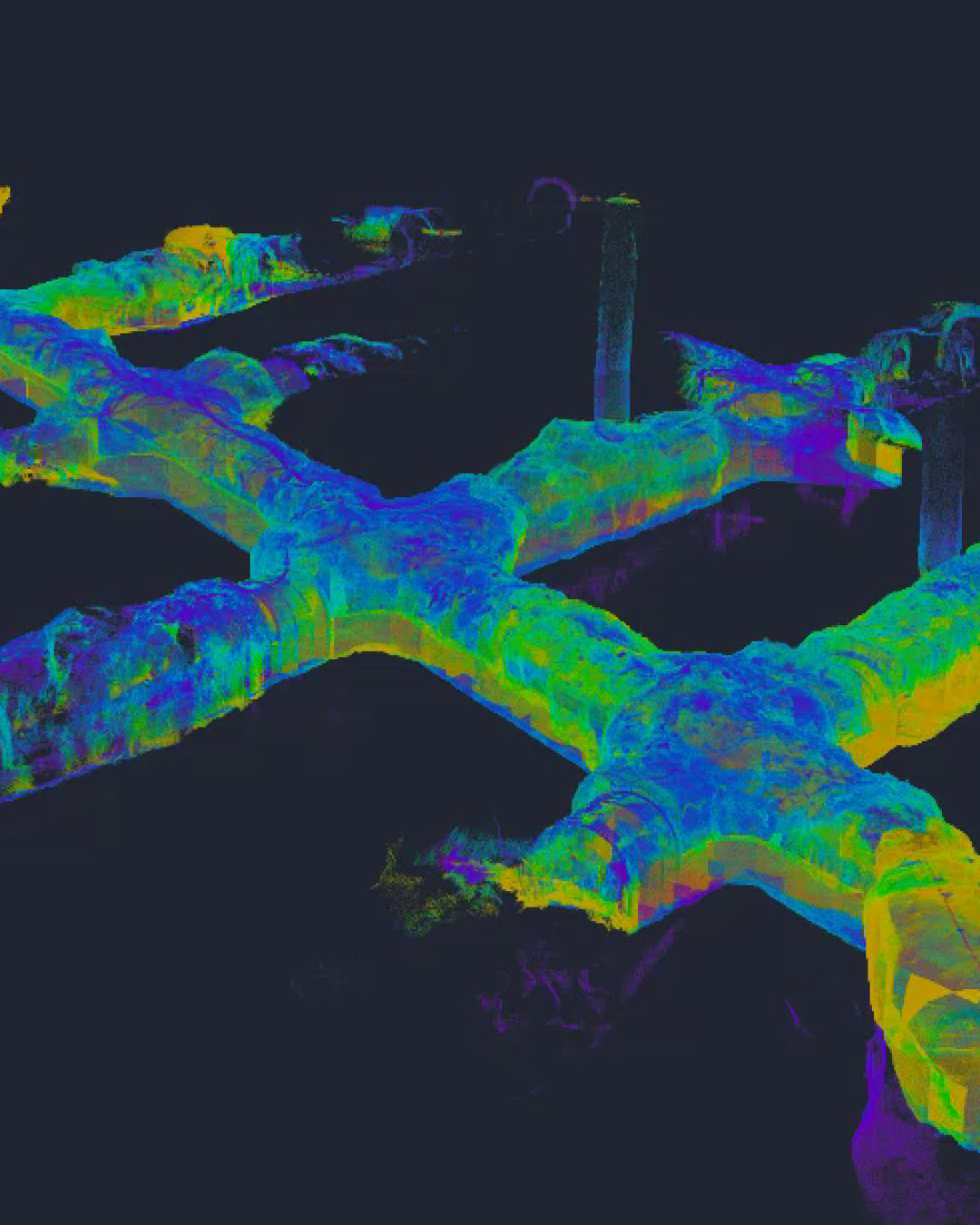
XGRIDS Lixel L2 Pro: Boost your productivity with on-the-go scanning in underground mining
In a recent experience in active tunnels, the XGRIDS mobile system demonstrated its capability by scanning 1.5 kilometers in less than two hours, eliminating operational interruptions and ensuring centimeter-level accuracy.
Efficiency and operational continuity are the pillars of modern mining, and in the field of underground surveying, the transition from static methods to mobile technologies is marking a before and after. Recently, the GEOCOM team conducted a critical survey using the Multi-SLAM XGRIDS Lixel L2 Pro system, achieving productivity milestones that previously seemed unattainable in active tunnel environments.

High Productivity: 1.5 km in record time
Traditionally, tunnel scanning with static equipment requires multiple setups, operational stops, and long capture times. However, in this instance, the use of mobile technology allowed for scanning 1.5 kilometers in less than 2 hours.
As it is a SLAM, measurement is dramatically simplified: the operator simply walks through the tunnel. This methodology not only minimizes interference with moving machinery but also allows access to hard-to-reach areas where traditional tripods cannot be set up.

The power of Multi-SLAM and the "Narrow" algorithm
The XGRIDS Lixel L2 Pro is not a conventional SLAM scanner. Its Multi-SLAM engine integrates data from LiDAR, dual 48 MP cameras, and inertial measurement unit (IMU) information processed using artificial intelligence.
For projects in underground environments, the equipment stands out for:
- "Narrow" Algorithm: Specifically optimized for tunnels and narrow corridors, avoiding common drifts in traditional SLAM systems in confined spaces.
- Topographic Grade Accuracy: Offers a relative accuracy of 1 cm and absolute accuracy of 3 cm, allowing the point cloud to perfectly adjust to project coordinates using ground control points.
-
LixelUpSample™: This technology reduces point cloud noise to just 5 mm, delivering data ready for detailed analysis and precise volume calculations.


Proven Versatility in the Field
This tunnel experience adds to a series of success stories documented by GEOCOM. Previously, the system had already demonstrated its robustness in industrial processing plants (as shown in its recent technical demonstrations), where the ability to capture photorealistic point clouds in real-time allows for immediate decision-making without the need for lengthy office processes.
Even in large-scale linear applications, the L2 Pro can be mounted on vehicles, reaching capture speeds of up to 40 km/h, making it one of the most versatile tools in the reality capture portfolio.
Compartir:
GEOCOM introduces GEOCASTER: The new era of free NTRIP connectivity for our clients
Trimble Positioning Hub: The New Trimble RTX PP Space