

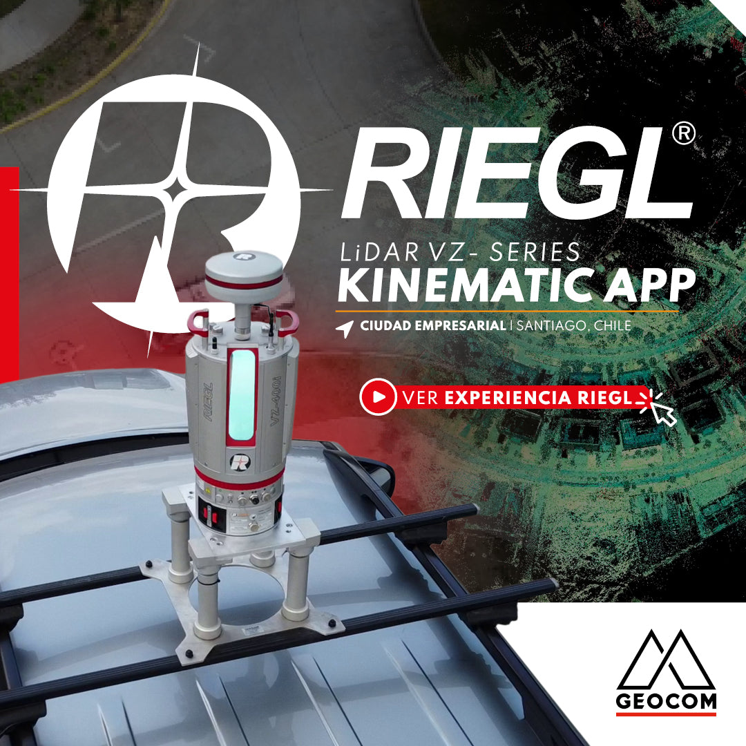

RIEGL VZi-Series: Kinematic Measurements with Terrestrial LiDAR Equipment (TLS)
Experience in Ciudad Empresarial, Santiago, Chile
The importance of performing safe and in-motion scans is a constant challenge in engineering and infrastructure projects. Through various LiDAR capture techniques, a tool is incorporated that allows transforming a static LiDAR into a kinematic one, by integrating LiDAR + GNSS RTK + internal IMU data (an expert one is not necessary). Together with the Kinematic APP, this allows for kinematic captures using a vehicle of the various areas that need to be captured.

By using a RIEGL GNSS RTK antenna that provides centimetric positioning at all times (for example, through NTRIP corrections) and the Kinematic APP, which allows controlling the necessary configurations to perform this in-motion capture, a kinematic system for in-motion captures is set up.
Through different configuration options, kinematic captures can be performed in the following ways:
⨮ RADAR Mode – LiDAR equipment rotates 360° while moving. Speed up to ~10 km/hr
⨮ FIXED Mode – LiDAR equipment is fixed while moving. Speed up to ~15 km/hr
In this urban project, carried out in Ciudad Empresarial, we can review the potential that exists in the use of this kinematic capture method, allowing to cover a large area in very short times, compared to the static scanning methodology, providing a high representativeness of the study area along with precise georeferencing.


Compartir:
Total Stations in Geomonitoring: Performance and Continuous Installations
Trimble ProPoint Engine: Next-Generation Centimeter-Level Positioning and Orientation