


RIEGL LiDAR: Railway Infrastructure Applications
Maipo River Railway Bridge - Existing Structure Inspection and Control
Current Situation
As we developed in the San Rafael Station project, https://www.geocom.cl/blogs/news/lidar-riegl-infraestructura-ferroviaria-estacion-san-rafael, it is relevant in railway infrastructure to identify and survey existing elements in the corresponding right-of-way.
Another important aspect to consider is the inspection and control of existing structures.
By using geospatial techniques such as LiDAR presented by RIEGL, it is possible to obtain a highly representative analysis and study of the work, obtaining as initial data a high-definition, highly representative point cloud with a high level of precision appropriate for these challenges.
With this data, rich in attributes and technical aspects, the technical area responsible for analyzing and inspecting the work receives high-quality input data, which helps prevent and control potential incidents in the study work through a detailed inspection of the various elements that make up the structure.
Maipo River Railway Bridge Project Development
This emblematic structure, located at the southern exit of Santiago, allowed the railway to reach the city of Rancagua in 1859. It is a highly important infrastructure given its crucial logistical role. To date, various works have been carried out to maintain its structural condition and to expand and reinforce the original load capacity.

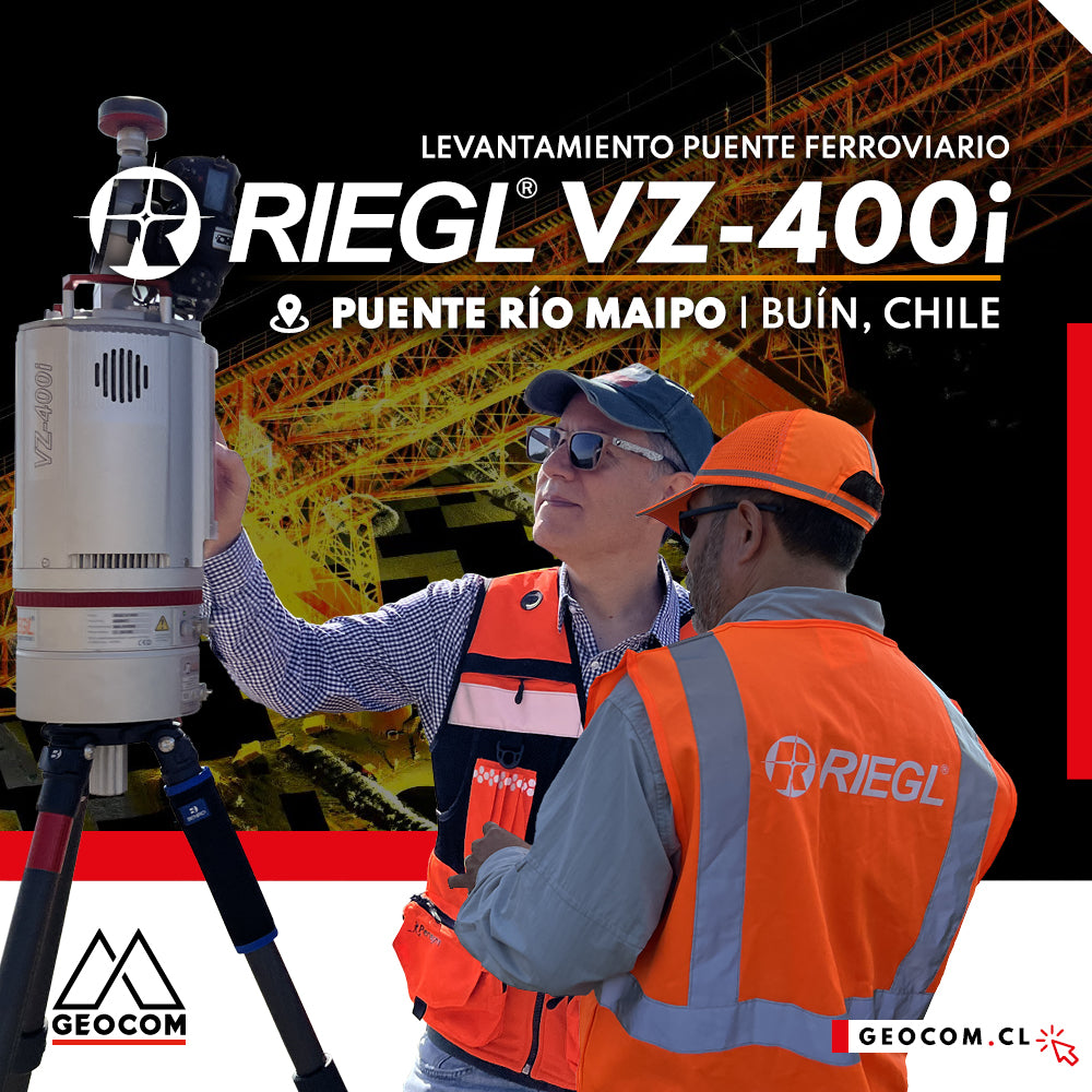
In this project, our main motivation is to demonstrate the importance of using LiDAR technology for Railway Infrastructure Inspection and Control, using RIEGL LiDAR technology. The scanning was performed with the VZ-400i sensor to obtain point cloud data with color attributes, with the aim of conducting various analyses and representations of this important structure.

Among the generated results, we obtained the following products:
- Point cloud: can be obtained in various formats, for example, LAS.
- Different views or sections.
- Cuts or sections of different areas, to show the state of the structure with great precision.
- Identification of various existing assets.
To carry out this project, we did the following:
- LiDAR used: RIEGL VZ-400i.
- Capture methodology: static, installed on an ultralight carbon fiber tripod.
- A total of 67 scanner positions.
- Execution time: 2 hours.
- Around 730 million points.
- Panorama 40 = 40 mdeg – 70mm resolution at 100m.
- Cloud + photo capture = 46 seconds (simultaneously).
- Total section: approximately 465m, carried out from the old bridge, next to the railway bridge.
The use of Panorama 40 mode provides a high level of detail, balancing the amount of data captured, simultaneous capture of high-resolution photographic images, and an appropriate capture time, making this scanning pattern a standard.

In the workflow used with the VZ-400i, the OneTouch work scheme is used, setting the angular resolution to Panorama 40 and the measurement program to the fastest mode at 1200 kHz.
Additionally, Automatic Registration is configured so that, parallel to scanning, the VZ-i's second computer registers each scanner position.
At scanning position 56, a window with a scanning resolution of 0.02° is established, which translates to a spatial spacing of 6.9cm at 200m.

This workflow is highly productive, as the equipment is simply moved from one place to another and the START icon is pressed.

In the data processing stage, using RiscanPro 2.16.2 software (Go to RIEGL tips), a set of tasks are performed automatically using the One-Touch Processing Wizard.
One-Touch Processing Wizard, in this version 2.16.2, has a total of 16 tasks.

The following task groups stand out:
- Cloud filtering by reflectivity, deviation, and echoes, if required.
- Automatic registration and Multi-adjustment: in this process, the various sensors of the scanner, along with GNSS and the Multi-adjustment tool, can be fully utilized. This process can be performed in the field, parallel to the capture in the VZ-400i, by activating On-Board Registration.
- Camera calibration and cloud coloring: the initially established calibration for that particular installation can be improved to increase the precision of the cloud-pixel relationship. With this new calibration, the clouds are colored for each of the scans.

- Identification of dynamic objects such as vehicles, people, or any element considered dynamic, and identification of clouds that are only present in one scan, necessary to obtain the scene as filtered as possible from these elements, especially in areas of high interaction, such as infrastructure and urban environments.


Cyan: Single Source Point / Magenta: Dynamic Object Point

- Cloud spacing filtering: up to 4 different cloud spacing outputs can be defined for later export to other software and generation of deliverables. This, in conjunction with export in LAS format, allows the entire process to be carried out in a single workflow until a point cloud is obtained.

Visualization and Deliverable Generation
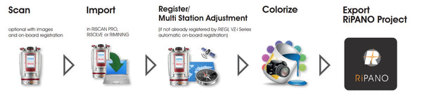
One of the tools presented by RIEGL is the RiPANO software, which is a fast and easy visualization software for terrestrial LiDAR projects.
It allows CAD users to easily extract orthogonal views and graphics for later use in the software or for direct visualization using their browser.
This is enabled by exporting the complete project, or only the required and useful positions, from RiSCAN PRO. (http://www.riegl.com/media-events/multimedia-apps/riegl-ripano/)
Workflow from capture to export in RiPANO


Height Filter
This interesting tool allows quick point cloud management by defining certain visualization parameters, such as using reference planes to generate the visualization reference.
In this way, we gain an understanding of the entire point cloud from a different perspective, enabling evaluation and inspection through this tool.

RiPANO - Maipo Bridge Project
Once exported from RiSCAN PRO software, we have different ways to frame the executed project through various visualizations, where all the scans present at the time of export are displayed.


Pillar Structure INSPECTION
If a scanning position is selected, everything captured from that position can be viewed in a complete view.

At this point, we can query and dimension the scene and export the dimensioned elements.

Section Extraction
Various tools are available for extracting sections.

Side View: A longitudinal profile of the study area.
Section : Sections
Plan View : Plan of an area.

There are various parameters to define how to extract and visualize the identified section.

We can export this visualization in PDF, image, and DXF formats for use in CAD.

Publication of Results:
The file structure generated by RiPANO allows data to be hosted on a server, enabling queries via an internet connection and a web viewer.
In this way, the data becomes available for any type of query within the RiPANO context, for any user with the access link.

RIEGL RiPANO Maipo Bridge Project
To access the Maipo Bridge project, you can check it by clicking on the following link.

To obtain other projects from the RIEGL portal, you can do so using the following links.
RIEGL RiPANO Link
http://www.riegl.com/media-events/multimedia-apps/riegl-ripano/
Click on the image or the following link and follow the instructions.

We invite you to review this project in more detail and see how accessible it is to use this RIEGL LiDAR capture technique, along with well-established workflows from point cloud acquisition to the generation of various deliverables.
Compartir:
Where to measure an instrumental height on a Trimble GNSS receiver?
WEBINAR | Redefining Industry Standards with the new Mavic 3 Enterprise