

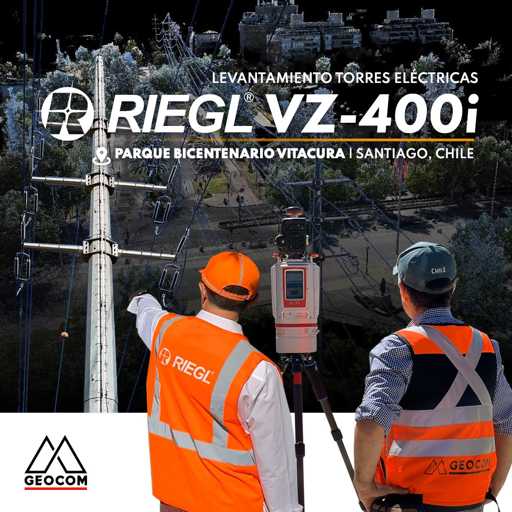

RIEGL LiDAR: Urban Infrastructure – Electrical Transmission Towers
Urban development results in the coexistence of existing elements and new constructions. In the case of Santiago, the electrical transmission systems, visible through high-voltage lines, manifested as elevated conductors by means of towers, leave their mark on the territory, materially shaping public space.
This is evident next to the Bicentennial Park, in the municipality of Vitacura, where along Avenida Alonso de Córdoba, the existing relationship between the urban environment and overhead power lines is visible through towers, which can be seen originating from the Santiago Metropolitan Park, continuing along Avenida Alonso de Córdova, which then follows Avenida IV Centenario; between the municipalities of Vitacura, Las Condes and La Reina.
In this type of infrastructure project, where urban elements and electrical infrastructure are framed within a complex topographical context such as hills and parks, it is possible to capture reality using Geospatial techniques such as RIEGL's LiDAR, with static work instrumentation, capturing with high precision, great representativeness, and highly productive execution times. In addition, it is possible to have simple and intuitive visualization tools, and deliver reports in very standardized formats such as a PDF document or WEB publication.
Project Development – Electrical Towers
Bicentennial Park is a public park located in the municipality of Vitacura, in the city of Santiago, next to the Mapocho River, covering approximately 27 hectares. From this point and continuing along Avenida Alonso de Córdova, an electrical transmission axis is deployed by means of large electrical towers.

This project was approached and executed in conjunction with Claudio Avello from RIEGL, using the technology presented by the RIEGL VZ-400i LiDAR equipment.
Among the generated results, we obtained the following deliverables:
- Point cloud in LAS format
- Floor plans with existing elements
- Cuts or sections of different areas, to show the state and inspection of the towers with high precision
- Identification of various existing assets
To carry out this project, we did the following:
- LiDAR used RIEGL VZ-400i
- Capture methodology: static, installed on an ultralight carbon fiber tripod
- A total of 70 scanner positions
- Execution time: 2 hours 15 minutes
- Around 690 million points
- Panorama 50 = 50 mdeg – 87mm resolution at 100m (allows up to 14.4 million points)
- Cloud + photo capture = 30 seconds (simultaneously)
- 470m total linear of streets and 300m of power lines


The Panorama 50 mode was used to achieve a balance between the quantity of captured data, simultaneous capture of high-resolution photographic images, and an adequate scanning time, positioning this scanning pattern as the standard for all positions performed.

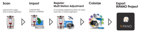
In the workflow used with the VZ-400i, the OneTouch work scheme is used, setting the angular resolution to Panorama 50 and the measurement program to the fastest mode at 1200 kHz.
Additionally, Automatic Registration is configured so that, parallel to the scanning process, the VZ-i's second computer performs the registration of each scanner position.
This workflow is highly productive, as the equipment is simply moved from one location to another and the START icon is pressed.

In the data processing stage, and by using RiscanPro 2.16 software (link to RIEGL tips), a set of tasks are performed automatically using the One-Touch Processing Wizard.
One-Touch Processing Wizard, In this version 2.16, there are a total of 16 tasks.

The following task groups stand out:
- Cloud filtering by reflectivity, deviation, and echoes, if required.
- Automatic registration and Multi-adjustment: in this process, the scanner's various sensors, along with GNSS and the Multi-adjustment tool, can be fully utilized. This process can be performed in the field parallel to the capture in the VZ-400i, by activating On-Board Registration.
- Camera calibration and cloud coloring: the initially established calibration for that particular installation can be improved to increase the precision of the cloud-to-pixel relationship. With this new calibration, the clouds for each scan are then colored.

- Identification of dynamic objects such as vehicles, people, or any element considered dynamic, and identification of clouds that are only present in one scan, necessary to obtain the scene as filtered as possible from these elements, especially in areas of high interaction, such as infrastructure and urban areas.


Cyan: Single Source Point / Magenta: Dynamic Object Point

- Cloud spacing filtering: up to 4 different cloud spacing outputs can be defined for later export to other software and to generate deliverables. This, together with export in LAS format, allows the entire process, from point cloud capture to obtaining a point cloud, to be performed in a single workflow.

Visualization and Deliverable Generation
One of the tools presented by RIEGL is the RiPANO software, which is a software for quick and easy visualization of terrestrial LiDAR projects.
It allows CAD users to easily extract orthogonal views and graphics for later use in software or to visualize directly using their browser.
This is made possible by exporting the complete project from RiSCAN PRO, or only the positions that are required and useful for the project. (http://www.riegl.com/media-events/multimedia-apps/riegl-ripano/)
Workflow from capture to export in RiPANO

RiPANO - Vitacura Project
Once the export from RiSCAN PRO software is done, we have different ways to frame the executed project, through various visualizations, where all the scans present at the time of export are displayed.


Electrical Tower INSPECTION
If a scan position is selected, everything captured from that position can be viewed in a complete view.

At this point, we can query and dimension the scene and export the dimensioned elements.

Section Extraction
There are various tools for extracting sections.

Side View: A longitudinal profile of the study area.
Section : Sections
Plan View : Plan of an area.

Various parameters are available to define how to extract and visualize the identified section.

We can export this visualization in PDF, image, and DXF format for use in CAD.

Publication of Results:
The file structure generated by RiPANO allows data to be hosted on a server, enabling queries via an internet connection and a web viewer.
In this way, the data is available for any type of query within the RiPANO context, for any user with the access link.

In this project, I am only publishing the data locally, to visualize the capture using the Chrome viewer.

RIEGL RiPANO Project
On its portal, RIEGL presents a project open to the public where you can perform the queries generally explained in this publication.
RIEGL RiPANO Link
http://www.riegl.com/media-events/multimedia-apps/riegl-ripano/
Click on the image or the following link and follow the instructions.

We invite you to review this project in more detail and see how approachable it is to use this RIEGL LiDAR capture technique, along with well-established workflows from point cloud capture to the generation of various deliverables.
Compartir:
News new version 4.1 UAS Sync Geocom
What is Trimble DA2?