

Airborne GPR: How to see underground with Drones and SPH Engineering
In our previous installment, we saw how the magnetometer is king for detecting hidden metals. But, what happens when we need to understand the structure of the terrain? What about stratigraphy, cavities, objects or pipes beneath the surface?
This is where GPR comes in...

HOW DOES GPR WORK?
To understand GPR, we can think of a doctor performing an ultrasound. The basic principle is very similar.
The equipment emits short pulses of electromagnetic energy (radio waves) into the subsurface. These waves travel at high speed through the ground until they "collide" with something different.
GPR does not "see" objects per se, it sees changes in materials or media. When the wave passes from dry soil to a metal pipe, or from sand to solid rock, or from earth to an air-filled cavity, an "echo" is produced. Part of the energy continues downwards and another part bounces back to the surface.

Image 1. Georadar operation.
This rebound is picked up by the receiving antenna. The equipment precisely measures in nanoseconds how long the signal took to go and come back. That is, the raw value provided by the GPR is TIME.
• If it bounces quickly → The object is close to the surface.
• If it takes longer → It is deep.
HOW DO WE INTERPRET THIS TIME?

Image 2. Radargram with different hyperbolas.
Why? Because the radar "sees" the object before it is directly above it and continues to see it for a short time after passing it. Our job (and that of the processing software) is to take these deformed echoes and reconstruct the reality of the subsurface, i.e., interpret this data as an object.
Thus, what for an inexperienced eye are just smudges and lines on a screen, for us is a clear x-ray of geological strata, buried utilities or, as we will see below, the bottom of a lagoon.
FROM DRAGGING THE BOX TO SCANNING FROM THE SKY
Historically, GPR has been synonymous with physical contact. The classic methodology required the antenna to be attached to the ground to transmit energy. This meant only one thing: dragging the equipment. Whether in a wheeled cart (at best) or a heavy sled pulled by the operator, data collection was an endurance test.

Image 3. Old GPR working methodology.
The problem was not only the weight, but the environment. To create a decent GPR survey grid on a hill or in a virgin area, one first had to clear a path. Entire crews had to enter with machetes to clear vegetation, level paths, or risk walking on unstable tailings areas or dangerous slopes.
Covering a few hectares could take weeks of slow, systematic walking.
The rule was simple: "If you can't walk it, you can't measure it." Swampy areas, toxic lagoons, or steep ravines simply remained blind spots on the map.
The arrival of drones represented a new opportunity, but also a difficult question: Can the antenna be separated from the ground without losing the signal?
For years, the answer was no. Raising the antenna meant losing energy (the signal bounces off the surface). But the evolution of drone and sensor technology changed the situation.
Today, thanks to low-frequency antennas specifically designed to "launch" the signal from the air (such as the ZondAero line from Radsys) and intelligent flight systems like those from SPH Engineering, we have broken that barrier.

Image 4. Radsys ZondAero LF airborne GPR.
THE TECHNICAL CHALLENGE: FLYING CLOSE TO THE GROUND
Taking GPR airborne was a greater technical challenge than the magnetometer. Why? Because radar waves lose a lot of energy traveling through the air before hitting the ground. For it to work, the drone cannot fly "more or less" low; it has to fly very low and constant, copying every unevenness of the terrain like a shadow.
This is where the integration of SPH Engineering shines again. Thanks to the True Terrain Following system, we manage to keep the antenna at a constant distance from the ground (generally between 0.5m to 2m), regardless of whether the hill rises or falls sharply. This allows us to use low-frequency antennas (like the Radsys ZondAero 75-400MHz) to achieve impressive depths without losing resolution. This represents a significant increase in coverage and also access to sectors that were previously impossible to survey.
FROM THEORY TO PRACTICE
Case Study: Bathymetry without touching the water
Many times we are asked: Can a ground-penetrating radar see through water? The short answer is: Yes, as long as it is fresh water. And the long answer can be seen in the attached image.

Image 5. Radargram with Laguna Caren profile.
This radargram corresponds to a flight over a lagoon. What is seen is the raw profile of the aquatic subsurface:
- The upper zone is the water column, which acts as a transparent medium for our low-frequency antennas.
- The sharp diagonal line crossing the image is the bottom of the lagoon, showing a slope that descends from approximately 150ns to 200ns, which can be converted using the transmission velocity in that medium to obtain the depth, approximately 1.8m to 4m deep.

Image 6. Bottom of the lagoon visualized in radargram.
Why is it revolutionary? Traditionally, obtaining this profile required a boat, an echosounder, and personnel navigating (sometimes in tailings water or unstable areas). With the SPH + Airborne GPR integration, we obtained this bathymetry by flying, without anyone setting foot in the water and covering the area in minutes.

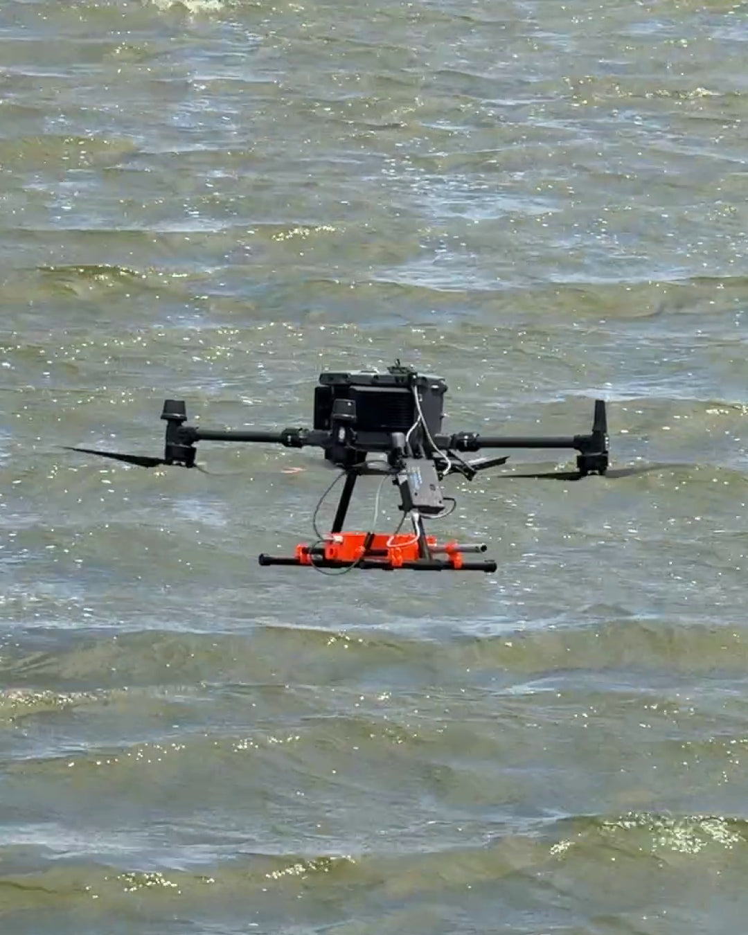
Image 7. Flight planning experience.

Image 8. Bathymetry in freshwater lagoon with GPR.
The tests in this experiment were simple: a flight at 1m above the water surface over fresh water, with a low flight speed for safety, and using a 300Mhz antenna to find the "bottom" of the lagoon. The results, shown above, clearly demonstrated the feasibility of using GPR for these purposes mounted on a drone.
We also performed the same flight with a 100MHz antenna, just to see the differences in system resolution. Here's a comparison.

Image 9. Radargram with 300Mhz antenna.

Image 10. Radargram with 100Mhz antenna.
One shows a flat bottom, the other shows a layer above the harder bottom, this is clear evidence of the resolution that differentiates and is vital between one antenna and another.
CONCLUSION
If anything, this cycle of tests and validations has taught us that geophysics has entered a new stage thanks to technological revolution.
Until recently, talking about GPR meant talking about heavy logistics, endless treks, and inaccessible areas. The great technological advance of recent years has not only been making the sensor fly, but achieving that this integration is operationally simple and reliable.
Thanks to intelligent systems such as those from SPH Engineering, the complexity of flying while maintaining a constant height above the ground (something humanly impossible to do manually for long) has become an automated task. This has transformed airborne GPR: it went from being an experimental curiosity to a robust industrial tool.
What is the great contribution of having it airborne?
- No more blind spots: Swamps, tailings, lagoons, or steep hills are no longer an excuse. If the drone can fly it, we can measure it.
- Operational safety: We exchange the risk of a crew walking on unstable terrain for the safety of a pilot operating from a safe area.
- Response speed: What used to take weeks of planning and execution, today is resolved in highly efficient flight days.
At Geocom, we are convinced that this technology does not come to replace the geophysicist, but to provide a gigantic plus to their data capture and overall workflows. The ability to see the invisible (whether it's oversized rocks, leaks, or strata) without touching the ground is a paradigm shift that is here to stay and is gradually becoming an industry standard.

Compartir:
[GEOCOM WORKSHOP] Geodetic Transformations in TBC
Trimble DA2 in support of geophysics