

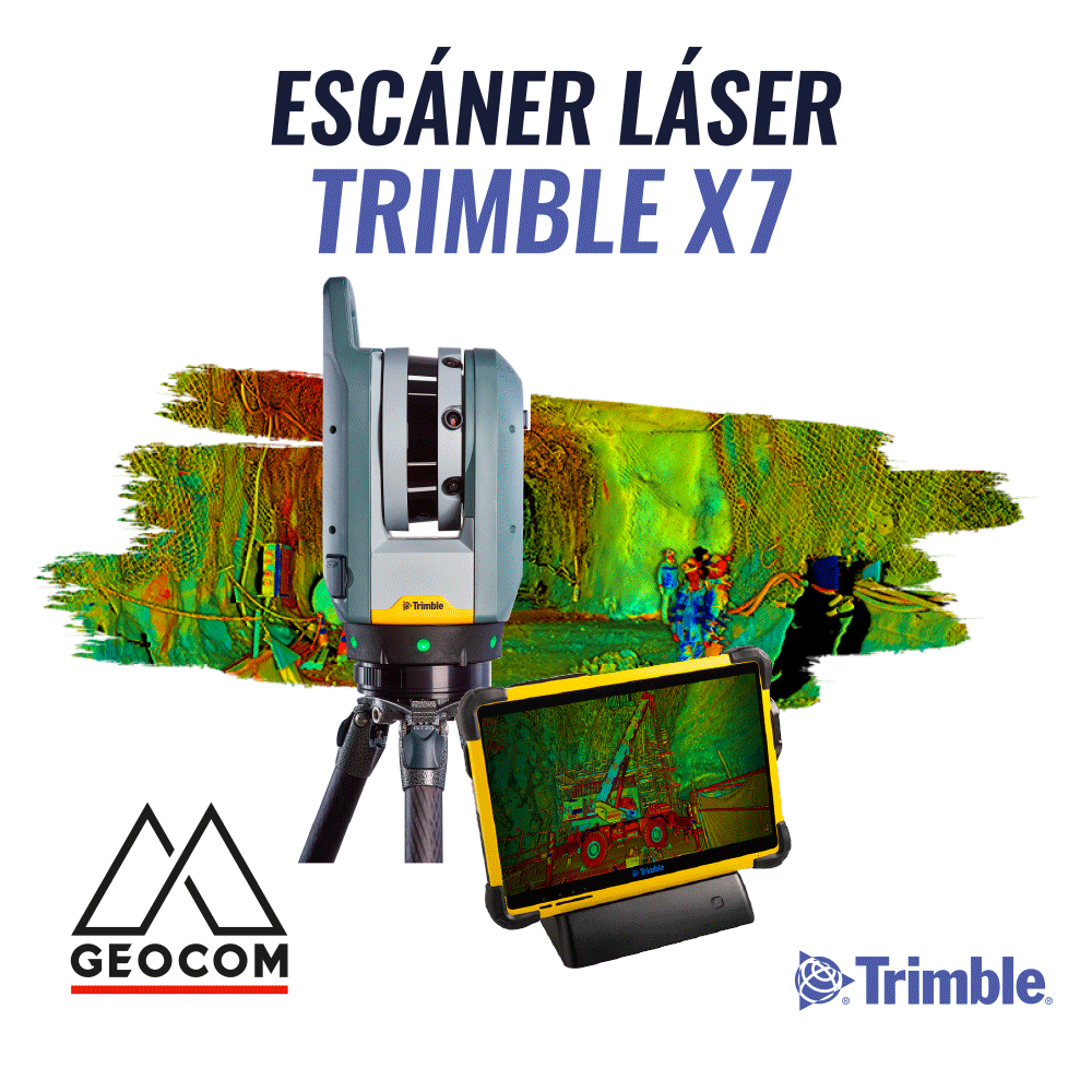
trimble x7 laser scanner
The Trimble X7 is a professional and robust high-speed scanner, especially suited for areas with harsh operational and environmental conditions.


The Trimble X7 is the world's first dual vertical deflection scanning system that integrates a survey-grade Servo-Drive system, high-speed scanning, and a coaxial 3-camera system. All of this in a protected central unit that allows it to be the first laser scanner with self-calibration. Before each measurement, the Trimble X7 checks and corrects its internal parameters if necessary, ensuring that the survey carried out in the field is correct. There are no recommendations for annual factory maintenance and/or calibration, which reduces maintenance costs.

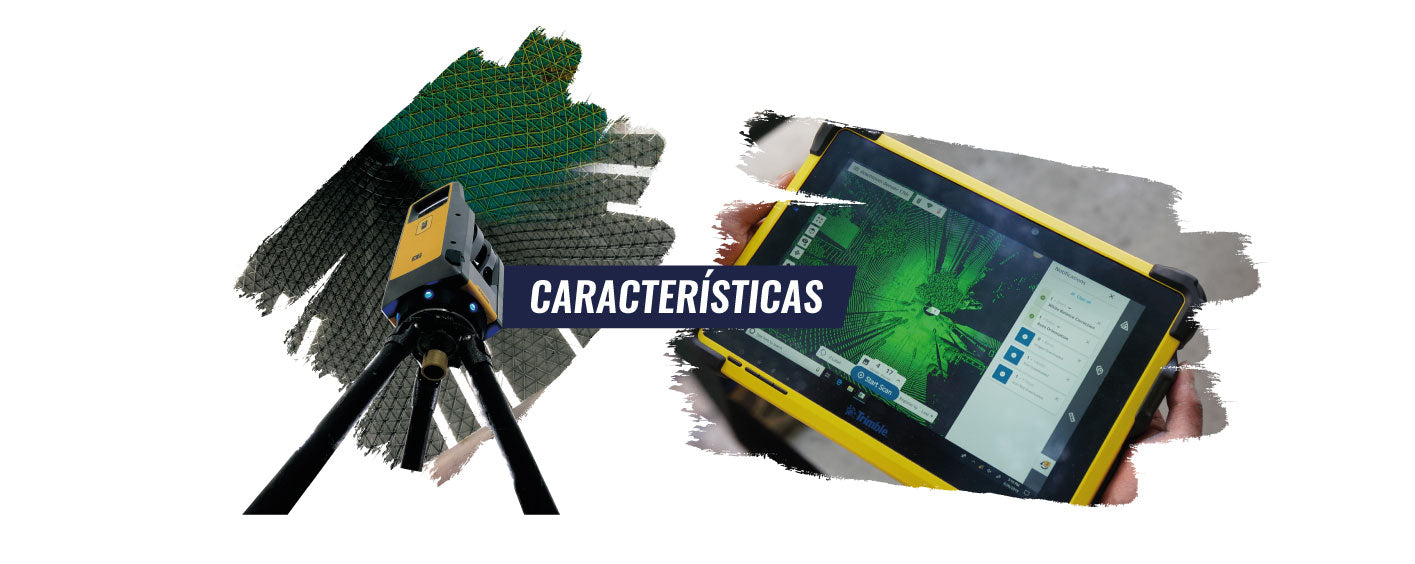
T10 TABLET + TRIMBLE PERSPECTIVE | AUTOMATIC IN-FIELD REGISTRATION
The Trimble Perspective field software, installed on the T10 Tablet, performs automatic in-field registration, based on the use of a built-in IMU, an automatic leveling sensor, and the same geometric characteristics of the surveyed point cloud.
With Trimble X7, registration is completely flexible; it is done based on the previous position or any desired position, with no time or consecutiveness limitations.
Obtaining in-field registration reduces processing times and ensures complete data capture.
IN-FIELD GEO-REFERENCING
IN-FIELD ANNOTATIONS AND MEASUREMENTS
Thanks to automatic in-field registration, it is possible to add annotations directly in the field, which can then be viewed in the office using Trimble RealWorks or Trimble Business Center software.
AUTO-LEVELING
It has an auto-leveling sensor with a range of 5° and an accuracy of 3″ (0.3mm @ 20m), sufficient for flatness and verticality analysis.
HARDWARE QUALITY
The Trimble X7 comes with a market-leading 2-year warranty. It is robust in complex environments, as demonstrated by its IP55 rating (resistant to high pollution and direct water jets) and its operating temperature range of -20°C to +50°C. It is a durable and professional piece of equipment.
High Sensitivity Measurement

PORTABILITY
It weighs 5.8 kg with its battery included, making it easy to move around in the field. It includes a carrying backpack, a Gitzo tripod, and a quick release for easy installation. It is allowed as carry-on luggage on airlines.
INTEROPERABILITY
The survey data can be exported to a variety of software programs, using industry-standard formats (RCP, E57, LAS, among others), to continue with the 3D modeling and/or data analysis process.
Types of applications

Plant operation and maintenance
SCAN TO BIM | AS-BUILT
3D digitalization can be performed using software like Trimble Realworks, which creates a geometric 3D model that can be used, for example, for interference analysis of future projected installations, generation of general plans, etc., or it can be a 3D model where each component has additional information such as its dimensions, standard, maintenance plan, suppliers, material transported, among others.
REVERSE ENGINEERING
Geomagic Design X is specialized software for converting 3D scan data into high-quality feature-based CAD models. It does what no other software can, thanks to its combination of automatic and guided solid model extraction, incredibly accurate surface fitting to organic 3D scans, mesh editing, and point cloud processing.
Now it is possible to virtually scan anything and create manufacturing-ready CAD designs.
CONDITION MONITORING
Geomagic Control X is professional metrology software that allows processing 3D laser scanner data to perform inspections between nominal and scanned components. This is done with the aim of extending their useful life, monitoring their wear over time and allowing for the generation of temporary projections for optimized and planned coating changes.
3D ENGINEERING
Through massive and precise surveying of facilities and components, it is possible to perform digital assembly simulations. By simulating the fit of a manufactured component before its actual installation, it is possible to verify if the component is within manufacturing tolerances, installation fit tolerances, plan personnel, equipment, and maneuvers necessary for installation. This optimizes plant shutdown times and ensures compliance with stipulated deadlines.
MORE INFORMATION | MINING PLANT OPERATION AND MAINTENANCE
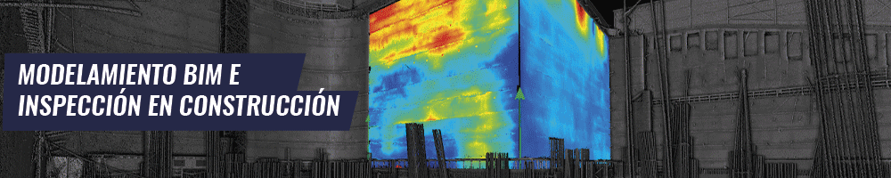
BIM MODELING AND CONSTRUCTION INSPECTION
SITE INSPECTION
Combining the Trimble X7 scanner and Trimble Realworks point cloud processing software allows for complete control of the work from start to finish.
Automated inspection tools, which analyze floor, ceiling, and wall deformations by comparing the laser scanner survey with the design, enable precise and representative dimensional analyses of potential deviations and deformations in construction.
Furthermore, it is possible to monitor earthmoving, quantity take-offs, generate the as-built of the project, among other things.
MORE INFORMATION | SITE INSPECTION

Underground Spaces and Tunnels
The Trimble X7 is the tool to "bring the tunnel to the office," where, through Trimble Realworks and/or Trimble Business Center software, the different project areas will have detailed information on the current situation of the tunnel, with all the necessary information to make decisions and apply corrective measures. This is aimed at achieving the highest efficiency and quality in the "advance cycle."
HERITAGE AND ARCHAEOLOGY
The Trimble X7 allows for quick and simple recording of archaeological and heritage sites. Thanks to the scanner's high level of detail and its 3 integrated cameras, it is possible to fully document the site, for later more detailed analysis or for mass public dissemination.
REQUEST A QUOTE
Compartir:
Phantom 4 Multispectral Drone DJI Enterprise
DJI Terra Software