


By Ariel Silva | Support and Pre-sales Manager | GEOCOM
INTRODUCTION
Since September 2003, SIRGAS has been established as the official geodetic datum of Chile. The advantages of using a geocentric datum are well proven and go hand in hand with the systematic use of GNSS and measurement and calculation methodologies associated with space geodesy.
Furthermore, SIRGAS offers weekly solutions in terms of coordinates associated with an instantaneous epoch of a network of continuous reference stations distributed throughout the continent. These solutions establish one of the most reliable origins for the densification of geodetic positions in Latin America.
Trimble Business Center allows the processing of extremely long GNSS baselines. In addition, calculation is facilitated by tools that help in downloading GNSS observations, as well as in obtaining precise orbits and Earth orientation parameters from various data servers.
PROBLEM
There is a growing need to calculate geodetic positions with high precision through a simple process from a variety of GNSS reference stations. While this is solved based on the use of scientific software, there are a large number of users who do not have this tool. For them, it is absolutely necessary to be able to use conventional software for baseline processing.
USE OF TRIMBLE BUSINESS CENTER
Trimble Business Center is a well-known GNSS baseline processing and network adjustment software. In the field of GNSS data processing, it has incorporated tools for downloading GNSS observations from Trimble reference stations, as well as from specialized servers. It also enables automatic download of precise orbits and Earth orientation parameters. In addition, it features a scientific processing engine that allows for precise calculation of components, considering a complete parametrization of the effects present in GNSS observations.

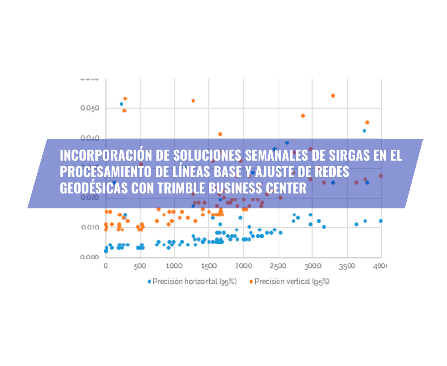
An example of the above is the processing of a variety of baselines with 24 hours of observation and up to 4000 km in length using the normal and scientific configuration. After applying the scientific configuration, processing improves by almost double:

WEEKLY COORDINATES OF SIRGAS-CON STATIONS
The continuous operation SIRGAS network, SIRGAS-CON, is composed of about 400 stations distributed across the American continent. One of SIRGAS's most interesting products corresponds to the weekly coordinates adjusted to the same reference frame used by the IGS in the calculation of GNSS satellite orbits. Its use is recommended for all geospatial activities that require a precise and reliable coordinate origin. Furthermore, weekly coordinates are especially useful after earthquakes that cause deformations in the reference frame, rendering previously calculated coordinates unusable (excerpt from www.sirgas.org).

COORDINATES AND EPOCH
It is well known that the Earth's crust undergoes deformations over time. The causes of this are extremely varied and originate from different sources. Undoubtedly, the geodynamic component must be incorporated into geodetic calculations, as space geodesy has developed positioning techniques that have achieved a higher resolution level than this effect.
According to the above, geodetic positions change over time depending on local and global conditions.

EXAMPLE OF COORDINATE CALCULATION IN TRIMBLE BUSINESS CENTER
Network Design
During 2019, a GNSS reference station was installed in the city of Calama. It was decided to use the closest continuous reference stations of the IGS (International GNSS Service, http://www.igs.org/network) as fixed points. These stations are:
- IQQE (Iquique, Chile): 274 km
- UNSA (Salta, Argentina): 437 km
- AREQ (Arequipa, Peru): 718 km
- SCRZ (Santa Cruz de la Sierra, Bolivia): 795 km
- CORD (Córdoba, Argentina): 1094 km
- SANT (Santiago, Chile): 1192 km

The coordinates of the stations are calculated weekly by SIRGAS with a delay of approximately 1 month.
Data Import
Data import is automatable in TBC. Regarding GNSS observations, it can be separated into two areas:
From a Trimble reference station, data download can be managed locally by connecting directly to the receiver. This saves data storage on a server.
Another way is to access an FTP/HTTP server where the data is organized according to a defined rule.
Regarding SIRGAS weekly coordinates and precise orbits, access is similar to FTP/HTTP.

It should be noted that there is a wide variety of servers that can be used to access different data sources.
Baseline Processing
Baseline processing should be performed using precise orbits and 24-hour observations. The Melbourne Wübbena linear combination (especially for extremely long lines) is used.

About network adjustment
After processing the baselines, the network adjustment is performed, considering the SIRGAS-CON stations as fixed points. The epoch for this determination corresponds to 2019.87:

Finally, the coordinates for GMLA are:
Latitude = -22°29’00.20188″
Longitude = -68°55’53.10898″
Ellipsoidal Height = 2295.5578 m
X = 2120367.6555 ± 0.0029 m
Y = -5504045.9176 ± 0.0059 m
Z = -2424835.3440 ± 0.0031 m
Epoch: 2019.87 (week 2079)

Periodic Calculation
With the same network design, the coordinates of a reference station in the Copiapó region are calculated. Approximately 100 days of GNSS observations are processed weekly.


CONCLUSIONS
With TBC, it is possible to process extremely long baselines (it is suggested not to exceed 1500 km in sessions of no less than 24 hours without using a scientific configuration).
Access to GNSS observations, precise orbits, SIRGAS weekly coordinates, among others, is increasingly simplified. All that is needed is to set up an automatic internet download. Given that GNSS observations are used, it is recommended to use orbits that include all satellite constellations (for example, orbits from the IGS MGEX project).
While it is beneficial to use more fixed points in network adjustment, sometimes access to observation data is not immediate, which complicates or delays the position calculation process. For this reason, IGS stations are chosen as they are more stable in terms of operation and data access.
Regarding SIRGAS weekly coordinates, one must wait for the calculation corresponding to the week in which the observation was made to be available, which gives rise to the epoch. However, it is possible to use determinations from previous epochs to perform the calculation. Usually, SIRGAS takes no more than 1 month to publish the weekly coordinates.
VIEW DOCUMENT
Compartir:
GEOCOM GNSS Network Adjustment 2019.91
Important Geodetic Station Reinstalled for Earthquake Monitoring at the University of Concepción