

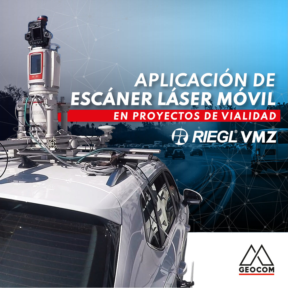

Currently, geospatial information is commonly captured using traditional topography, either with GNSS receivers or total stations. These methodologies provide information for road projects, with a discrete database and low representativeness of the study area. Furthermore, these types of surveys are associated with extensive capture times and risk exposure for the professionals who carry them out.
Capture techniques are constantly evolving towards the massive acquisition of geospatial data associated with mobile mapping technology, which has made great progress in recent years, incorporating high-end inertial sensors, high-precision GNSS receivers, LIDAR sensors, and cameras. This technology provides a faithful representation of reality and allows us to perform captures with equipment in motion, which translates into significant help in surveying road projects where it is necessary to capture extensive sections for pre-feasibility studies, road redesign, standard changes, asset inventory, among others.
Mobile Mapping technology can be classified according to the sensor used to acquire geospatial information, which can be georeferenced photographs, capture from LIDAR sensors, or a combination of both techniques to obtain complementary data. It can also be classified according to the mobile platform on which the sensor is installed, including aerial, unmanned aerial, and terrestrial platforms.
A differentiating point among the various survey techniques using mobile equipment is those that have both capture sensors (image + LIDAR). These provide valuable information, as we will have image data to identify infrastructure and, additionally, LIDAR provides additional environmental data, such as the reflectivity or intensity of the surfaces where the signal bounces. In this way, we can identify reflective elements such as horizontal road markings and signs, which is very useful and relevant information when generating the final products of our survey.
Other benefits of surveying with LIDAR equipment are that it allows us to capture in multiple scenarios, including night surveys, where traffic flow is lower. This feature is thanks to an active sensor that does not depend on ambient light, which facilitates the work and reduces risks on site.
Methodology and capture process
This project aims to capture a 10 km section of a dual carriageway to survey the topographic base and existing infrastructure, in order to make modifications to this route.
To achieve this objective, some considerations are necessary:
- The survey was conducted at night, due to existing traffic conditions, so RGB information was not captured for subsequent analyses.
- The survey includes multiple passes in both directions, in order to capture as much data as possible from the study area.
GNSS Base Location
All surveys conducted with Mobile Mapping technology need to be linked to a GNSS base that allows for differential correction, thus achieving centimetric precision. To ensure these precision levels, the GNSS base must be located within 20 km of the study area.
To ensure the correct link of the GNSS base to the National reference system, a NETWORK is generated to determine the fixed position of this base station, which is recording data for post-processing at a capture rate of 1Hz, from which the mobile trajectory calculation process will be performed later.

Figure 1. GNSS Base Calculation
LIDAR Survey in Motion
Massive captures in motion are based on the incorporation of inertial sensors in the instruments. These devices are capable of measuring acceleration and angular velocities. From these, it is possible to calculate a relative position; however, it is necessary to add an instrument that can capture absolute positions, such as GNSS, to this system. This way, it is possible to measure the mobile's trajectory every second and determine its position, inclination, and orientation.
Finally, this trajectory data is applied to the LIDAR information, using common capture times to achieve the 3D reconstruction of the surveyed information.
LIDAR capture is performed using the Riegl VMZ mobile equipment, which has the advantage of being able to configure multiple capture modes, including RADAR mode, where the equipment rotates 360° while moving through the study area. In profiling mode, the equipment measures in a single direction while the mobile moves, obtaining a highly detailed point cloud.

Figure 2. Mobile LIDAR capture process
Trajectory process and Point Cloud acquisition
When the survey is carried out in the field, information corresponding to the equipment's trajectory, measured by the inertial sensor and the system's GNSS receiver, is generated. It is necessary to process the trajectory data using the Applanix POSPAC MMS software to obtain a centimetric solution, linking them to the GNSS base installed for this purpose.
The final trajectory accuracy is subject to numerous factors, among which the most important is satellite availability in the study area, which can significantly affect the final survey result. One way to address this loss of information is to incorporate external sensors into the system that help us calculate the distance traveled by the mobile in the absence of a GNSS solution; this device is called a DMI (Distance Measurement Instrument).

Figure 3. Trajectory Post-processing and Accuracy Analysis
Once accurate trajectory data is obtained, it is necessary to link it with the LIDAR information. This process is done using the timestamps present in both datasets. This process is carried out using the software platform of the mobile equipment manufacturer; in this case, the software used is Riprocess. In this software, the georeferencing of the LIDAR to the project's reference system is also performed.

Figure 4. Final Point Cloud
Final Deliverables in Trimble Business Center:
While having LIDAR point cloud information, which allows us to bring the field to the office, is only half of the equation. This is why it is necessary to have specialized software for handling and visualizing point clouds that allows us to optimize information extraction for the generation of final products. Trimble Business Center does this, and with specialized tools, it optimizes office processes.
The process of generating final deliverables begins with the import and reprojection of LIDAR information, coming from the Riprocess software, which is Riegl's mobile LIDAR information processing software.

Figure 5. Point Cloud Visualization and Projection in PTL Coordinates
A fundamental tool for managing large amounts of LIDAR information is point cloud classification. TBC allows point cloud classification in outdoor, indoor, and underground spaces. Outdoors, it allows classification of buildings, terrain, tall vegetation, poles, signs, and power lines. From this, the point cloud is segmented into different layers, which will help in managing the point cloud and extracting features.

Figure 6. Automatically Classified Point Cloud
Once the point cloud is classified, it is possible to use automated drawing tools, for example, to extract point features such as poles, trees (canopy, trunk, and height), signage, and also to extract line features such as sidewalks, gutters, pavement markings, and overhead cables.

Figure 7. Point Feature Extraction

Figure 8. Line Feature Extraction
From the point cloud, TBC allows cataloging any existing element. CAD tools help create 2D, 3D lines, points, polygons, among others. They also allow classifying them into layers, applying colors and line styles. Based on these tools, it is possible to generate the vectorization of all existing infrastructure in the survey area, such as bus stops, pedestrian bridges, horizontal markings, etc.

Figure 9. Surface Generation
Once the survey has been generated graphically, it is possible to start producing sheets or exporting the information to various design software. For this, TBC offers export options in multiple universal formats, allowing sharing with software such as CIVIL 3D, Istram, among others.
Conclusions:
The incorporation of Mobile Mapping technology is an important contribution to the massive capture of reality focused on linear projects, complementing traditional topography in road projects. Its incorporation into this type of project is validated through an established workflow in the field, which allows obtaining data with high precision, high definition in representation, and excellent productivity for these types of projects.
Managing this type of geospatial information requires the incorporation of new tools such as suitable computers for point cloud handling, software that allows us to optimize feature extraction processes, in order to obtain a continuous workflow and become a real contribution in terms of quality and accuracy of deliverables.
A very important aspect is to organize the distribution of data within the work team, so that each member is responsible for specific tasks such as:
- Point cloud cleaning.
- Feature extraction and vectorization.
- Obtaining final products.
This workflow will allow us to optimize processes and avoid data duplication.

Compartir:
Trimble R12i: Just Another GNSS Receiver with IMU?
OPINION COLUMN | Integrating Acceleration into Geometry