

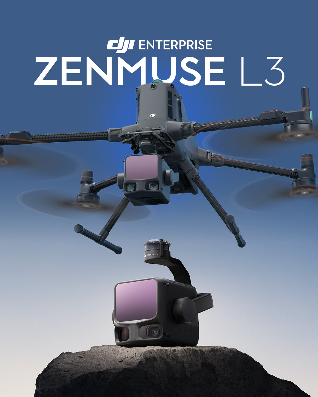
Discover how DJI's Zenmuse L3 redefines aerial LiDAR mapping with exceptional range, accuracy, and efficiency for professional geospatial missions.
DJI has taken a significant step in LiDAR innovation with the launch of the Zenmuse L3, a system designed to make high-precision aerial mapping faster, simpler, and more accessible for professionals across various industries.
Built on years of experience in aerial imaging and surveying, the L3 represents a breakthrough in how efficiency and precision can coexist in a single payload. From large-scale topographic surveys to power line inspections and infrastructure modeling, it provides mapping specialists, engineers, and environmental researchers with a tool that simplifies complex workflows while delivering survey-grade accuracy.
By seamlessly connecting with DJI Terra, Modify, and FlightHub 2, the Zenmuse L3 integrates planning, data capture, processing, and visualization—forming an end-to-end ecosystem that redefines what professionals can expect from an aerial LiDAR system.
Pushing LiDAR Range and Clarity to New Limits
Long Range, Wide Coverage
The Zenmuse L3 achieves a maximum detection range of 950m at a pulse rate of 100 kHz, tested under 100 klx ambient light and on objects with 10% reflectivity. The adjustable pulse rate allows for flexible output power and optimal adaptation to different operational scenarios.

Small Spot, High Energy
With a laser beam divergence of only 0.25 mrad (1/e²), the spot size at the same distance is approximately one-fifth of the Zenmuse L2, allowing for the detection of smaller objects such as power lines and branches.
Higher energy density results in stronger penetration capability, significantly increasing the ground point density under vegetation and enabling high-precision reconstruction of complex terrains and structures.

Adjustable Pulse Rate, Returns, and Scan Modes
Adaptability to the task at hand is another highlight of the Zenmuse L3. With a maximum laser pulse emission frequency of 2 million points per second and support for up to 16 returns, the L3 is suitable for various mapping scenarios.
Point cloud density and penetration capability can be adjusted to suit needs, from high-precision mapping to complex environments, resulting in highly accurate spatial reconstruction.
Additionally, the L3 offers Linear, Star-shaped, and Non-repetitive scan modes for different operational scenarios:
- Linear: Achieves a more consistent point cloud distribution, ideal for high-precision terrain mapping.
- Star-shaped: Balances precision with multiple scanning angles and penetration capability, well-suited for forests or dense urban environments.
-
Non-repetitive: Provides multiple scanning angles and broader coverage, optimized for power line inspections and other complex structural surveys.

Clearer Reconstructions and Mapping Efficiency with Dual RGB Cameras
Dual 100MP RGB Mapping Cameras
Precision mapping requires not only distance but also detail, and the Zenmuse L3 offers both.
Equipped with dual 100MP 4/3 CMOS RGB sensors and a mechanical shutter, it captures high-resolution images with remarkable clarity and consistency. These cameras not only allow for the generation of true-color point clouds for more realistic visualization but also significantly improve efficiency by capturing photogrammetry data, reducing flight time while maintaining exceptional accuracy.

Ultra-Wide 107° Field of View
Complementing the LiDAR's long-range capabilities, the dual cameras provide a wide horizontal field of view (FOV) of 107°. This ultra-wide perspective allows each flight to cover a larger area, reducing mission time while maintaining data accuracy. Even with only 20% lateral LiDAR overlap, users can capture data for digital orthophoto maps (DOM) and digital elevation models (DEM) in a single flight, simplifying workflows and maximizing efficiency for large-scale mapping projects.

Elevated Performance: Precision Meets Efficiency
With the Zenmuse L3, DJI has refined every link in the data chain—from positioning and distance measurement to image capture—to ensure that each dataset meets survey-grade standards.
Equipped with an enhanced POS system that achieves a heading and pitch accuracy of 0.02° and 0.01° respectively (post-processed, 1σ), along with DJI’s self-developed LiDAR with a distance measurement repeatability of 5mm at 150m (1σ) and microsecond-level temporal synchronization, the Zenmuse L3 takes long-range aerial LiDAR performance to the next level.

LiDAR Data Accuracy
The Zenmuse L3 offers vertical accuracy better than 3 cm at 120m altitude, better than 5 cm at 300m, and better than 10 cm at 500m, easily supporting 1:500, 1:1000, and 1:2000 scale mapping projects.
The resulting point cloud thickness is only half that of the Zenmuse L2, allowing for advanced analysis and high-precision applications even in complex environments.

RGB Data Accuracy
Thanks to its dual 100 MP RGB mapping cameras, the Zenmuse L3 achieves a ground sample distance (GSD) of 3 cm even at a flight altitude of 300m.
Real-time position synchronization allows for operation without ground control points (GCPs), producing highly accurate and visually rich images for precision mapping.

High Ground Point Density
In challenging environments such as dense vegetation or irregular terrain, maintaining ground visibility is critical for accurate mapping. Based on its optimized laser design, the Zenmuse L3 offers superior penetration performance, capturing more ground points with greater integrity.
This significantly enhances the accuracy and integrity of terrain data, ensuring a reliable foundation for precise modeling and surface reconstruction.

High Efficiency: Up to 100 km² per Day
Efficiency defines productivity in aerial mapping, and the Zenmuse L3 is designed to deliver it.
When mounted on the DJI Matrice 400, it achieves outstanding coverage efficiency at a flight altitude of 300 meters; a single mission can map up to 10 km², allowing for up to 100 km² of daily coverage.
At a lower altitude of 120 meters and a flight speed of 15 m/s, a single mission can cover up to 4 km² (around 400 hectares), resulting in mapping efficiency that is at least 54% greater compared to the Zenmuse L2. This flexibility allows operators to maintain high productivity across different project scales and terrain types.

Optimized End-to-End Workflow: From Capture to Application
Versatility and Efficiency in Data Capture
Beyond simultaneously capturing LiDAR and RGB data, the Zenmuse L3 maximizes operational efficiency by allowing multiple mapping deliverables to be produced from a single flight. This integration simplifies workflows by reducing the need for repeated missions and post-processing, while ensuring consistent alignment between LiDAR and RGB datasets.
From digital elevation and orthophoto maps to 3D reconstructions, each dataset is captured with survey-grade accuracy, giving professionals faster access to ready-to-use results for analysis and application.

Integrated DJI Enterprise Ecosystem
Seamless integration is at the core of the Zenmuse L3.
Within the DJI ecosystem, it forms a complete end-to-end mapping workflow that connects data acquisition, processing, and application into a single unified chain.
This integrated approach allows professionals to plan missions, capture data, process results, and generate products within a single cohesive platform, simplifying operations while improving overall efficiency.
Compared to traditional multi-platform setups, the DJI ecosystem eliminates compatibility barriers and reduces manual workload. From DJI Pilot 2 for mission planning, to DJI Terra and Modify for data processing and visualization, each step is tightly connected.
The result is a streamlined, faster, and more intuitive workflow that empowers users to complete complex mapping tasks with greater accuracy and confidence.

Get Started with the DJI Zenmuse L3
The DJI Zenmuse L3 represents a significant leap forward in aerial LiDAR innovation, combining long-range laser technology up to 950m, dual 100 MP RGB mapping cameras, and a high-precision POS system into a compact, integrated solution. From long-range topographic surveys to detailed infrastructure modeling, the L3 empowers professionals to capture, process, and analyze geospatial data with unparalleled accuracy and efficiency.
By seamlessly integrating with DJI Terra, DJI Modify, and FlightHub 2, the Zenmuse L3 completes a truly end-to-end workflow that covers every stage, from flight planning to data visualization. Whether deployed for forest management, power line inspection, or large-scale terrain mapping, the L3 offers the precision and reliability required for mission-critical operations.
Explore how DJI's most advanced LiDAR system helps you see through, far, and clearly, and experience a new level of precision in aerial mapping.
Compartir:
Geospatial Seminar 2025 - A decade of innovation and connection
[U. ANTOFAGASTA - WORKSHOP] Real-time GNSS and TBC innovations