


GNSS has become the main geodetic observation technique for topographic representation in a variety of situations. Its simple application allows users to interpret the correct determination of coordinates in the field based on the deployment of precisions, number of satellites, among other indicators. However, it has traditionally been thought that higher precision means greater complexity in equipment deployment, which, nowadays, is a misconception.
Trimble RTX has changed the paradigm for many land surveyors and topographers by not requiring a base station to send differential corrections to achieve survey-grade precision in topographic operations.
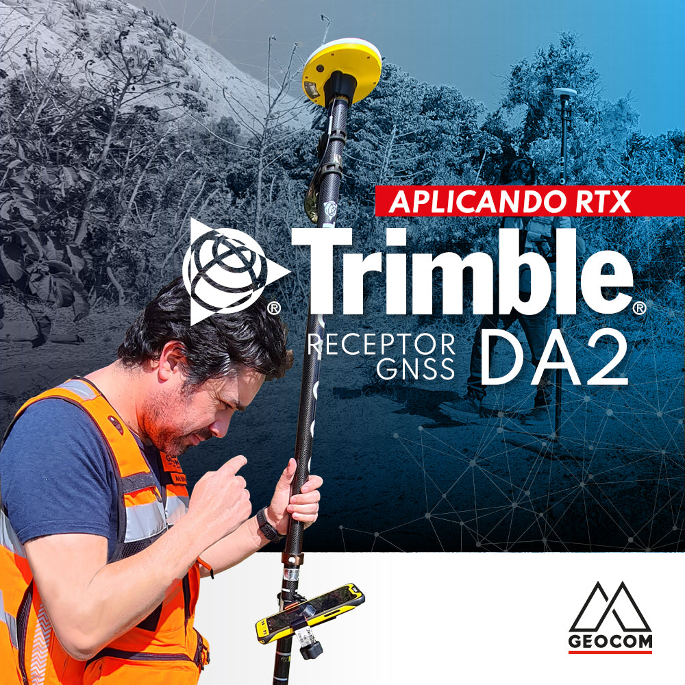
About Trimble DA2
DA2 is Trimble's new GNSS receiver that is addressing a variety of problems requiring precise accuracy. DA2 adapts to the precision the user needs for a particular operation, investing only what is necessary in a scalable way, specifically addressing each job.
This is achieved through the design of an extremely economical antenna. In this way, the user who acquires DA2 has the necessary hardware to perform geodetic positioning based on multi-constellation satellite observation. This is where the user must decide on the source of corrections they will use.
About Trimble RTX
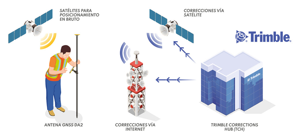
RTX is a precise point positioning (PPP) technique. This technique is characterized by offering an operation in which the user does not depend on a GNSS base station. Traditionally, survey-grade GNSS was obtained under the logic of differential observation, either in post-processing or RTK. For its part, RTX proposes sending a correction to the GNSS mobile device, solving three aspects: orbits, atmospheric modeling, and clock. This is achieved based on a global network that Trimble maintains and on which it calculates different products in real-time that serve as the basis for a correction that is sent to the mobile device via satellite or the internet.
How do DA2 and RTX work together?
Once a DA2 receiver has been acquired, the next step is to define the precision of the work to be carried out:
| Service | Achieved Accuracy | Comments |
| RTK | 1 - 2 cm | A GNSS base station is required to transmit differential corrections via the internet (a Catalyst 1 subscription is needed) |
| Catalyst 1 | 1 - 5 cm | RTX-based services |
| Catalyst 10 | 10 cm | RTX-based services |
| Catalyst 60 | Sub-meter (60 cm) | RTX-based services |
Then, the service's time coverage is defined:
| Subscription | Catalyst 1 | Catalyst 10 | Catalyst 60 |
| Annual |
✔ |
✔ |
✔ |
| Monthly |
✔ |
✔ |
|
| On-Demand* |
✔ |
|
*On-Demand subscription available in 10 and 100-hour packages.
About the Application Experience
A DA2 receiver with a Catalyst 1 subscription was tested for the topographic representation of a property for cadastral and delimitation purposes.
Trimble DA2 is powered directly from a battery pack, just like a smartphone. It connects via Bluetooth to both Trimble controllers and smartphones. In this case, the field software is chosen by the user, depending heavily on the controller to be used. GEOCOM recommends the use of TDC600 as a controller.

Figure 1. Trimble DA2 positioned on a 2m pole
Generally, DA2 becomes a conventional GNSS mobile device mounted on a 2m pole. Once the antenna is mounted, an RTX initialization is required, which does not exceed 5 minutes. Once survey-grade precision is achieved, the receiver can begin the topographic operation, which is exactly the same as what would be done with RTK.

Figure 2. Trimble DA2 in operation
Regarding RTX signal reception, it should be noted that it can be received via satellite or the internet. For greater autonomy, it is recommended to use satellite reception, as mobile internet connection is not available everywhere. The only thing required in this case is to have line of sight to the geostationary satellite that sends this correction: a condition to maintain initialization is not to lose line of sight with the geostationary satellite.

Figure 3. Satellite observation context in Santiago for April 26, 2022, at 11:25 AM (UTC -4). The satellite sending RTX corrections is at an elevation of 47° with an azimuth of 28°.
In this way, positions defining the boundary of the rural property were surveyed. The work was completed in 1 hour and 15 minutes, determining the coordinates of 112 points, achieving a performance of 1 point every 41 seconds.

Figure 4. Productivity report
Regarding the accuracy obtained, RTX maintained survey-grade accuracy most of the time. On average, there is a mean horizontal accuracy of 2.5 cm and a mean vertical accuracy of 5 cm (68% confidence interval). The points exceeding 10 cm (8 out of 112) were located in complex areas for satellite observation.
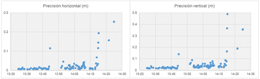
Figure 5. Accuracy distribution over time
Conclusions
Trimble DA2, along with an RTX subscription, provides a complete solution to problems related to topographic representation with the corresponding logistical gains. Not considering a GNSS base station brings a series of benefits that result in better utilization of resources for typical surveying tasks. Furthermore, DA2 offers great flexibility in approaching different jobs based on their precision.
Compartir:
ProPoint™ Technology in Trimble DA2
Bentley Invites Professionals and Students to Experience Its Products for Free