

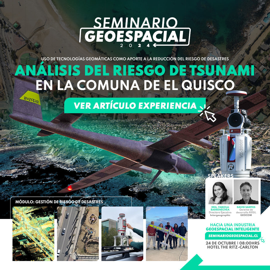

GEOSPATIAL SEMINAR EXPERIENCE | Tsunami risk analysis in the municipality of El Quisco
Experience by Intergeographic & Geocom
In their own words, “the Intergeographic Foundation is a non-profit organization with a team of professionals with vast experience in disaster risk reduction and climate change, whose purpose is to support and accompany public and private organizations and the community in general, in developing capacities and management strategies for decision-making.”
In pursuit of this purpose of supporting disaster risk reduction on the coastal edge of the municipality of El Quisco, GEOCOM has contributed to the surveying and generation of geospatial products that will serve as a basis for a proper study of the sector. In this context, an aerial photogrammetric flight was generated with a high-performance fixed-wing UAS, the Quantum Systems Trinity Pro, to create an orthophoto of the entire coastal edge of El Quisco and a point cloud that will support a general survey carried out in the sector.
In parallel, a terrestrial scan of the entire coastline was carried out with a laser scanner, a Riegl VZ2000i.
The final objective is to obtain a complete product integrating both technologies, generating a general point cloud that includes both the terrestrial scan and the one generated by the flight. This implies a general model of the sector with unprecedented precision that will greatly complement the disaster risk reduction study for the sector.
Scope
The approximate area to be surveyed was 900 Ha, so 2 polygons were generated to carry out the flights. Take-off and landing locations were planned in open and safe areas, where the assistance of municipal personnel was essential to complement operational safety.
To cover the entire area, two flights with the Trinity Pro and a 42 MP RX1RII sensor were planned in the Qbase 3D software (Quantum-Systems' own), where the polygon of the area to be flown, 70% frontal and lateral overlap for both cases, and the required GSD (Ground Sample Distance) size for this survey were set.


Figure 1. Flight planning
The Trinity Pro is a VTOL (Vertical Take Off Landing) fixed-wing drone, as it performs vertical take-off and landing before commencing its flight mission. This take-off and landing point was set within the polygon area, with a circular descent to the vertical landing height to avoid obstacles, always prioritizing safe flight.
In addition, considering all safety considerations, a safe return to the landing point is generated. This is necessary in case of any flight incident, where the system automatically takes this return path to avoid possible collisions. Considering that there may be areas with many obstacles, this is vital to ensure that there are no accidents of any kind. All of this must be considered prior to generating the flight, and only once thoroughly reviewed, is it possible to carry out such a flight.
Given that the area to be flown is urban and coastal, all preventive measures were taken to avoid any inconvenience and in compliance with the regulations established by the DGAC.
Under all these conditions, the flight planning software, Quantum Systems' Qbase 3D, estimates both flights to be approximately 1 hour and 20 minutes each. It is important to note that the Trinity Pro, among its main features, has a flight autonomy of 90 minutes per battery, so using a single battery for each flight is sufficient in this specific case.


Figure 2. VTOL Trinity Pro
But prior to the flight itself, ground conditions are also necessary to support the flight. This requires the use of a GNSS receiver to support the flight for direct referencing, a topic that will be addressed in the next point.
DETERMINATION OF THE REFERENCE FRAME
This point is vital in the work carried out, as it will be the basis for proper referencing of both the aerial photogrammetric flight and the mobile scanning, as well as the capture of GCPs (Ground Control Points) that control the accuracy of the products.
For this, Trimble receivers were used, an R12i as a roving base and a Trimble DA2 as a mobile unit. The use of these devices is vital given their powerful features that ensure good measurement of both static observation and the mobile unit receiving differential corrections.

Figure 3. Trimble R12i / Trimble DA2
Within this point, it is important to highlight the possibilities offered by Trimble systems, as Trimble's IBSS technology (explained below) was used, which allows the R12i to be used as a roving base, meaning it transmits differential corrections via the internet, allowing it to function as a reference station. This is because the DA2 mobile unit acts as a correction receiver via the internet.
Trimble's IBSS (Internet Base Station Service) technology is an advanced solution in the field of precise positioning. This service allows users of latest-generation Trimble GNSS receivers to use remote base stations via the internet, instead of having to deploy physical base stations in the field.

Figure 4. Trimble IBSS
Here are some key points about Trimble's IBSS technology:
- Remote Access to Base Stations: Users can connect to base stations located in different places via an internet connection, which facilitates the collection of precise data without the need to be near a physical base station.
- Improved Accuracy: By using remote, internet-connected base stations, users can improve the accuracy of their GNSS measurements, obtaining real-time differential corrections.
- Ease of Use: IBSS simplifies the process of setting up and using base stations, eliminating the need for additional equipment and reducing the time and costs associated with establishing physical base stations.
- Flexibility and Mobility: Users can move freely within the service's coverage area without losing connection to the base station, depending only on the internet connection, which increases flexibility and efficiency in field work.
This base receiver works using a SIM card that provides mobile internet, and also records data with a static measurement at a 1-second logging rate, to serve as a base for subsequent processing of the flight and mobile scan trajectory. The base receiver was installed within the facilities of the municipality of El Quisco, where a point was materialized to calculate its precise coordinates in a post-process.

Figure 5. R12i roving base.
The precise coordinates of this point were obtained by processing the static observation with another Trimble technology, called Trimble RTX-PPP. The reference framework for this project was SIRGAS-Chile 2021, and Trimble Business Center (TBC) is fully compatible with this framework, therefore all this processing was carried out within TBC so that the entire project is aligned with the national geodetic network.
PPP (Precise Point Positioning) is a GNSS data processing method that uses observation data from GNSS satellites to calculate positions with high precision without the need for local base stations. Instead of relying on differential corrections from nearby base stations, PPP uses global correction models that include precise satellite orbits and clock corrections.
In turn, Trimble RTX is a correction service that provides real-time correction data through various transmission technologies, such as satellites or the internet. This allows precise real-time positions to be obtained. In addition to the real-time service, Trimble RTX offers the ability to post-process GNSS data collected in the field. This involves downloading GNSS observation data and RTX corrections to perform more detailed and precise processing at a later stage, further improving the accuracy of the results.

The PPP results using Trimble RTX within TBC are shown in the following image.

PHOTOGRAMMETRIC FLIGHT
For the execution of the flight, the VTOL Trinity Pro system was used. This fixed-wing drone has a flight autonomy of 90 minutes and is equipped with three servo-assisted motors that rotate at a 90-degree angle for takeoff and landing, while in the cruise flight stage, only one motor operates, significantly reducing the amount of energy used, which positions it as a highly productive system compared to others in its class.

Figure 7. VTOL Trinity Pro
The Trinity Pro allows the loading of multiple sensors (RGB, multispectral, LiDAR, among others); for this experience, the Sony R1RXII 42 MP photographic camera was used, whose technical specifications can be seen in the following image:

The flight parameters are detailed in the following table:
|
Flight Log |
|
|
UAS |
VTOL Trinity Pro |
|
Average Resolution (GSD) |
5.3 cm / px |
|
Flight Time |
80 min per flight |
|
Lateral / Front Overlap |
70 % |
|
Front Overlap |
70 % |
|
Number of Photographs |
Approx. 600 per flight |
Finally, this was reflected in the QBase 3D planning software, fulfilling the flight parameters defined above.

Figure 9. Photogrammetric flight execution with Trinity Pro
The flight execution had an effective duration of approximately 80 minutes for each flight. Once the Trinity Pro landed, it was checked that the data had been captured correctly, and 1247 photographs were counted.
These images were post-processed, and the orthophoto of the El Quisco coastline was correctly generated, along with the point cloud that will be integrated with the cloud generated by the terrestrial scanner.


On the other hand, the second step of the project was a laser scan of the coastal edge.
Mobile and Stationary Terrestrial Scanning of El Quisco's Coastal Edge
LiDAR (Light Detection and Ranging) technology is a type of direct measurement that uses a light beam to measure distances and thus obtain a highly representative point cloud.
As an active sensor, the LiDAR sensor can operate correctly both day and night, with no limitations regarding capture time. One of the great advantages of working with this technique is that, due to its multiple return capability, it can penetrate dense vegetation and capture hidden terrain, thus providing a more accurate measurement of it. Some LiDAR applications include: forest and vegetation studies, linear surveys, natural hazard analysis, among others.
The Terrestrial Mobile Scanning Systems presented by RIEGL allow for the capture of massive geospatial data with high precision from areas of interest, enabling the rapid and safe capture of millions of spatially distributed points.

Figure 10. LiDAR Riegl mobile scanning.
The main strengths of using these technologies are the freedom to obtain this information without intervening in the object of study, which makes them technologies that provide high safety for operators and equipment placed in the measurement areas, a robust system, and highly reliable results.
In addition, their high data capture speed and constant availability reduce the exposure time of professionals in the study areas, making it a highly secure solution with a high return on investment in a short time.
The integration of the RIEGL LiDAR sensor, together with a high-performance inertial sensor and kinematic GNSS, makes it a unique 3D capture tool, controlling the sensor's position and orientation, along with the high performance of a RIEGL laser scanner capturing in all directions.
The system used in the El Quisco project corresponds to the RIEGL VZ-2000i + VMZ Terrestrial Mobile LiDAR, installed on an SUV with standard roof bars, allowing the RIEGL LiDAR system to be mounted high for better perspective at all times.
The work plan consisted of traversing each of the streets in the coastal area of the commune, a task that was completed in one day, taking approximately 5 hours. This route was constantly verified using a handheld Trimble device, which recorded the route and displayed it on the Trimble Access platform.
The data processing consisted of obtaining the trajectory of the entire route by performing GNSS processing in Applanix's Pospac Software for the 4 projects into which the capture was divided: north zone, central zone (2 projects), and south zone. The GNSS base used in this project was established in the municipality of El Quisco.

Figure 11. LiDAR Riegl terrestrial scanning.
Then, in RIEGL RiPROCESS software, the corrected trajectory (which contains precise positioning and recording of the vehicle's roll and pitch at all times) is integrated with the point cloud captured by the RIEGL VZ-2000i. This integration is performed by time, resulting in a georeferenced point cloud.
Finally, a raw point cloud is available, which, through various cleaning and homogenization tools, yields LAZ files with 5cm resolution for use in Trimble Business Center software, where it will be integrated with the point cloud obtained with the Trinity Pro, and analyses and queries of the captured data will be performed.


Figure 12. Point cloud with Riegl LiDAR
CONCLUSION
It was possible to link both products (photogrammetry and LiDAR) conveniently and quickly, using different highly efficient technologies and software (such as TBC) that allow for unified work within the same environment.
This entire general survey involved in the coastal area of the commune of El Quisco will greatly help in the prevention of disaster risks of any kind for the commune, where the Intergeographic foundation will compile all the data set provided by Geocom to clearly, concisely, and orderly provide different action plans and new opportunities to the community.
This experience also confirms the compatibility between technologies and the method of obtaining massive data, providing complete effectiveness for users of both drones and laser scanners.

GEOSPATIAL SEMINAR 2024 TALK
Want to know more details about this experience and the use of geospatial technology to analyze natural disaster risk? Don't miss the talk: "Tsunami Risk Analysis in the Commune of El Quisco: Use of geomatic technologies as a contribution to Disaster Risk Reduction" presented by Intergeographic's Executive Director, Dr. Fabiola Barrenechea.
DON'T MISS OUT ON THE 2024 GEOSPATIAL SEMINAR! We look forward to seeing you on Thursday, October 24th at The Ritz-Carlton Santiago Hotel.

Compartir:
DJI Drones | Advanced infrastructure inspection
Trimble Reality Capture: Existing conditions survey