


GENIUS Mini UAV LiDAR System
The GENIUS Mini UAV LiDAR System is a new small and lightweight LiDAR sensor (laser scanner), specially designed to be mounted on UAS or Drone equipment. It is manufactured by the Chinese company SureStar, and its integration and distribution are carried out by the Canadian company Altitude Geospatial.
This ultralight LiDAR sensor system weighs only 1.2 kg, is highly integrated, and easy to operate (activated with a single button). It is a highly portable system that can be directly installed on DJI Drones, Matrice 200, and Matrice 300 RTK models. GENIUS comes integrated with a Trimble Applanix IMU-GNSS inertial system, allowing it to obtain high-precision results (< 10 cm).
Two models are available, 16-channel and 32-channel, which have the same weight and size due to their modular design and unique component assembly process. The 32-channel model allows for double the point density of the 16-channel model.
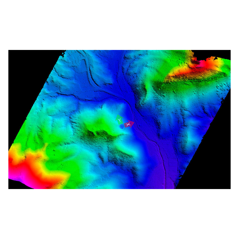
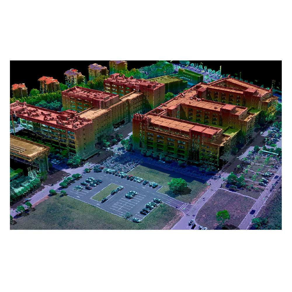
Thanks to the efficient hardware and software integration carried out by Altitude Geospatial, a fast workflow for data acquisition and post-processing is possible, resulting in highly dense point clouds, high-representativity digital surface models (DSM and DTM), and high-resolution images.
Technical Specifications of the Mini UAV LiDAR
- Models: 16 / 32 channels
- Pulses: 2 pulses
- Max. scanning range: 200 / 250 m
- Pulse frequency: 320 / 640 KHz (320,000 / 640,000 pts/s)
- Point density: > 100 / > 200 pts/m2
- Scanning accuracy: 2 cm
- Vertical accuracy: < 10 cm
- Horizontal accuracy: < 10 / 15 cm
- Mapping scale: 1:500 / 1:1000
- FOV: 360° x 30°
- IMU-GNSS: Trimble Applanix APX UAV
- Constellations: GPS L1/L2 – GLONASS L1/L2 – Beidou B1/B2
- Software: POSPac UAV – UI-RF – SS-Powerline – SS-Survey
- Weight: 1.2 Kg (1.8 Kg with Sony A7III camera)
- Compatible cameras: RGB – Infrared – Multispectral – Hyperspectral
He also takes
-
Consulting
Our team is ready to help you overcome any challenge in your projects. We have specialists with real technical training, who will guide you to integrate the exact solution your operation needs. Get advice from us via WhatsApp here
-
After-sales (Support and Technical Service)
We provide immediate technical support through our engineers to advise you on using your equipment to its maximum potential. Contact us to schedule your Technical Support via WhatsApp, or visit our Specialized Support portal to resolve operational queries.
-
News
Always stay one step ahead with the latest innovations in geospatial technology. Learn about new product launches, exclusive events, and technical talks designed to optimize your solutions. Discover all our news on the GEOCOM Blog
