

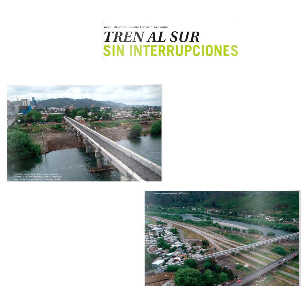
GEOCOM was featured in the latest December 2020 edition of En Concreto magazine. Among its main topics was the reconstruction of the Cautín railway bridge, an infrastructure project in which we participated with mobile laser scanner technology.

One of the main difficulties in topographic surveys is the need to directly access the measurement location. This is the case with total station and GNSS observations, where an operator is required to position a prism or GNSS antenna to determine point coordinates based on an observation. With the advent of Direct Reflex technology, it is possible to use a disto on any surface, obtaining the distance without the need to position a prism. However, the techniques described involve discrete data acquisition, which is positive when representing realities that do not offer much complexity. Typically, engineering has worked for a long time with these topographic representation models based on breaklines, and they have indeed worked wonderfully as a basis for creating engineering designs in various construction fields.
The emergence of laser scanners undoubtedly constituted a paradigm shift in surveys based on breaklines. Today, engineers and designers have access to a completely detailed representation of reality.
Terrestrial scanners have made significant progress in mass representation, although they still rely on techniques well known in conventional topography: installation is still on a tripod, performing static data capture.
Furthermore, until recently, the overrepresentation produced by point clouds captured with laser scanners posed a difficult problem.
This leads to the field of Mobile Mapping, which establishes a premise aimed at improving productivity without sacrificing precision or safety. By mounting a laser scanner on a vehicle, it is possible to acquire geospatial data that is extremely rich in information. Point clouds and images are obtained, which contribute to understanding the physical space to be represented in detail. In addition, these point clouds are the basis for advanced machine learning algorithms to automatically or semi-automatically draw breaklines and other elements. Through extremely fast surveys (the time it takes for the vehicle to move from one point to another), data can be acquired that constitutes a true geospatial database from which a multipurpose topographic representation can be extracted.


REPORT ON THE RECONSTRUCTION OF THE CAUTÍN RAILWAY BRIDGE


Along with the construction of 100% of direct and deep foundations, abutments and a total of 14 piers were installed to support the upper structure along its 414 meters length.
The project required an investment of $9 billion.
Compartir:
Attention all RTX users
Trimble Tunnel