

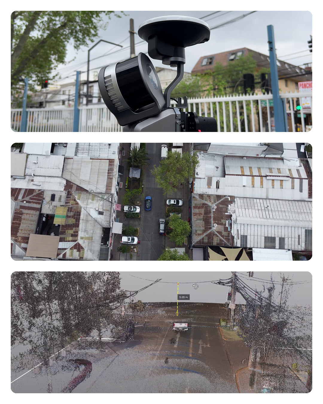
GEOCOM Introduces the New Vehicle Mounting Bracket for the Lixel L2 Pro Multi SLAM System
A revolution in data capture for linear projects: speed, precision, and safety
Reality Capture technology takes a significant leap with the introduction of the new vehicle mounting bracket for the XGRIDS Lixel L2 Pro system, a solution that transforms how surveys are conducted for infrastructure projects, urban mapping, and road corridors.
Innovation in Mounting and Autonomy
The new accessory incorporates a dual-suction cup system with automatic activation, designed to provide maximum security during the mounting of the L2 Pro laser scanner on vehicles. This feature ensures that the equipment remains firmly attached even at high travel speeds.
One of the most notable improvements is the integrated external battery, which significantly extends the autonomy of the Lixel L2 Pro system, allowing for longer workdays without interruptions. The mount offers up to 3 hours of continuous operation, ideal for extensive projects.


High-Precision Georeferencing
In-motion captures reach a new level of accuracy thanks to the high-precision GNSS antenna, a complementary accessory in the system. This technology allows for georeferencing of surveys through:
- Differential correction via real-time NTRIP
- Post-processing correction for maximum precision
The system can operate at speeds of up to 40 kilometers per hour, although it is recommended to work between 20-30 km/h for optimal results.


Intelligent Monitoring and Quality Control
The mount features an intelligent suction monitoring system that detects any loosening in real-time, immediately alerting the user. This feature ensures that the equipment remains secure throughout the operation.
Productivity for Linear Projects.
This accessory complements the measurement options of the Lixel L2 Pro Multi SLAM system, offering a powerful solution for optimizing captures in:
- Road and railway mapping
- Documentation of extensive construction sites
- Infrastructure asset management
- Development of digital twins for smart cities
- Environmental monitoring in large areas
- Urban planning

System Technical Specifications
Multi-SLAM XGRIDS Lixel L2 Pro
The XGRIDS Lixel L2 Pro mobile laser scanner combines LiDAR, visual, and IMU modules with artificial intelligence, providing real-time point cloud data with quality comparable to post-processing.
Key features:
- Multi SLAM (Simultaneous Localization and Mapping) technology
- Real-time data capture
- Integration of LiDAR, visual camera, and IMU modules
- AI-based processing
- Point cloud coloring
- Versatility of use: handheld, vehicle-mounted, and drone-mounted
Vehicle Mounting Bracket - Key Features
The L2 Pro vehicle mount is a lightweight accessory (under 2 kg without battery) designed for efficient data capture on the go. It stands out for its dual-suction cup system with automatic activation and intelligent monitoring, which ensures equipment safety with real-time alerts. With up to 3 hours of autonomy thanks to its integrated external battery, it allows operation at speeds of 20-30 km/h (up to 40 km/h maximum). The Lixel L2 PRO system can incorporate a high-precision GNSS antenna compatible with RTK/NTRIP correction in real-time or post-processing to georeference the point cloud.

Increased Productivity and Coverage
The new vehicle mount for the XGRIDS Lixel L2 Pro represents a significant advancement in data capture for linear projects, allowing professionals in surveying, civil engineering, and infrastructure management to dramatically increase their productivity and area coverage.
By transforming any vehicle into a mobile mapping platform, this accessory eliminates the traditional bottlenecks of manual scanning, reducing weeks of fieldwork to days or even hours.


Compartir:
[Webinar GEOCOM] Infrastructure inspection with Twinspect
[GEOCOM Webinar] Underground Mining Inspection