

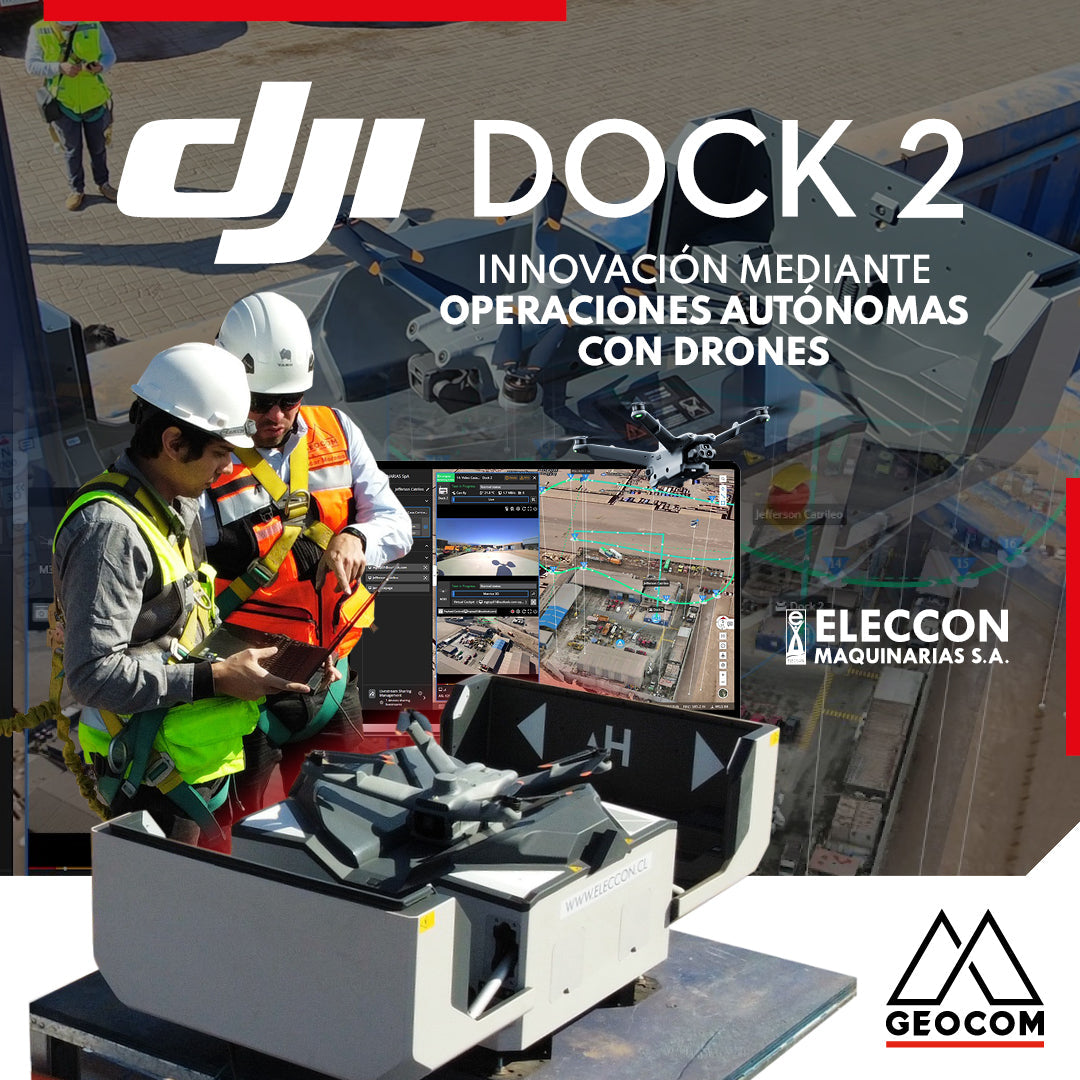

DJI DRONES | Innovation through autonomous drone operations
Experience with Eleccon Maquinarias
Drones have become an indispensable solution in different industries, mainly due to three factors: they reduce project costs, increase productivity, and provide greater operational safety (avoiding exposing operators to risky situations like falls). In this sense, DJI's Enterprise line drones are at the forefront, not only because they offer drones that can be operated conventionally via remote control, but also because they allow automating flights from hangars that can be operated 24/7, and controlled from hundreds of kilometers away through a cloud platform that acts as an operations center.
The following UAS article showcases a success story where a photogrammetry and inspection project was executed using the DJI Dock 2 drone-in-a-box system.

Figure 1. DJI Dock 2 from Eleccon Maquinarias
Automated flights with DJI Dock 2
The Dock 2 is DJI's new hangar, which is smaller and offers better features compared to its predecessor, Dock 1. It provides high-level operational capabilities and intelligent cloud functions for efficiency and quality. This technology offers a fully automated and rapidly deployable drone solution for situations ranging from topographic surveys and infrastructure inspection to emergency response and security monitoring.
This type of technology enables autonomous operations by creating systems where drones are housed, charged, launched, and returned to the hangar without the need for an on-site operator. This box will serve as the drone's base station and an automated service mechanism controlled from a cloud platform called FlightHub 2, requiring minimal operator intervention. The platform itself facilitates status checks, charging, and uploading of captured data, among other tasks previously performed manually.
Some benefits:

Figure 2. DJI Dock 2
The Dock 2 can operate with two high-performance drone models: the DJI Matrice 3D and the DJI Matrice 3TD.
-
The Matrice 3D is designed for photogrammetry and visible light inspection. It is equipped with a telephoto camera and a 20 MP wide-angle camera with a mechanical shutter, providing high-quality images for RTK and PPK photogrammetric reconstructions, meeting the needs for high-precision surveys at a 1:500 scale.
- The Matrice 3TD is designed for inspection and security. It is equipped with a wide-angle camera, a telephoto camera, and an infrared camera, allowing it to capture both visible light and thermal images.
Flights executed with both drone models can be planned directly on the FlightHub2 platform, which allows planning, executing, and monitoring flights at all times.
Main applications
Currently, surveying, public safety, and infrastructure maintenance are among the main sectors that benefit from its implementation.
-
Surveying: Optimizing productivity, drones will capture high-resolution images that will automatically be uploaded to the cloud for subsequent post-processing and obtaining highly detailed 2D and 3D reconstructions, facilitating the acquisition of more precise and representative measurements that can be studied multi-temporally over time.
-
Public Safety: Improves emergency response strategies, allowing rapid deployment in search and rescue operations, accident scene analysis, and disaster management.
- Infrastructure Maintenance: Facilitates automatic inspection of critical infrastructure such as bridges, power lines, and wind turbines. Such inspection helps identify problems before they worsen, reducing downtime and maintenance costs.
Project execution
This experience was carried out by our client Eleccon Maquinarias. This is a construction project company founded in Iquique, Tarapacá region, in 1998. Since its inception, it has focused on the execution of high-quality projects and services for medium and large mining, with a team of highly trained professionals and workers from northern Chile. In 2024, they have taken a significant step in innovation by acquiring the DJI Dock 2 with the Matrice 3D drone for photogrammetry and visible light inspection.
Why did Eleccon decide to innovate with DJI Dock 2?
Mainly to possess an advanced automated drone system that allows for improved efficiency in mapping and inspection tasks.
"The Matrice 3D drone will allow us to collect high-quality data autonomously, reducing risks and optimizing decision-making. This implementation reinforces Eleccon Maquinarias SpA's commitment to innovation and safety in the mining industry. This advancement takes us one step further in our mission to adopt the latest technologies and offer innovative solutions in the construction mining industry."
José Luis Alcayaga, Deputy Manager PMO of Eleccon Maquinarias
On-site evaluation and implementation
The DJI Dock 2 weighs 34 kg. Being 75% smaller and 68% lighter than the previous generation, it can be carried by two people, making its installation simpler and more economical. The installation for this project was carried out at Eleccon Maquinarias' main office, located in Alto Hospicio, Iquique Province. This location was used as a test center, with more than 30 flights already performed with the system.
The system had to be installed at a fixed point, which required electrical power and an internet connection. To ensure a successful platform installation, the Dock 2 used the Matrice 3D's vision sensors to evaluate the installation site, ensuring that the flight path and destination had a good GNSS signal.


Figure 3. DJI Dock 2 on-site installation and configuration
Once the safe environment was validated, the final reconfiguration of the Dock 2 was carried out, fulfilling a series of steps that ensured the successful operation of the system: the network connection was checked, the system was linked to the FlightHub 2 platform, precise coordinates for RTK flight were defined, an alternative landing site for emergencies was defined, among others.

Flight planning and execution with DJI Dock 2
FlightHub 2 is the platform used to control Dock 2. This is a cloud-based multi-function platform for managing operations with various DJI drones.
- Plan, monitor, and manage data created by a fleet of drones directly from an operations center.
- Provides comprehensive real-time situational awareness.
-
The platform allows for:
- Route planning
- Flight scheduling
- Task execution
- Uploading and storing planning data
- Like DJI Dock 2, the software requires internet access to receive photos/videos captured during flight.
- Captured data will be displayed on a 2.5D base map along with its coordinate information.


Figure 5. Operations center using DJI FlightHub 2 platform at Eleccon Maquinarias
For this specific project, Eleccon Maquinarias acquired the system with the Matrice 3D drone, as in addition to executing flights for inspection and security, they needed to perform photogrammetric flights. In this regard, the FlightHub 2 platform provides the operator with various flight strategies: mapping for photogrammetry, vertical for facades and infrastructure, trajectory for inspection based on photo and video capture, among others.


Once the desired flight strategy is created, a plan must be generated on the platform to execute the mission. This plan defines whether the flight should be executed immediately, at a specific time, recurrently, or continuously. With this already defined, the system prepares for takeoff.


Figure 7. DJI Dock 2 plan creation and takeoff
The FlightHub 2 platform allows constant monitoring of each flight's execution, thus promoting operational safety. In addition, since Dock 2 is equipped with a weather station, the operator can obtain information on environmental conditions during flight, allowing intervention if necessary.


Figure 8. DJI FlightHub 2 Interface
Visualization of captured data and preliminary processing in FlightHub 2
Once the drone lands successfully on the platform, the data automatically begins to upload to FlightHub 2. This data is organized into separate folders according to the mission executed. Whether for mapping or inspection flights, each photograph and/or video can be downloaded, and they can also be reviewed on a 2.5D visualization map.

Figure 9. Photograph captured during inspection flight with Matrice 3D
For quick decision-making, the platform allowed the generation of 2D and 3D reconstructions within the same platform, to obtain orthophotos, point clouds, and other additional products.


"Automatic cloud processing allowed us to reduce processing times, obtaining fast and high-quality products that were immediately stored in the cloud, which could be downloaded and shared quickly with the end-user."
Fabian Moyano, Geospatial Engineer in charge of UAS / Scanner Processes
Finally, for the generation of more precise products, photographs can also be downloaded with precise coordinates obtained in RTK, so that the data can be processed in other photogrammetric processing software such as Trimble Business Center Aerial Photogrammetry, Agisoft Metashape or DJI Terra.
Do you want to know more about the DJI Dock 2 and the use Eleccon Maquinarias is giving it in the mining industry?
Cristian Michell, UAS product manager at GEOCOM, and German Lafuente, head of Topography at Eleccon, will be presenting the paper “Automated mapping with DJI DOCK 2” at our Geoespacial 2024 Seminar, where they will share the results and experiences of another project executed with the Dock 2 in a mining operation in northern Chile.
Don't miss it!

Figure 11. DJI Dock 2 in mining project
Conclusions
The DJI Dock 2 allows professionals to execute automated missions that were previously impossible. The system stands out for its ease of implementation, versatility of use thanks to being equipped with two drone models that have different types of sensors, advanced integrated functions, and security improvements. This type of in-a-box drone technology makes it the ideal solution for companies and professionals looking to maximize operational efficiency and performance. DJI Dock 2 represents the future of remote drone technology, allowing users to achieve unprecedented levels of performance and productivity in their respective industries.
Acknowledgements
GEOCOM thanks ELECCON Maquinarias for sharing their successful project with the DJI Dock 2 drone.

Compartir:
New Geomagic Design X modules: Go, Plus, and Pro
CONTEST! 📷 GEOCOM CALENDAR 2025