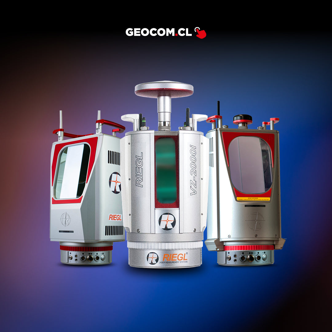
Long-range Laser Scanner
RIEGL VZ-6000
Description
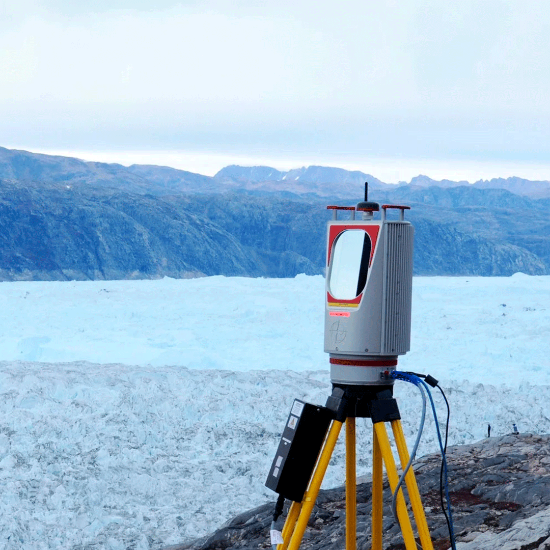
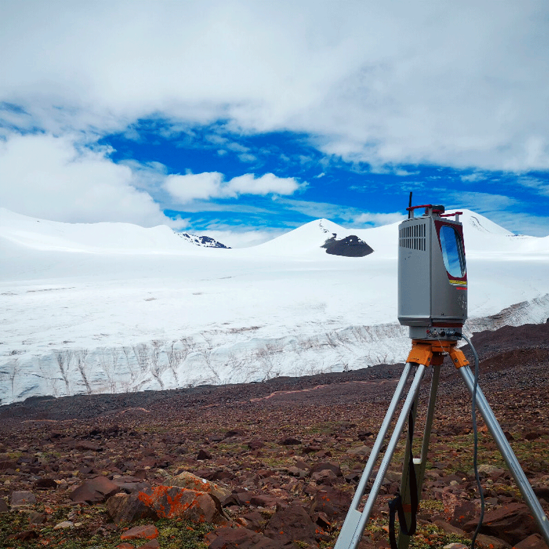
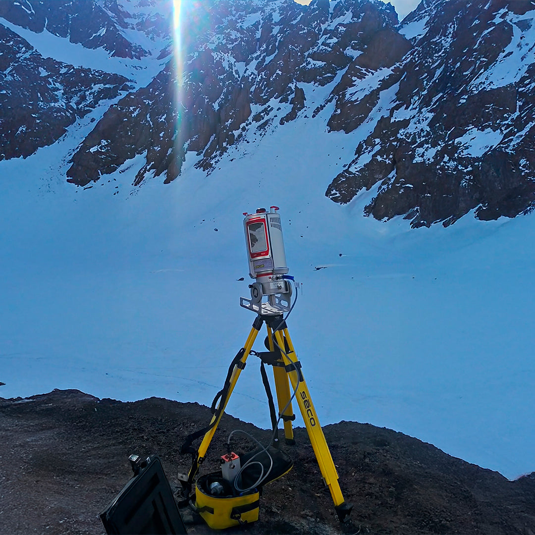
IDEAL FOR ULTRA LONG-RANGE MEASUREMENTS
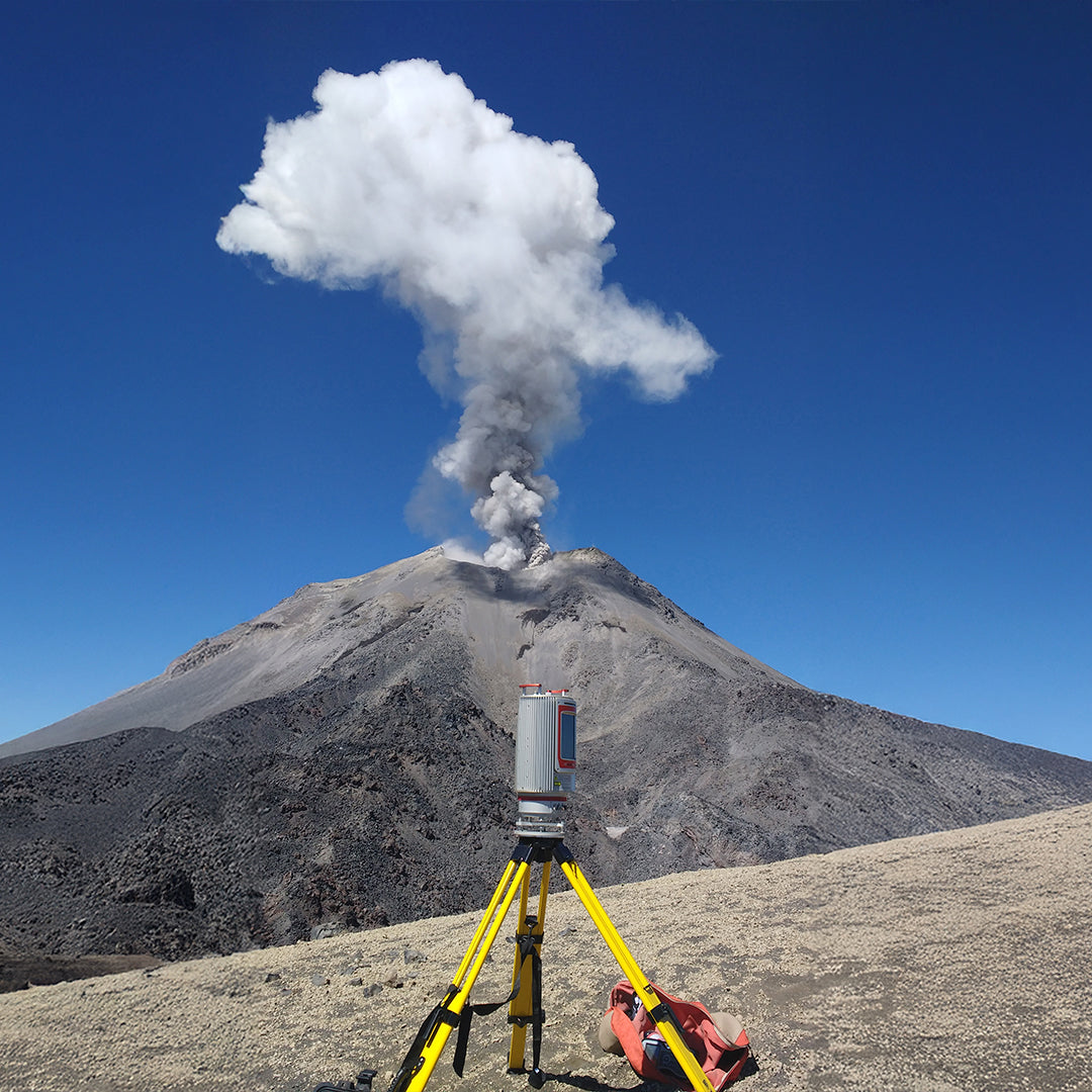
VZ-6000 laser scanner, the new high-speed, high-resolution terrestrial product that offers a measuring range of more than 6000m for surveying applications (static). Due to the composition of the Class 3B laser, it is suitable for measuring snow and ice-covered terrain in mapping, glacier monitoring, and mountainous regions.
Specifications
• Long Range up to 6000m
• Class 3B Laser
• Wide field of view 60° x 360°
• High-speed data acquisition up to 222,000 points per second
• Built-in compass
Video
Datasheet
Download Datasheet
Characteristics
Specifications
Operating Modes
Video
Includes:


He also takes
-
GEOCOM Support
Our support team is made up of geomatics engineers specializing in different technologies, with the training and technical experience necessary to advise clients on the use of their products. Visit our support page for more information here.
-
Instrument Rental
Lorem ipsum dolor sit amet, consectetur adipiscing elit, sed do eiusmod tempor incididunt ut labore et dolore magna aliqua. Ut enim ad minim veniam, quis nostrud exercitation ullamco laboris nisi ut aliquip ex ea commodo consequat.
-
Offices
Lorem ipsum dolor sit amet, consectetur adipiscing elit, sed do eiusmod tempor incididunt ut labore et dolore magna aliqua. Ut enim ad minim veniam, quis nostrud exercitation ullamco laboris nisi ut aliquip ex ea commodo consequat.
-
Guarantees
Lorem ipsum dolor sit amet, consectetur adipiscing elit, sed do eiusmod tempor incididunt ut labore et dolore magna aliqua. Ut enim ad minim veniam, quis nostrud exercitation ullamco laboris nisi ut aliquip ex ea commodo consequat.

Multi-target capability
Compact and robust design
Integrated tilt sensors
Ultra-long range performance
Built-in camera
Compatible Software Packages
Snowfield Monitoring