


Modern, connected, and scalable

Trimble R750 GNSS

MODERN, CONNECTED, AND SCALABLE
Incorporates industry-leading positioning technology
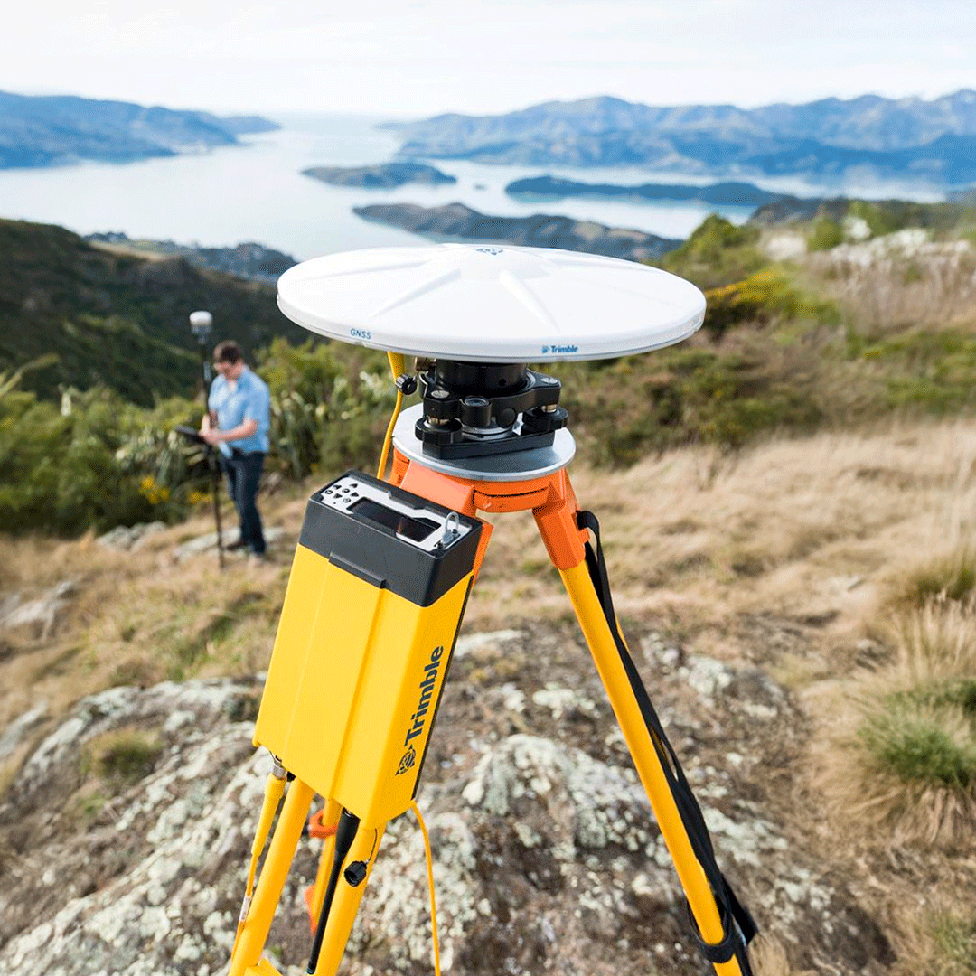
The Trimble R750 is a powerful and versatile GNSS receiver designed for a wide range of surveying and geodetic applications. It features an integrated 4G LTE modem, a reversible four-line front display, and USB-C PD charging. It incorporates the latest satellite positioning technology along with modern communications, all in a modular and rugged device that can be used in any environment.
⨮ Advanced Positioning Technology:
- Trimble Maxwell™ 7 GNSS ASIC with 336 channels.
- Trimble ProPoint® GNSS positioning engine.
- Trimble IonoGuard™ technology to mitigate ionospheric disruptions.
⨮ Satellite Tracking and Connectivity:
- Trimble 360 technology for advanced satellite tracking.
- Compatible with multiple constellations (GPS, GLONASS, Galileo, BeiDou, QZSS, NavIC).
- Wi-Fi®, Bluetooth®, Ethernet, USB, and 4G LTE connectivity.
⨮ Other Highlights:
- Internal Memory: 8 GB, external memory support.
- USB-C PD Charging: Fast charging with integrated internal lithium-ion battery.
- Front Panel: Display and keyboard for setup and data deployment.
⨮ Applications and Use
The Trimble R750 receiver is ideal for:
- Static and Kinematic GNSS Surveys: Providing precision and reliability in challenging GNSS conditions.
- Trimble RTX Corrections: Offering real-time centimeter accuracy.
- Mapping and Surveying Applications: Where precision and connectivity are essential.
⨮ GNSS Measurement:
- Trimble EVEREST™ Plus technology for multipath error reduction.
- Accuracy of <1 mm in carrier phase measurements.
⨮ Positioning Performance:
High-Precision Static:
- Horizontal: 3 mm + 0.1 ppm RMS.
- Vertical: 3.5 mm + 0.4 ppm RMS.
Network RTK:
- Horizontal: 8 mm + 0.5 ppm RMS.
- Vertical: 15 mm + 0.5 ppm RMS.
⨮ Hardware:
- Dimensions: 269 mm x 141 mm x 61 mm.
- Weight: 2.05 kg.
- IP67 protection against water and dust.
⨮ Certifications:
- Complies with safety and quality standards such as IEC 62368-1, FCC Section 15, EU RED 2014/53/UE, among others.
⨮ Communication:
- NTRIP, HTTP, Bluetooth, Wi-Fi protocols.
- Integrated UHF radio, LTE.

Characteristics
Specifications
Applications and usage
Video
He also takes
-
Consulting
Our team is ready to help you overcome any challenge in your projects. We have specialists with real technical training, who will guide you to integrate the exact solution your operation needs. Get advice from us via WhatsApp here
-
After-sales (Support and Technical Service)
We provide immediate technical support through our engineers to advise you on using your equipment to its maximum potential. Contact us to schedule your Technical Support via WhatsApp, or visit our Specialized Support portal to resolve operational queries.
-
News
Always stay one step ahead with the latest innovations in geospatial technology. Learn about new product launches, exclusive events, and technical talks designed to optimize your solutions. Discover all our news on the GEOCOM Blog

