Skip to content
  • Facebook
  • Instagram
  • YouTube
  • TikTok
  • LinkedIn

Welcome to our new website

October 8, 2026. Geospatial Seminar. Visit us!

Contact us via WhatsApp here

  • Products
  • Areas
  • We
  • News
  • Contact
Login
  • Facebook
  • Instagram
  • YouTube
  • TikTok
  • LinkedIn
Search
Geocom
  • Products Products
  • Areas Areas
  • WeWe
  • NewsNews
  • ContactContact
Search Login Cart 0
Cart

Your cart is currently empty.

  • Continue shopping
    Tax included and shipping calculated at checkout
    Subtotal
    0 CLP
    View cart
    Search

    Usamos cookies

    El sitio de GEOCOM utiliza cookies para ofrecer una mejor experiencia de usuario y realizar análisis.

    Home Search Store 0 Cart Login
    TRIMBLE MX50
    TRIMBLE MX50
    TRIMBLE MX50
    TRIMBLE MX50
    TRIMBLE MX50
    TRIMBLE MX50
    TRIMBLE MX50
    TRIMBLE MX50

    Productivity on the go
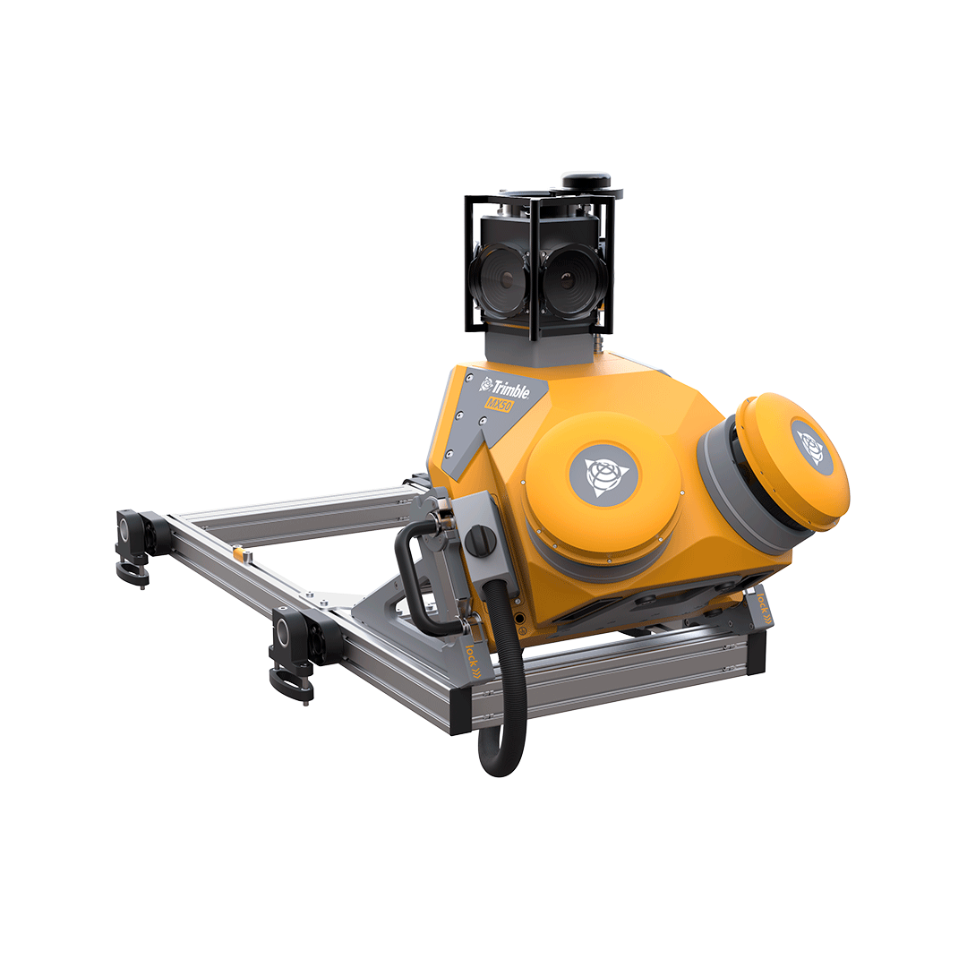
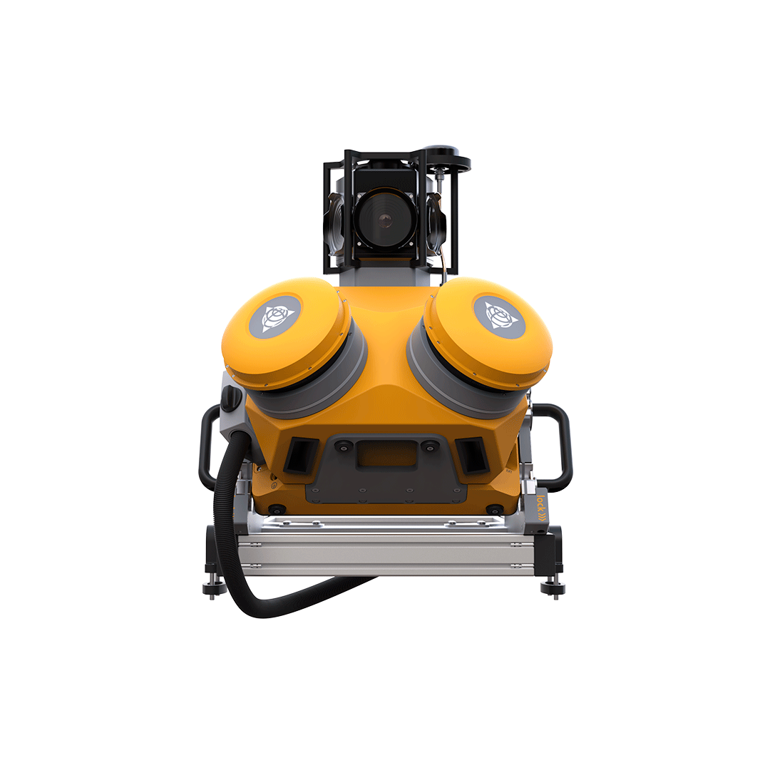
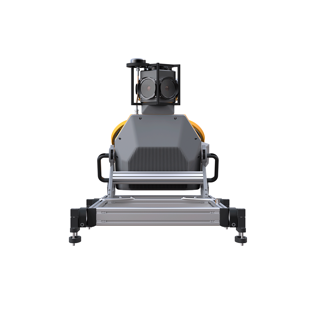
    TRIMBLE MX50

    PRODUCTIVITY ON THE GO

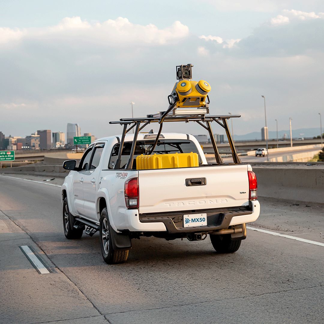
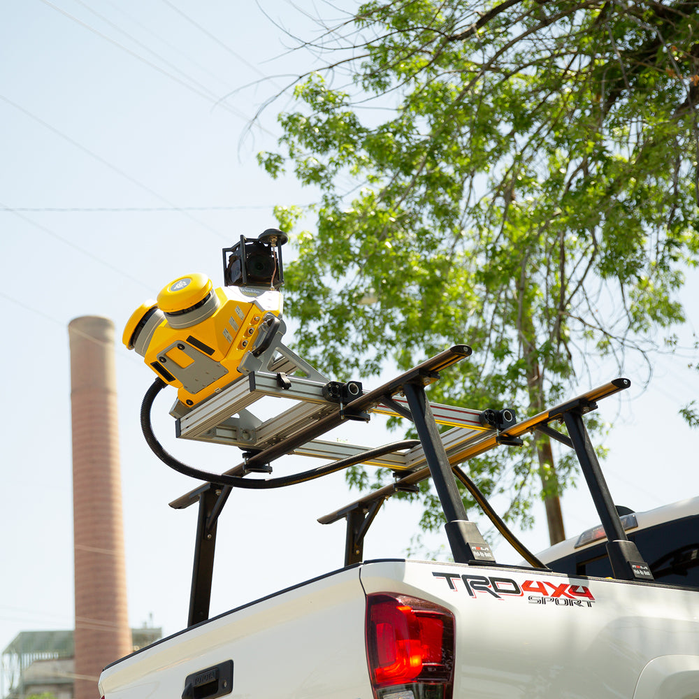
    Whether used for highway management, utilities or local government applications, the Trimble MX50 allows you to take control of your data capture project. The system is easy to install and operate and requires no particular experience.

    Point clouds and complementary images provide you with everything you need to extract location, size, condition and other inspection and attribute information from assets.
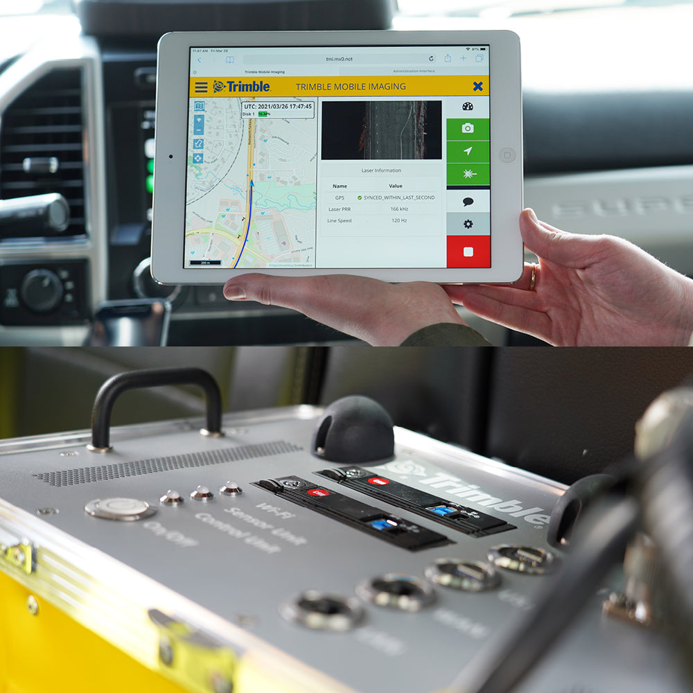
    SURVEY DEMO

    The vehicle-mounted mobile LiDAR system is an intermediate option for new and experienced mobile mapping users to equip their fleet with accurate, high-volume data capture technology for applications such as:

    • Highways
    • Urban planning
    • Accurate ground models
    • Engineering profiles and sections
    • Road surface information

    ⨭ Practical mobile mapping system combining precise LiDAR data with immersive panoramic images.

    ⨭ Latest generation Trimble LiDAR technology integrated into a trusted, proven mobile platform.

    ⨭ Accurate point clouds for road surface projects, highway maintenance or asset management.

    ⨭ Easy installation with intuitive browser-based operation.

    ⨭ Complete "end-to-end" Trimble workflow: data capture, processing, extraction and publication for sharing.

    Download Datasheet


    Formulario de cotización

    ¿Necesitas más información de un producto? ¿Quieres solicitar una demo? Completa el formulario con tus datos y nos pondremos en contacto.

    Characteristics

    A vehicle-mounted mobile LiDAR system is an intermediate option for both new and experienced mobile mapping users to enhance their fleet with precise, high-volume data capture technology for applications such as:

    • Roads
    • Urban planning
    • Accurate ground models
    • Engineering profiles and cross-sections
    • Road surface information

    Specifications

    ⨭ Practical mobile mapping system combining accurate LiDAR data with immersive panoramic imagery.

    ⨭ State-of-the-art Trimble LiDAR technology integrated into a proven and reliable mobile platform.

    ⨭ Accurate point clouds for road surface projects, highway maintenance, or asset management.

    ⨭ Easy to install with intuitive browser-based operation.

    ⨭ Complete end-to-end Trimble workflow: data capture, processing, extraction, and publication for sharing.

    Description

    Whether used for highway management, utilities, or local government applications, the Trimble MX50 puts you in control of your data capture project. The system is easy to install and operate and does not require any particular experience.

    The point clouds and complementary images provide you with everything you need to extract location, size, condition, and other inspection and attribute information from assets.

    Video
    Download Datasheet

    Includes:

    Accesorios incluidos

    He also takes


    Do you need help?
    • Consulting

      Our team is ready to help you overcome any challenge in your projects. We have specialists with real technical training, who will guide you to integrate the exact solution your operation needs. Get advice from us via WhatsApp here

    • After-sales (Support and Technical Service)

      We provide immediate technical support through our engineers to advise you on using your equipment to its maximum potential. Contact us to schedule your Technical Support via WhatsApp, or visit our Specialized Support portal to resolve operational queries.

    • News

      Always stay one step ahead with the latest innovations in geospatial technology. Learn about new product launches, exclusive events, and technical talks designed to optimize your solutions. Discover all our news on the GEOCOM Blog

    view more products from Trimble
    WE
    • About us
    • Shipping and Warranties
    • Exchanges and Returns
    • Terms and Conditions
    • Whistleblowing Channel
    CONTACT

    Address | Av. Salvador 1105, Providencia.
    Phone | +562 2480 3600
    Email | ventas@geocom.cl

    GNSS and Optics Support | Whatsapp
    UAS Support |
    Whatsapp

    Geocom

    Subscribe to our newsletter

    • Facebook
    • Instagram
    • YouTube
    • TikTok
    • LinkedIn
    • Choosing a selection results in a full page refresh.
    • Opens in a new window.
    ¡Gracias por contactarte con nosotros! Soon an executive will contact you