


Spectra Geospatial SP100 GNSS

PRODUCTIVITY AND SAFETY FOR ALL GEOSPATIAL WORK
Advanced technology with Trimble Geospatial backing
The Spectra Geospatial SP100 GNSS receiver is a robust GNSS solution for high-precision satellite positioning. Designed for the most demanding scenarios, the SP100 has a compact and ultra-rugged (IP68) design. Capture data with confidence and repeatability, even under tree canopies, with the Z-Blade™ multi-constellation GNSS processing technology.
Galileo and triple frequency
The incorporation of the Galileo constellation and Triple Frequency (L5) complement the SP100's base configuration (GPS+GLONASS and BeiDou), significantly increasing satellite availability, thus allowing faster initializations and robust satellite positioning. For this new standard, the SP100 incorporates 672 channels that enable highly efficient tracking.
Z-Blade™ GNSS Engine
Continue working with high accuracy wherever your job takes you, whether in an urban environment or in wooded areas, thanks to the improved Z-Blade GNSS engine, triple-frequency GNSS. It incorporates ionospheric, multipath, and anti-spoofing error mitigation, as well as compatibility with the Trimble CenterPoint® RTX correction service.
Optimal productivity and safety: get more done faster and safer
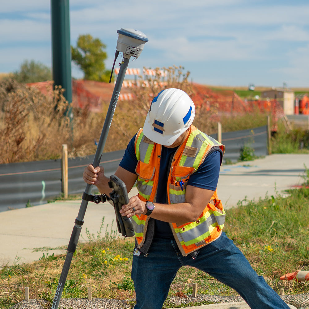
With its highly efficient tilt measurement capability, the SP100 automatically compensates to provide high-quality positions, without the need for leveling. Easily capture hard-to-reach points, from building corners and fence lines to river boundaries. Survey with complete confidence, as IMU tilt compensation allows you to work on roads and manage traffic simultaneously.
Spectra Geospatial® Origin
The SP100 is integrable with Spectra Origin field software. Choose the data collector that best suits you and take the SP100 to a high level of productivity: perform topographic or geodetic calculations in the field in a few steps, visualize your work through an advanced graphical interface, automatically link your work to the SIRGAS Chile 2021.0 geodetic framework. Also compatible with Trimble Business Center 2023.10
Superior resistance: ultra-rugged design for demanding environments.
With a compact and ultra-rugged design, the SP100 is built to withstand extreme physical conditions, ensuring continuous operation even in environments with dust, humidity, salinity, wind, or extremely high or low temperatures.
Spectra Geospatial Survey Office
Advanced GNSS signal tracking such as that provided by the SP100 can be automatically incorporated into Spectra Geospatial Survey Office, powerful GNSS processing software. Process and adjust GNSS networks, statistically analyze results, and generate topographic products with data from the SP100 in a few steps.
⨭Z-Blade Technology: Z-Blade™ multi-constellation GNSS processing technology and triple frequency support
⨭Centerpoint RTX: High accuracy of 1-2 centimeters with fast convergence time. (Paid service)
⨭Optional IMU: Measure faster and safer with IMU-based tilt compensation.
⨭Superior Resistance: IP68 rated, designed to withstand extreme physical conditions and harsh environments.
⨭Scalable by subscription: Unique receiver that works with subscription mode.
(Base › Rover › Base and Rover)
Signal tracking:
⨭GPS L1C, L1C/A, L2E(L2P),L2C,L5
⨭GLONASS L1C/A, L1P, L2C/2,L2P, L3
⨭GALILEO E1, E5A, E5B and E5AltBOC, E6
⨭BEIDOU B1, B2,B3, B1C, B2A
Communication and connectivity:
⨭Formats CMR+, CMRX, RTCM 2.1, RTCM 2.3, RTCM 3.0, RTCM 3.1, RTCM 3.2, NMEA (24 OUTPUTS) GSOF, RT17, RT27
⨭Wifi, Lemo (serial 1), Bluetooth, UHF communication
⨭Internal memory 9 GB
⨭Battery Rechargeable lithium-ion battery / automatic power-on with external supply
⨭Battery life Static: 5.5 hours average / RTK 4 hours average
⨭Horizontal 8 mm + 1 ppm

He also takes
-
Consulting
Our team is ready to help you overcome any challenge in your projects. We have specialists with real technical training, who will guide you to integrate the exact solution your operation needs. Get advice from us via WhatsApp here
-
After-sales (Support and Technical Service)
We provide immediate technical support through our engineers to advise you on using your equipment to its maximum potential. Contact us to schedule your Technical Support via WhatsApp, or visit our Specialized Support portal to resolve operational queries.
-
News
Always stay one step ahead with the latest innovations in geospatial technology. Learn about new product launches, exclusive events, and technical talks designed to optimize your solutions. Discover all our news on the GEOCOM Blog

