

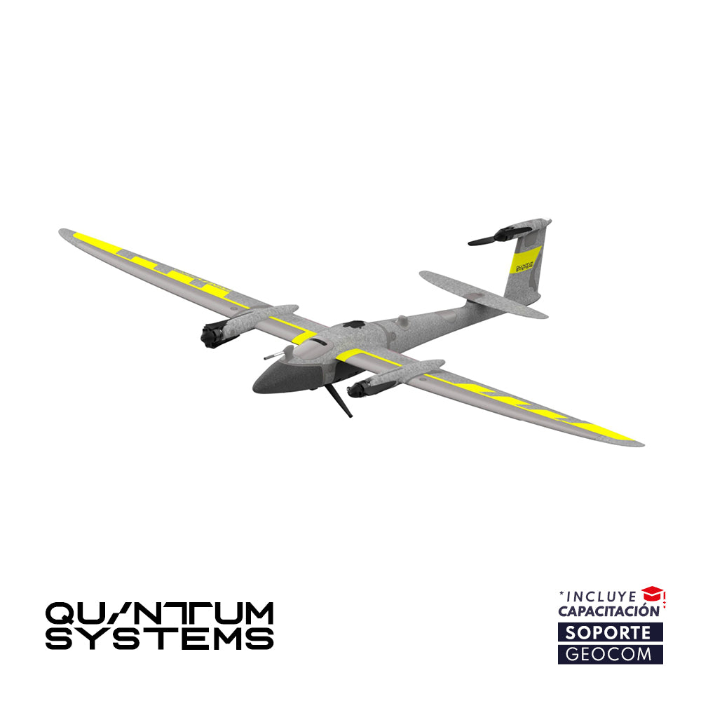


Quantum Trinity Pro VTOL
VTOL EVOLUTION
Quantum-Skynode Autopilot with integrated AI
Interchangeable sensors in a matter of seconds.
Trinity Pro is an aerial mapping solution designed in Germany with a futuristic approach, based on a reliable, easy-to-use, productive and safe platform.
Its design allows for easy sensor interchangeability to adapt to constantly evolving requirements, accelerating decision-making through aerial data. As technology evolves, so will Trinity Pro.
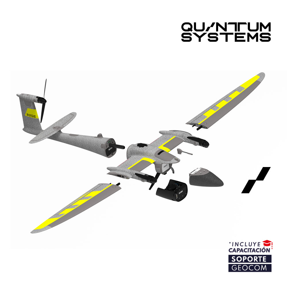
Trinity Pro integrates the latest Quantum-Skynode autopilot with an onboard Linux mission computer. These high-performance components provide greater processing power and internal storage, as well as connectivity, enabling the integration of next-generation cameras, as well as logging, simulation, and AI. These integrations will change how you interact with your data, reducing processing steps and office time.
Cameras can be easily swapped in a matter of seconds. They are securely integrated into the payload bay that connects to the UAS using a quick-locking mechanism. No tools are required.
Accessing captured data is straightforward. SD or microSD cards are accessible via internal or external card slots.
All cameras are vibration-dampened during flight to ensure expected image quality. The UAV's eVTOL capability allows for soft landings, which ultimately extends the cameras' lifespan.
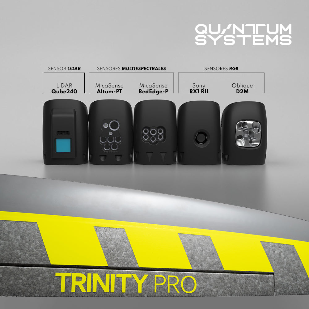
- Sony RX1 RII (RGB)
- Oblique D2M (Five-lens RGB)
- MicaSense RedEdge-P (Multispectral and RGB)
- MicaSense Altum-PT (Multispectral, RGB, and Thermal)
- Qube 240 (LiDAR Sensor)
⨭Compatible Sensors: Sony RX1 RII, Oblique D2M Camera, Qube 240 LiDAR, MicaSense RedEdge-P, MicaSense Altum-PT
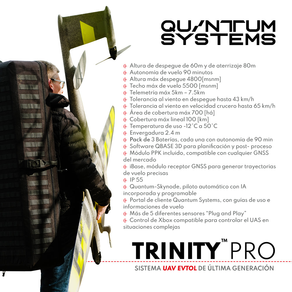
⨭Maximum Takeoff Weight: 5.75 kg
⨭Maximum Payload Weight: 1 kg
⨭Wingspan: 2.394 m
⨭Transport Case Dimensions (LxWxH): 1002x 830 x 270 mm
⨭Maximum Flight Time: 90 min
⨭Linear Coverage: 100 km
⨭Area Coverage: 700 ha
⨭Maximum Takeoff Altitude: 4800 m/ asl
⨭Maximum Flight Altitude: 5500 m/asl
⨭Cruising Speed: 61.2 km/h
⨭Wind Resistance: up to 64.8 km/h
⨭IP55 Protection
⨭Temperature Range: -12 to +50°C

He also takes
-
Consulting
Our team is ready to help you overcome any challenge in your projects. We have specialists with real technical training, who will guide you to integrate the exact solution your operation needs. Get advice from us via WhatsApp here
-
After-sales (Support and Technical Service)
We provide immediate technical support through our engineers to advise you on using your equipment to its maximum potential. Contact us to schedule your Technical Support via WhatsApp, or visit our Specialized Support portal to resolve operational queries.
-
News
Always stay one step ahead with the latest innovations in geospatial technology. Learn about new product launches, exclusive events, and technical talks designed to optimize your solutions. Discover all our news on the GEOCOM Blog
