


Trimble R780 GNSS

ROBUST POSITIONING
The best complement for geodetic and topographic sensors
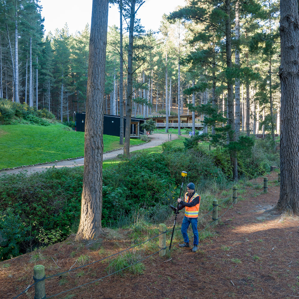
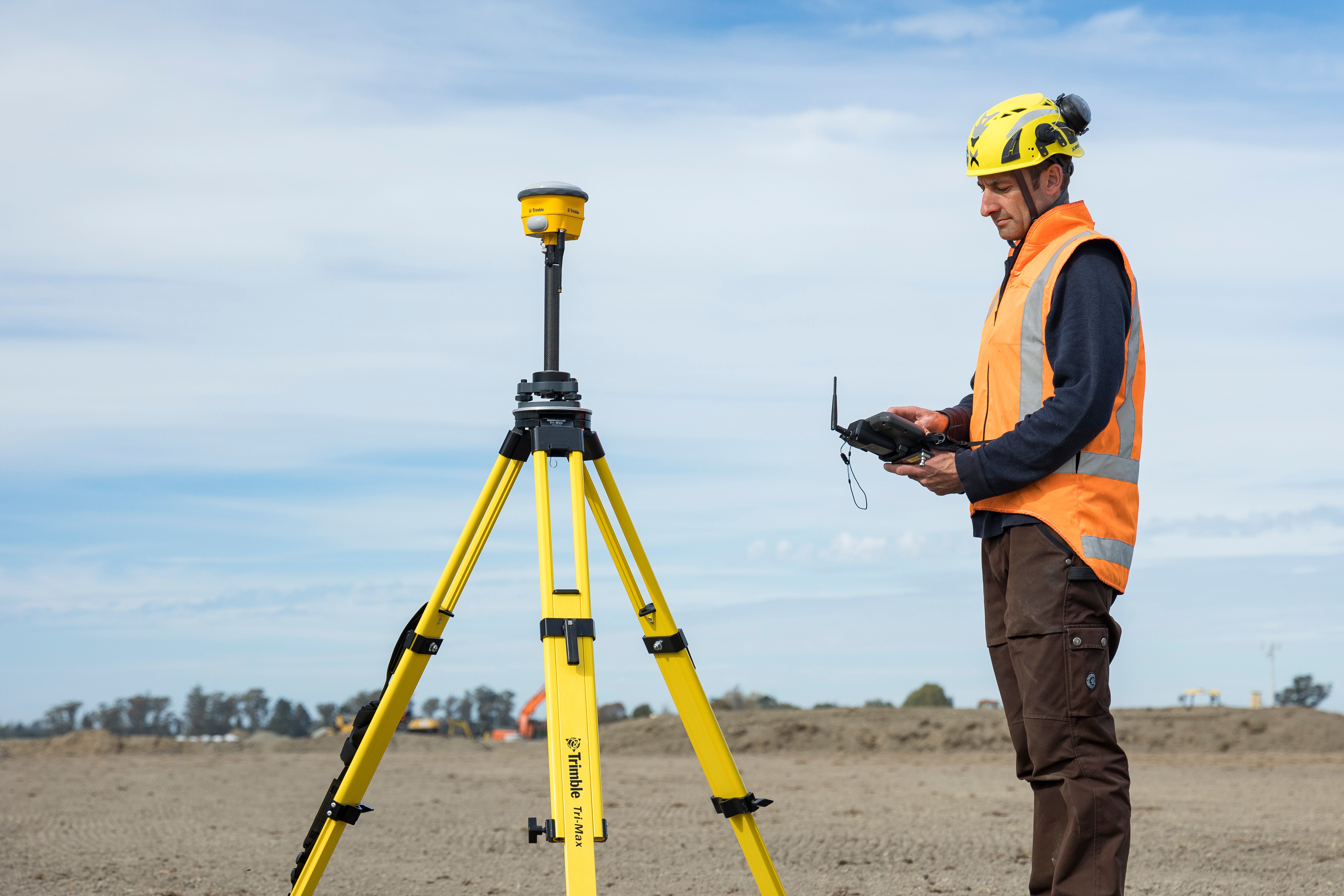
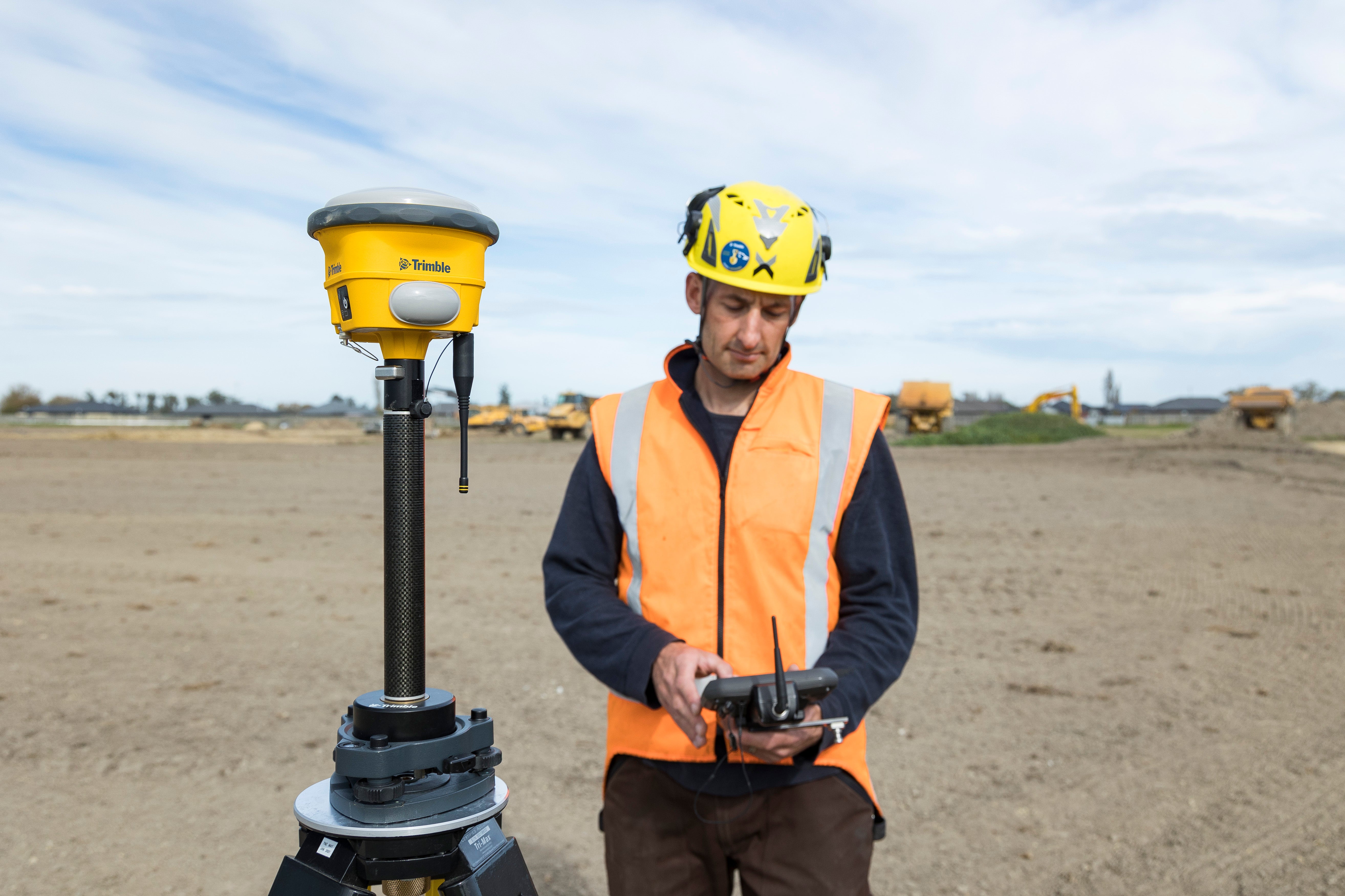
Trimble's R780 GNSS receiver is a robust GNSS solution for high-precision satellite positioning.
Designed for the most demanding scenarios, the R780 features a compact and ultra-rugged design (Rugged IP68), coupled with a powerful Trimble Maxwell™ 7 GNSS ASIC processor that enables multi-signal GNSS tracking under the control of an advanced system for interference filtering and multipath effects provided by EVEREST™ Plus technology.
The incorporation of the Galileo constellation and Triple Frequency (L5) complement the R780's base configuration (GPS and GLONASS), significantly increasing satellite availability.
Galileo and triple frequency
The incorporation of the Galileo constellation and Triple Frequency (L5) complements the R780's base configuration (GPS and GLONASS), significantly increasing satellite availability, thus allowing for faster initializations and robust satellite positioning. For this new standard, the R780 incorporates 336 channels that enable highly efficient tracking.
Trimble ProPoint™
The powerful Trimble ProPoint™ advanced processing technology is integrated into the R780, providing precise and reliable multi-constellation and multi-frequency real-time (RTK) solutions in traditionally complex environments, substantially increasing the productivity of field work.
Freedom to work your way
The R780 is a flexible and scalable GNSS receiver. Grow at your own pace! Incorporate new constellations, configurations (Base or Rover) or enhance your receiver with technologies such as Trimble TIP™, Trimble CenterPoint RTX, and Trimble xFill®.
Trimble Access™
The R780 is integrable with Trimble Access. Choose the data collector that best suits you and take the R780 to a high level of productivity: perform topographic or geodetic calculations in the field in a few steps, visualize your work through an advanced graphical interface, automatically link your work to the SIRGAS Chile 2021.0 geodetic framework.
Survey Methods
In addition to the well-known methods of topographic point, quick point, and observed control point, the Multiple Tilt Point is added, based on the powerful electronic bubble incorporated in the R780 GNSS system, it determines precise GNSS positions through multiple inclined measurements without the need for a magnetometer.
Trimble Business Center™
Advanced GNSS signal tracking such as that provided by the R780 can be automatically incorporated into Trimble Business Center, a powerful GNSS processing software. Process and adjust GNSS networks, statistically analyze results, and generate topographic products with data from the R780 in a few steps.
⨭Trimble TIP: IMU-based tilt compensation technology.
⨭Trimble ProPoint: Advanced processing technology that provides real-time (RTK) multi-constellation and multi-frequency solutions in traditionally complex environments.
⨭Flexible and scalable: Incorporates new constellations, configurations (Base or Rover) or enhances your receiver with technologies such as Trimble TIP™, Trimble CenterPoint RTX, and Trimble xFill®.
⨭Easy integration with geodetic and topographic sensors, such as Trimble S-series total stations, Drones, mobile and terrestrial LiDAR scanners, bathymetry systems, among others.
⨭High-precision static positioning: Horizontal 3 mm + 0.1 ppm / Vertical 3.5 mm + 0.4 ppm
⨭PPK Positioning: Horizontal 8 mm + 1 ppm / Vertical 15 mm + 1 ppm
⨭RTK Positioning: Horizontal 8 mm + 0.5 ppm / Vertical 15 mm + 0.5 ppm
⨭RTX Positioning: Horizontal 2 cm / Vertical 5 cm
Signal tracking:
⨭GPS L1C, L1C/A, L2E(L2P),L2C,L5
⨭GLONASS L1C/A, L1P, L2C/2,L2P, L3
⨭GALILEO E1, E5A, E5B and E5AltBOC, E6
⨭BEIDOU B1, B2,B3, B1C, B2A
Communication and connectivity:
⨭Formats CMR+, CMRX, RTCM 2.1, RTCM 2.3, RTCM 3.0, RTCM 3.1, RTCM 3.2, NMEA (24 OUTPUTS) GSOF, RT17, RT27
⨭Wifi, Lemo (serial 1), Bluetooth, UHF communication
⨭9 GB internal memory
⨭Battery Rechargeable lithium-ion battery / automatic power-on with external supply
⨭Battery life Static: 5.5 hours average / RTK 4 hours average
⨭Horizontal 8 mm + 1 ppm

Characteristics
Specifications
Communication and Connectivity
Video
He also takes
-
Consulting
Our team is ready to help you overcome any challenge in your projects. We have specialists with real technical training, who will guide you to integrate the exact solution your operation needs. Get advice from us via WhatsApp here
-
After-sales (Support and Technical Service)
We provide immediate technical support through our engineers to advise you on using your equipment to its maximum potential. Contact us to schedule your Technical Support via WhatsApp, or visit our Specialized Support portal to resolve operational queries.
-
News
Always stay one step ahead with the latest innovations in geospatial technology. Learn about new product launches, exclusive events, and technical talks designed to optimize your solutions. Discover all our news on the GEOCOM Blog

