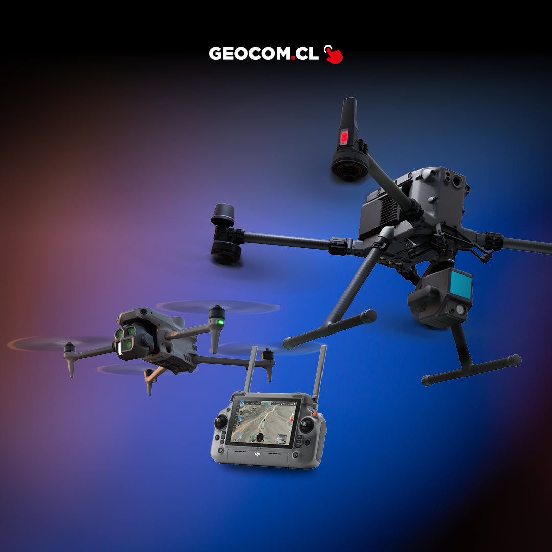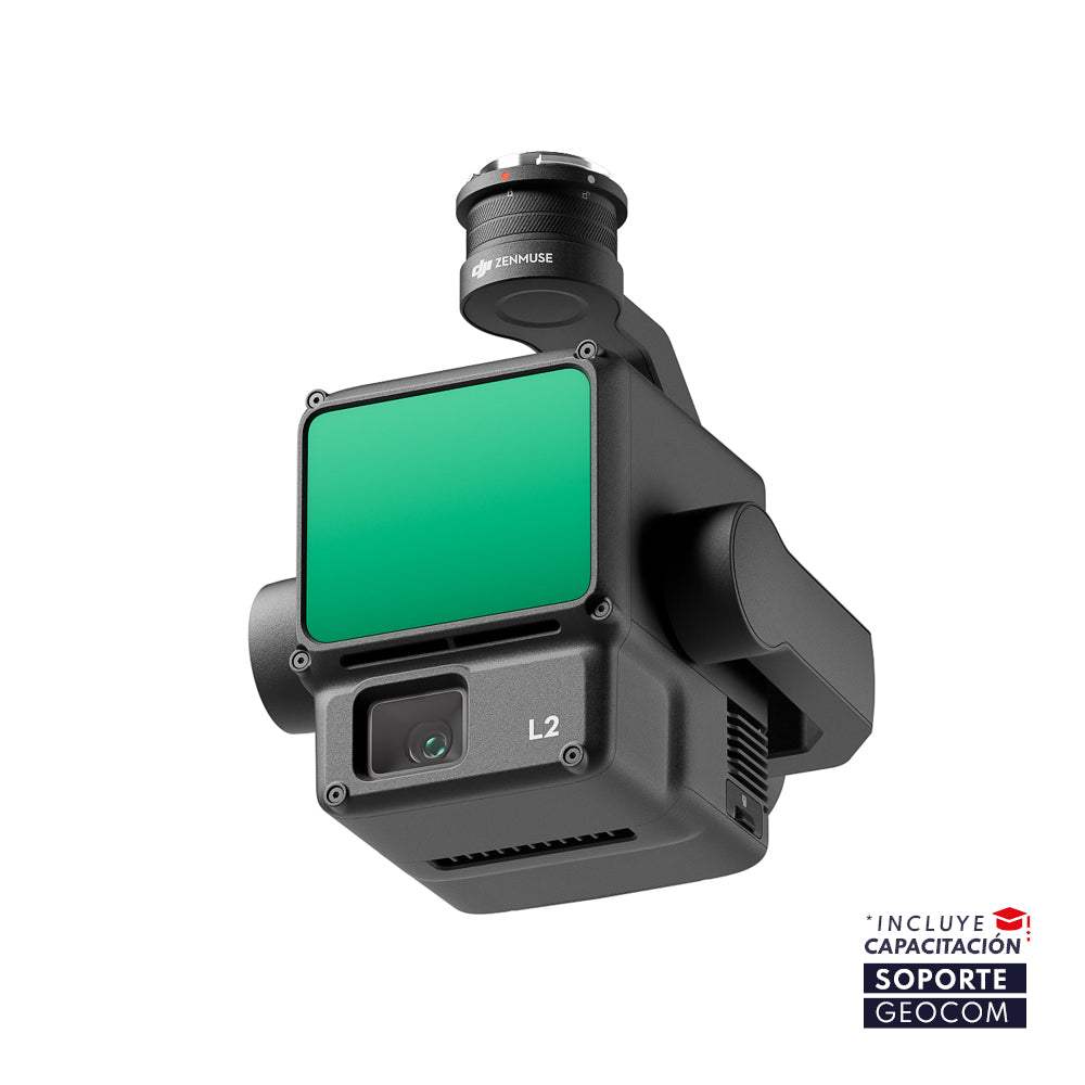

DJI Zenmuse L2 LiDAR
![]()
HIGH-PRECISION AERIAL LIDAR SYSTEM
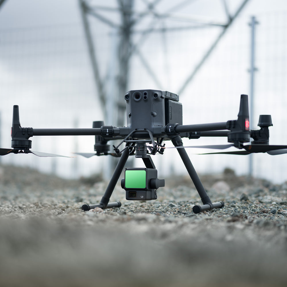
Zenmuse L2 integrates a frame LiDAR, a self-developed high-precision IMU system, and a 4/3 CMOS RGB mapping camera, providing DJI flight platforms with more accurate, efficient, and reliable geospatial data acquisition. When used with DJI Terra, it offers a turnkey solution for high-precision 3D data collection and post-processing.
Integrated LiDAR Solution
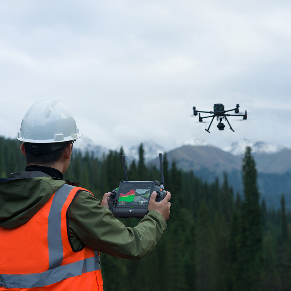
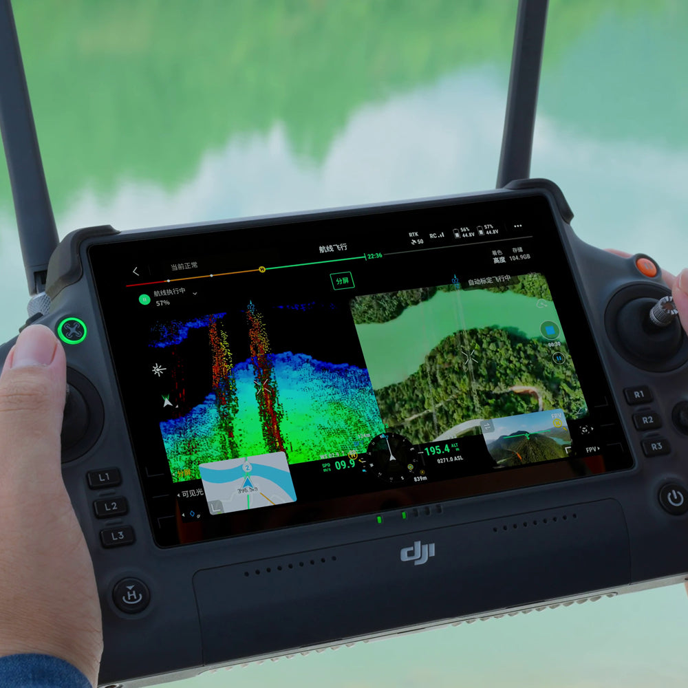
Backed by its powerful hardware, L2 enables precise scanning of complex subjects over an extended range and faster point cloud acquisition. During operations, users can preview, replay, and process point cloud models on-site, with task quality reports generated by DJI Terra, offering a simple, comprehensive solution to enhance overall efficiency. This allows users to achieve high-precision point cloud results with comprehensive post-processing.
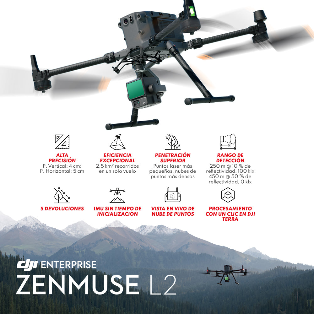
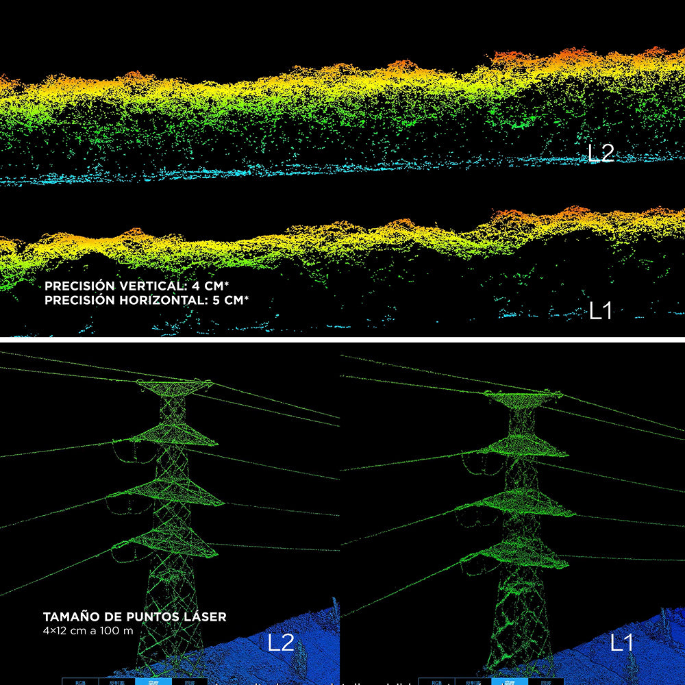
High-level Accuracy: By combining GNSS and a high-precision self-developed IMU, this solution achieves a vertical accuracy of 4 cm and a horizontal accuracy of 5 cm.
Exceptional Efficiency: It is ready to operate as soon as it's powered on and can collect geospatial and RGB data from a 2.5 km2 area in a single flight.
Intuitive Operation: Alongside Matrice 350 RTK and DJI Terra, L2 offers a turnkey solution that is easy to use and lowers the operational threshold.
30% Increased Detection Range: L2 can detect from 250 meters with 10% reflectivity and 100 klx, and up to 450 meters with 50% reflectivity and 0 klx. The typical operating altitude now extends up to 120 meters, significantly improving operational safety and efficiency.
Smaller Laser Spots, Denser Point Clouds: With a reduced spot size of 4×12 cm at 100 m, only one-fifth that of L1, L2 not only detects smaller objects with more detail but can also penetrate denser vegetation, generating more accurate digital elevation models (DEMs).
Supports 5 Returns: In areas with dense vegetation, L2 can capture more ground points beneath the foliage.
Effective Point Cloud Rate: 240,000 pts/s: In both single and multiple return modes, L2 can achieve a maximum point cloud emission rate of 240,000 points per second, allowing for the acquisition of more point cloud data within a given timeframe.
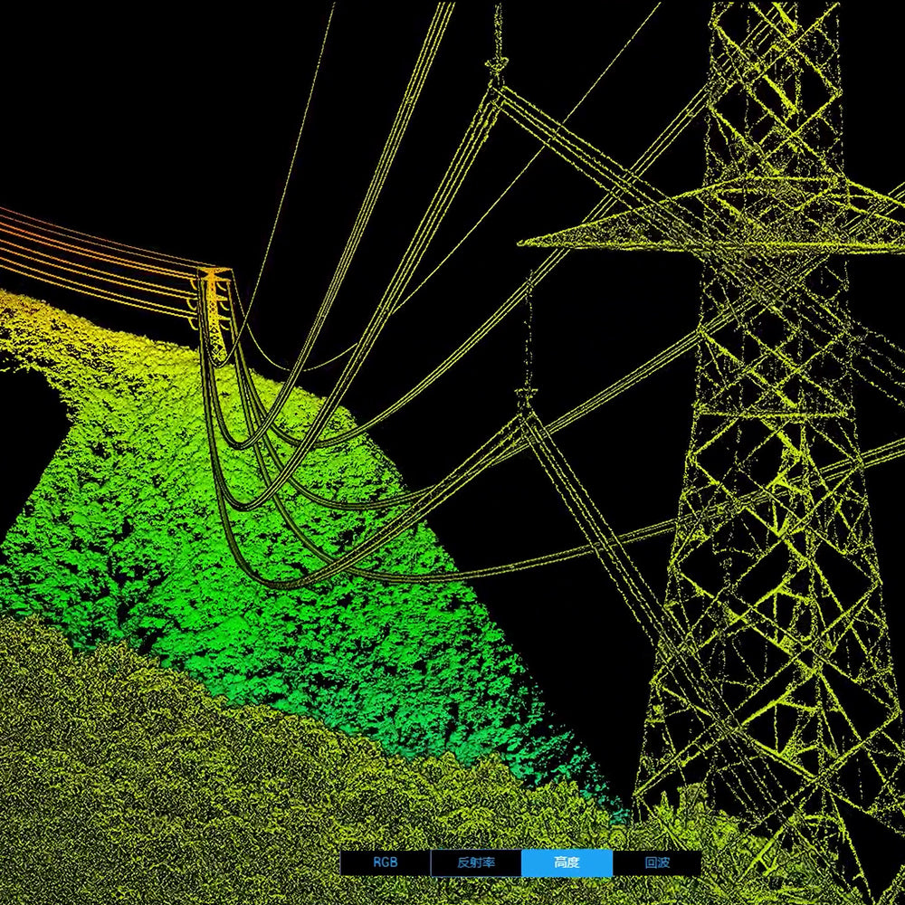
Two Scanning Modes: L2 supports two scanning modes, offering users flexibility based on their task demands. In repetitive scanning mode, L2's LiDAR can achieve more uniform and precise point clouds while meeting high-precision mapping requirements. In non-repetitive scanning mode, it offers deeper penetration for more structural information, making it suitable for power line inspection, forestry surveys, and other scenarios.
Frame-based Design: The frame-based design results in an effective point cloud data rate of up to 100%. Coupled with a three-axis gimbal, it opens up more possibilities for surveying scenarios.
Frame-based LiDAR
⨭Smaller laser spots, denser point clouds
⨭Point frequency: 240,000 pts./s
⨭5 returns
⨭Detection range: 450 m (50% reflectivity, 0 klx);
250 m (10% reflectivity, 100 klx)
⨭Repetitive and non-repetitive scanning
⨭Central point laser rangefinder (RNG)
RGB Mapping Camera
⨭4/3 CMOS
⨭20 MP
⨭Mechanical shutter, high-speed burst with interval
of 0.7 s
High-precision IMU System
⨭Yaw accuracy: real-time: 0.2°; post-processed: 0.05°
⨭Pitch/roll accuracy: real-time: 0.05°;
post-processed: 0.025°
⨭No IMU warm-up required, ready to operate after
power-on
Enhanced Operational Experience
⨭Live point cloud view
⨭Point cloud playback and fusion
⨭On-site task quality report
⨭PPK
⨭One-click processing in DJI Terra


He also takes
-
Consulting
Our team is ready to help you overcome any challenge in your projects. We have specialists with real technical training, who will guide you to integrate the exact solution your operation needs. Get advice from us via WhatsApp here
-
After-sales (Support and Technical Service)
We provide immediate technical support through our engineers to advise you on using your equipment to its maximum potential. Contact us to schedule your Technical Support via WhatsApp, or visit our Specialized Support portal to resolve operational queries.
-
News
Always stay one step ahead with the latest innovations in geospatial technology. Learn about new product launches, exclusive events, and technical talks designed to optimize your solutions. Discover all our news on the GEOCOM Blog