Magnetómetro aerotransportado ultrasensible

MagNIMBUS Magnetometer - SPH Engineering

ULTRASENSITIVE AIRBORNE MAGNETOMETER
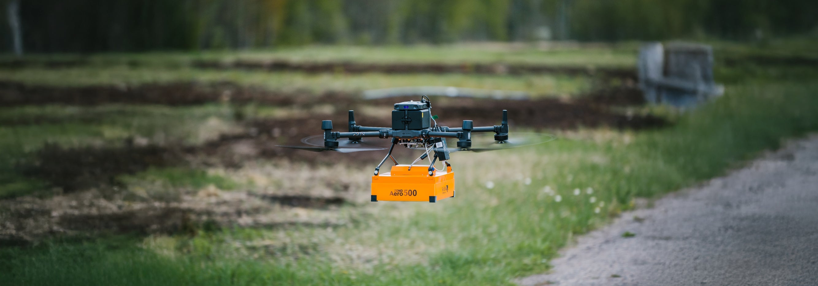
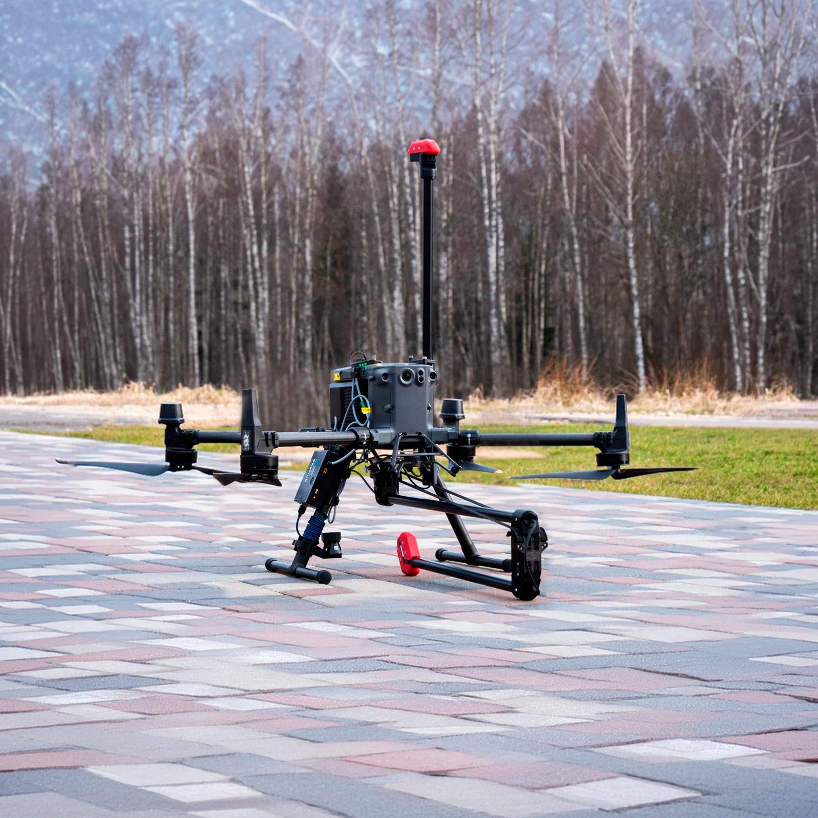
Integration with DJI Enterprise Matrice 300-350 RTK drone
- Search for UXO (unexploded ordnance) and landmines in metal casings
- Detection of metallic particles and GET (ground engaging tools) losses
- Localization of buried infrastructure (metal pipes and shielded cables)
- Environmental survey of abandoned wells, pipes, and tanks quickly and with precise positioning
- Geology and mineral prospecting: prospecting for regional magnetic field variations
- Archaeology
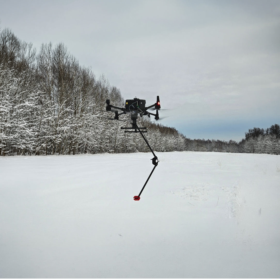
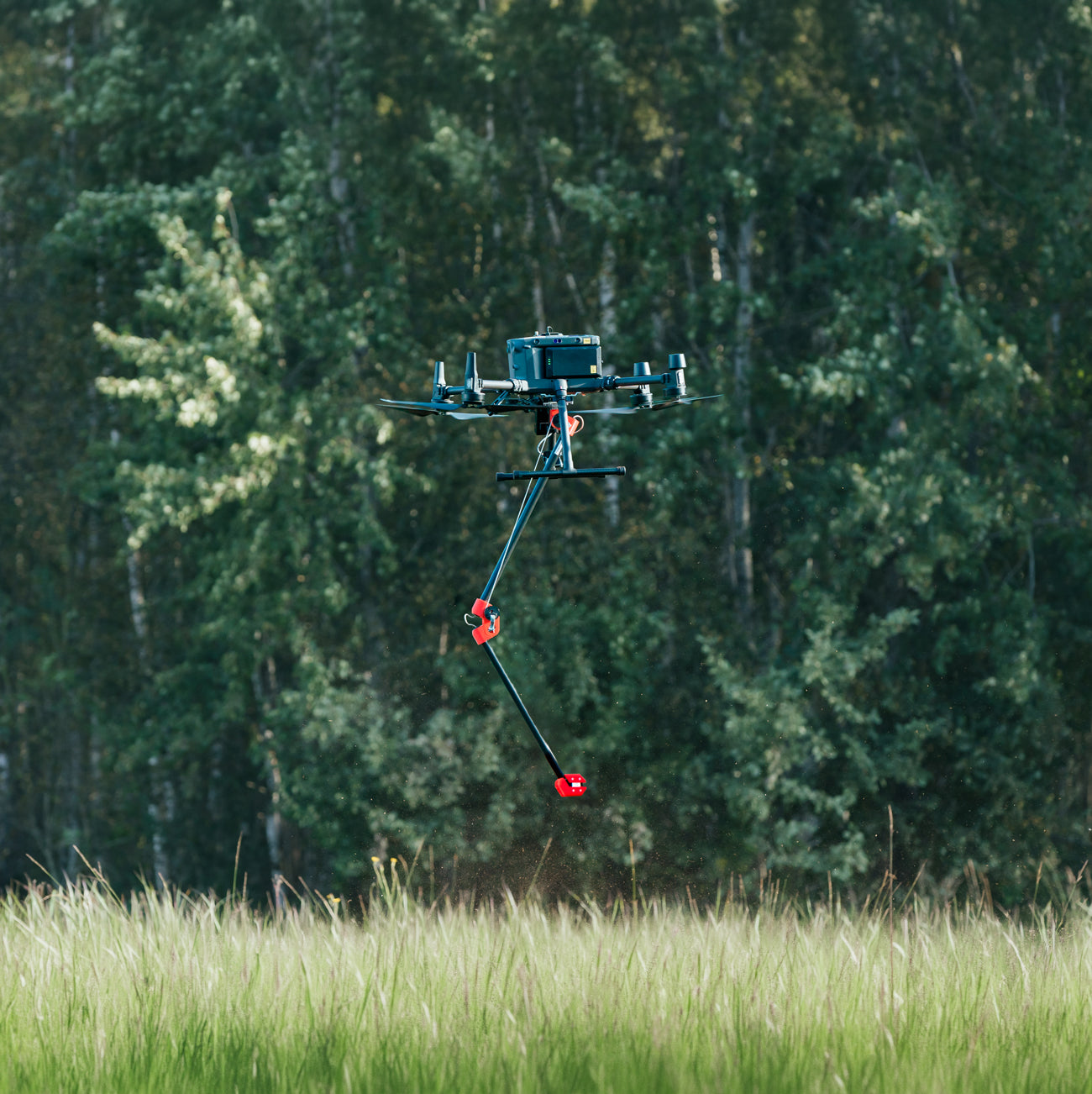
The system's unique design allows for extremely close ground-to-sensor flying, starting at about twenty centimeters. If the sensor touches the ground or an obstacle/vegetation, the drone will not crash. This capability is extremely important for the search for small unexploded ordnance in vegetated fields.
System variants
MagNIMBUS comes in two possible configurations:
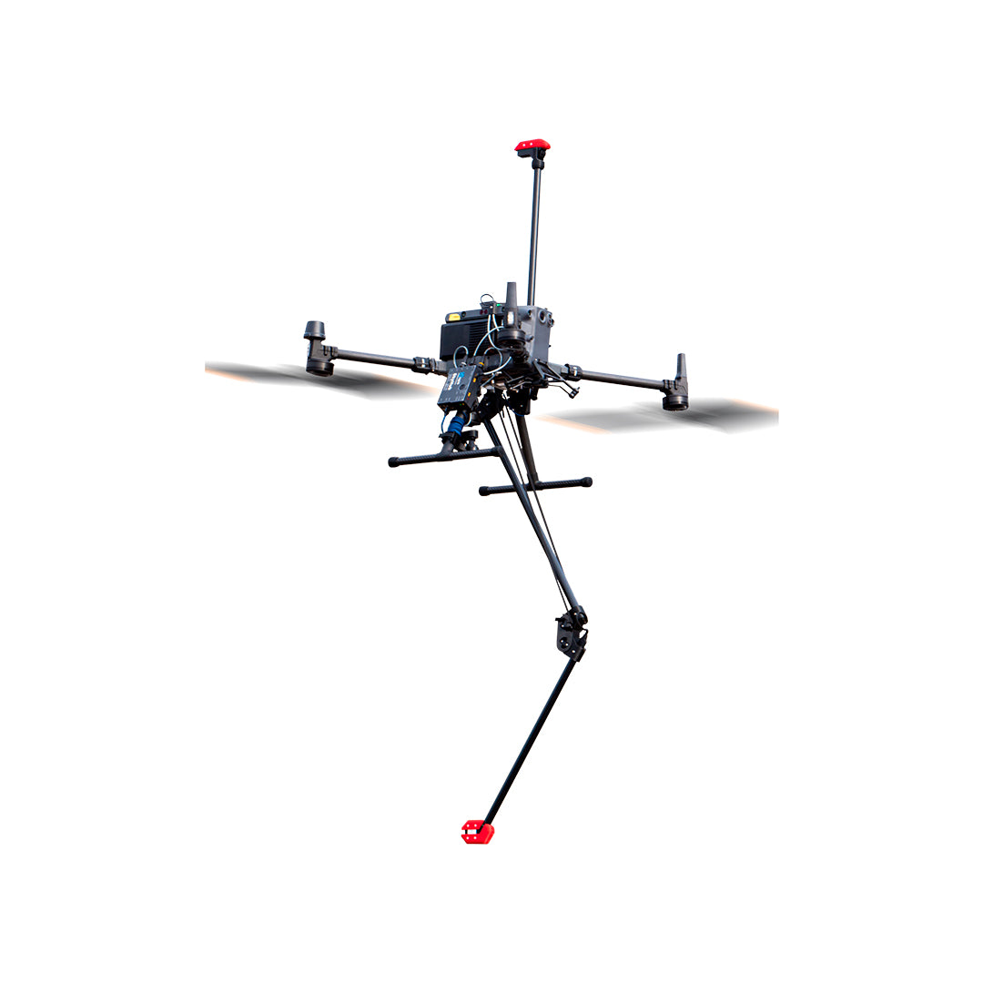
- Vertical gradiometer. This configuration greatly simplifies data processing and makes a magnetic base station unnecessary.
- Single sensor configuration with folding support. Detection capabilities are the same as for the gradiometer configuration, but it requires experienced specialists for data processing, and a magnetic base station is recommended for surveys near magnetic field sources.
Main system components:
- Recommended drones: DJI M350 RTK/M300 RTK. The standard kit comes with all mounts/cables for this drone. Integrations for other drone types, including Pixhawk-based ones, are available upon request.
- Folding mount with built-in QuSpin Gen-2 magnetic field sensor.
Pole with QuSpin Gen-2 sensor for vertical gradiometer configuration. - SkyHub onboard computer - acts as a data logger for magnetic field sensors and implements terrain-following mode for DJI drones.
- Altimeter (laser or radar).
- UgCS Expert flight planning/management software.
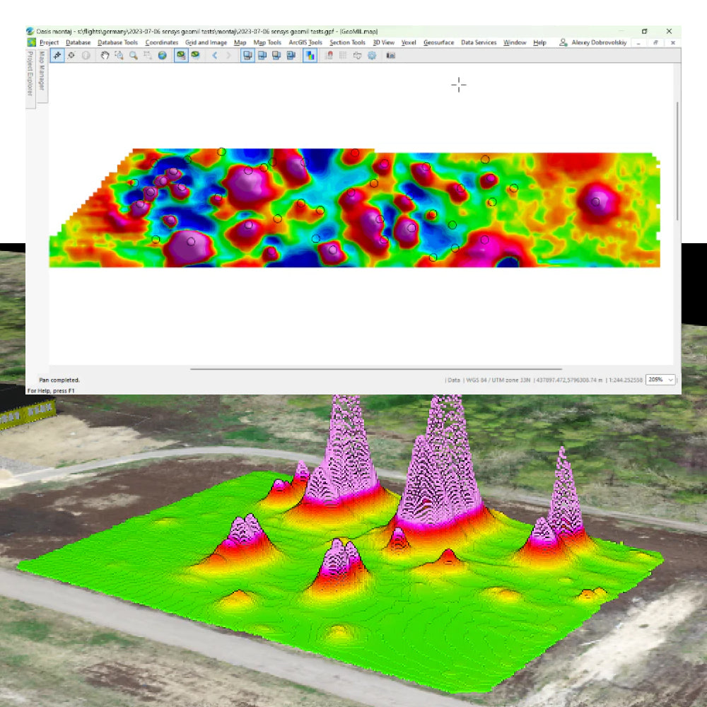
Recommended software for data processing: Geosoft Oasis Montaj.

Characteristics
Specifications
Aplicaciones de la magnetometría en drones son:
Video
He also takes
-
Consulting
Our team is ready to help you overcome any challenge in your projects. We have specialists with real technical training, who will guide you to integrate the exact solution your operation needs. Get advice from us via WhatsApp here
-
After-sales (Support and Technical Service)
We provide immediate technical support through our engineers to advise you on using your equipment to its maximum potential. Contact us to schedule your Technical Support via WhatsApp, or visit our Specialized Support portal to resolve operational queries.
-
News
Always stay one step ahead with the latest innovations in geospatial technology. Learn about new product launches, exclusive events, and technical talks designed to optimize your solutions. Discover all our news on the GEOCOM Blog