
LA ERA DEL VUELO INTELIGENTE

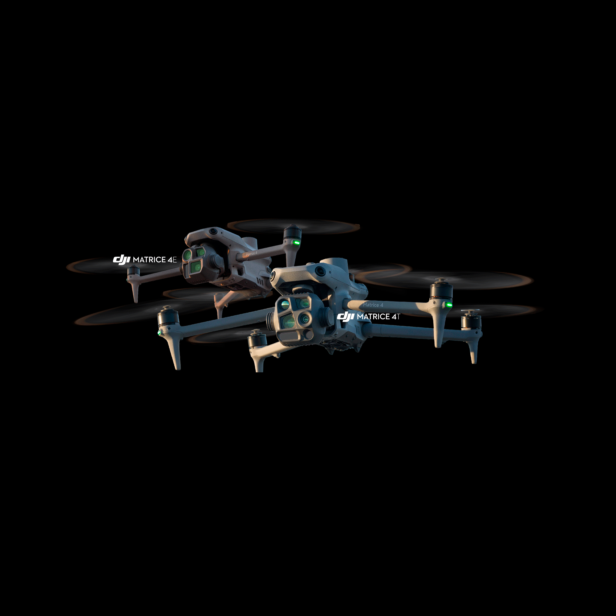
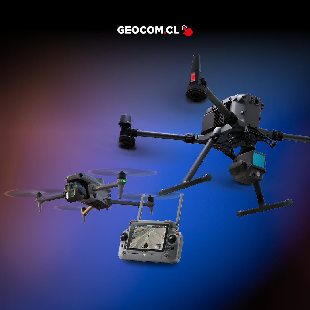
DJI Matrice 4 Series

THE ERA OF INTELLIGENT FLIGHT
This series includes two models: Matrice 4T and Matrice 4E. Both models include advanced features such as intelligent identification and laser annotation or measurement. They boast significantly improved capabilities and a safer, more reliable flight system, with a comprehensive enhancement of their accessories. Matrice 4T excels in different scenarios, such as emergency response in firefighting, inspections, or water and forest conservation. On the other hand, DJI Matrice 4E is designed for professional high-precision and high-efficiency geospatial surveys. Together, they usher in a new era for intelligent aerial operations.
Intelligent 3D Capture, Precision Modeling
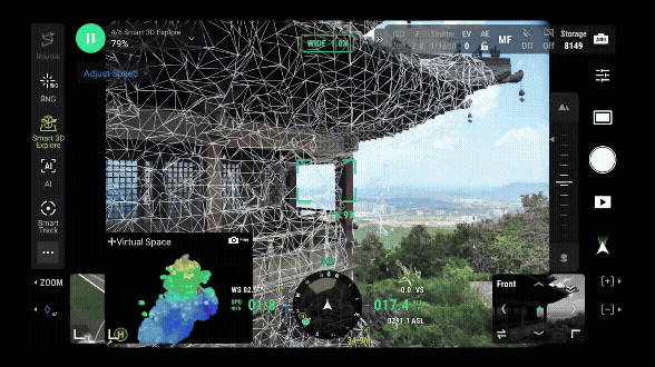
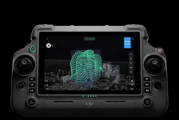
DJI Matrice 4E supports intelligent 3D capture, allowing you to capture and create an approximate model on the remote controller. Based on the approximate model, it can quickly generate precise mapping routes close to a structure's surface, performing detailed measurements and modeling of irregular buildings. It also supports virtual spatial route visualization and trajectory photos for intelligent 3D capture, which facilitates the evaluation of flight safety for specific routes and coverage areas.
Smarter Operations
The integrated model is capable of detecting vehicles, vessels, and targets during search and rescue operations or routine flights. It also supports model sharing to expand application scenarios. Additionally, it is compatible with high-resolution grid photos and includes powerful tracking functions.
Omnidirectional Low-Light Detection
The Matrice 4 series features six high-definition low-light fisheye visual sensors that significantly improve visual positioning in low-light scenarios and anti-collision system functions. This feature allows for automatic obstacle detection, automatic re-routing, and safe return in low-light urban environments.
3-Directional Photogrammetry
The DJI Matrice 4E performs 3-directional photogrammetry with side capture, effectively reducing overlap in the process. It can cover areas up to 2.8 km² in a single flight. It does not require elevation optimization routes and, when used with DJI Terra, improves reconstruction efficiency and quality.
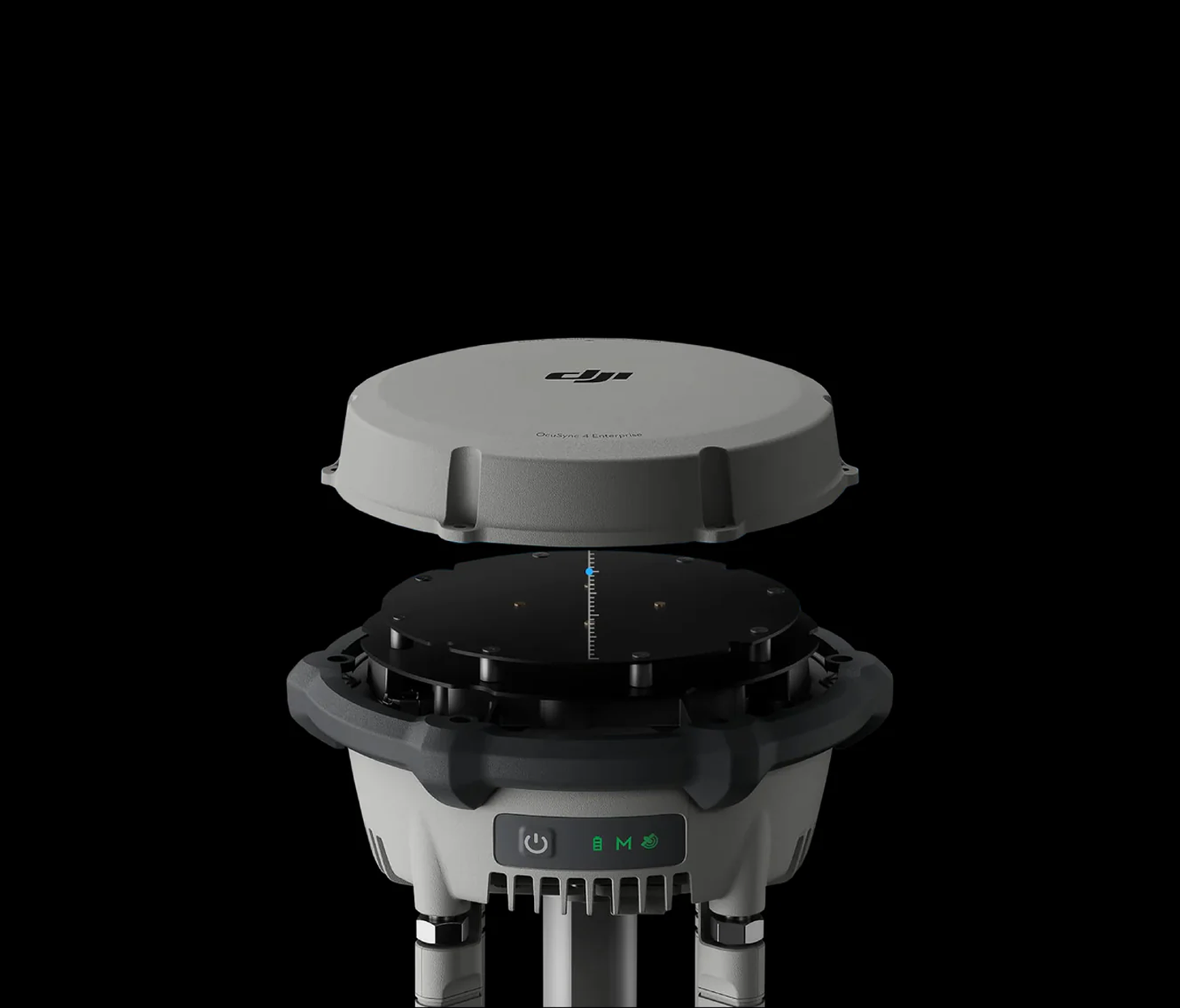
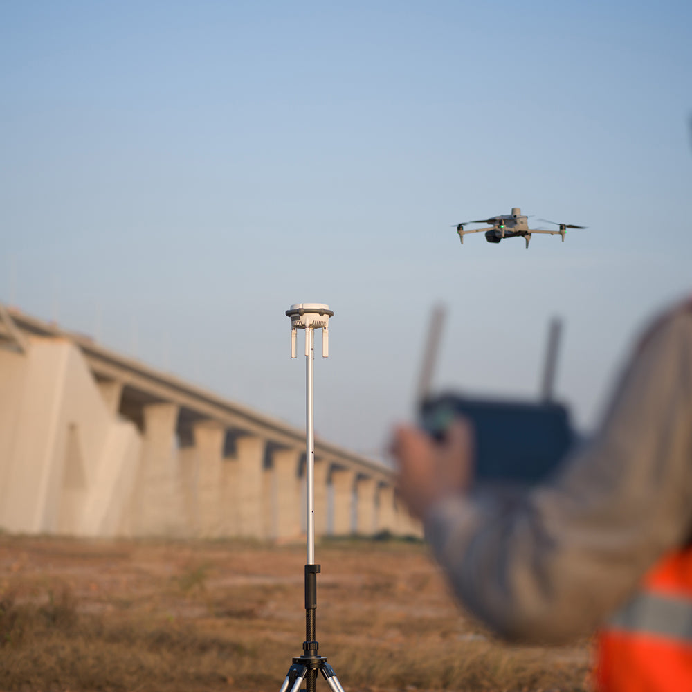
DJI D-RTK3 Multi-function Station
The new D-RTK 3 Multi-function Station integrates high-performance antennas and receiver modules, capable of tracking and resolving data from the world's major satellite navigation systems, and supports multiple data transmission links. Thanks to these extraordinary features, it can serve as a base station to provide centimeter-level precise positioning for multiple drones simultaneously, or extend the operating range of drones in relay station mode. Furthermore, the new survey station mode, combined with the DJI Enterprise application and DJI Terra, offers a comprehensive solution for high-precision aerial inspection applications, ensuring safe and accurate operation.
Intelligent Operating Performance
› Vehicle/Vessel Identification and Statistics
› Compatible with Custom Target Detection Models
› Real-time Laser Annotation/Measurement/Sharing
› Real-time Observed Area Recording
› FlyTo/POI/Smart Tracking/Cruise Functions
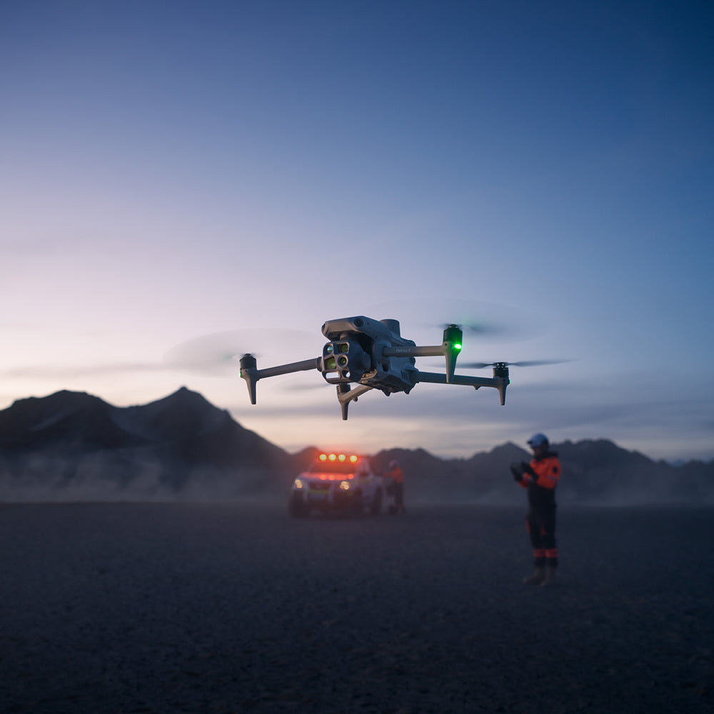
Excels in Low-Light Environments
› Night Scene Mode
› Smart Low-Light Photo
› NIR Illumination
› Real-time UHR Infrared Image
› Omnidirectional High-Definition Low-Light Fisheye Detection
Clear Vision and Stable Images
› Medium Telephoto Camera detects screws and cracks from 10 m away
› Telephoto Camera detects license plates from 300 m away
› Foreground Stabilization for stable zoomed images
› One-touch Defogging
High-Efficiency Precise Mapping
› 0.5s Scheduled Photography
› 5-directional Oblique Capture and 3-directional Photogrammetry
› Smart 3D Capture / Geometric Route / Slope Route
› DJI Terra 2.0 Distortion Correction
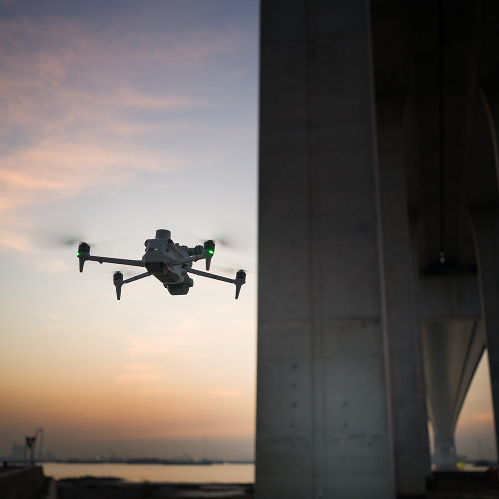
Improved Flight Safety
› GNSS+Vision Fusion Navigation and Positioning System
› Automatic Obstacle Data Acquisition
› 5-directional Vision Assistance
› 25km O4 Video Transmission, Powerful Anti-interference System
› Enhanced 4G Transmission for more stable signals
Comprehensive Accessory Updates
› Stabilizer Tracking Spotlight
› Real-time Speaker
› Integrated Broadcast and Illumination
› D-RTK 3 Multi-function Station
› DJI RC Plus 2 Enterprise P1, L1, H20, H20T, H20N, Radar CSM

Characteristics
Operaciones aéreas inteligentes
Video
Includes:


He also takes
-
GEOCOM Support
Our support team is made up of geomatics engineers specializing in different technologies, with the training and technical experience necessary to advise clients on the use of their products. Visit our support page for more information here.
-
Instrument Rental
Lorem ipsum dolor sit amet, consectetur adipiscing elit, sed do eiusmod tempor incididunt ut labore et dolore magna aliqua. Ut enim ad minim veniam, quis nostrud exercitation ullamco laboris nisi ut aliquip ex ea commodo consequat.
-
Offices
Lorem ipsum dolor sit amet, consectetur adipiscing elit, sed do eiusmod tempor incididunt ut labore et dolore magna aliqua. Ut enim ad minim veniam, quis nostrud exercitation ullamco laboris nisi ut aliquip ex ea commodo consequat.
-
Guarantees
Lorem ipsum dolor sit amet, consectetur adipiscing elit, sed do eiusmod tempor incididunt ut labore et dolore magna aliqua. Ut enim ad minim veniam, quis nostrud exercitation ullamco laboris nisi ut aliquip ex ea commodo consequat.

Potente sistema multisensor: Rendimiento superior en entornos con poca luz
Telémetro láser de gran alcance y múltiples cámaras
Rendimiento superior y máxima seguridad
Modo de escena nocturna
Luz auxiliar NIR
DJI D-RTK3
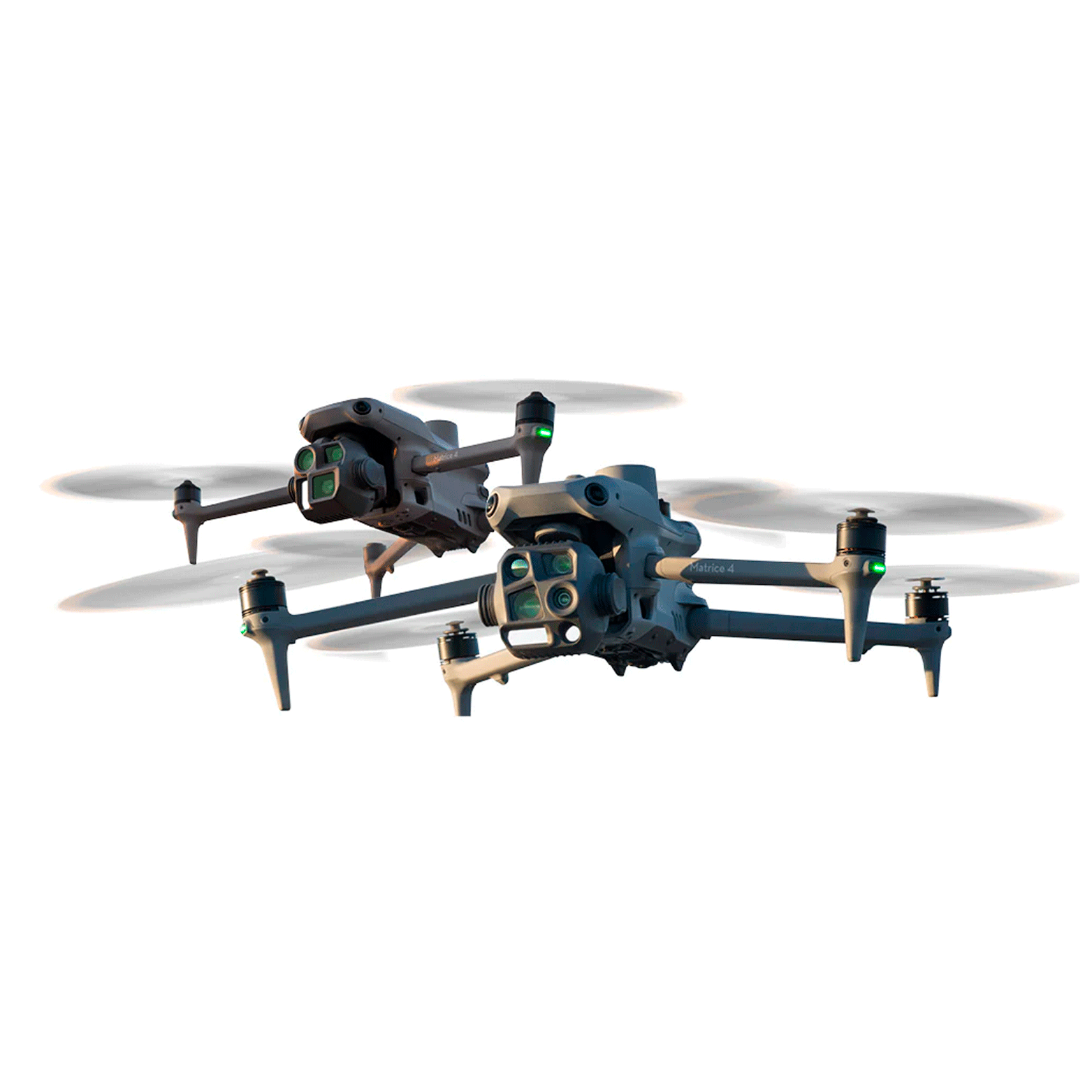
Dos modelos, innumerables aplicaciones