DRONE FLIGHT PLANNING AND CONTROL SOFTWARE

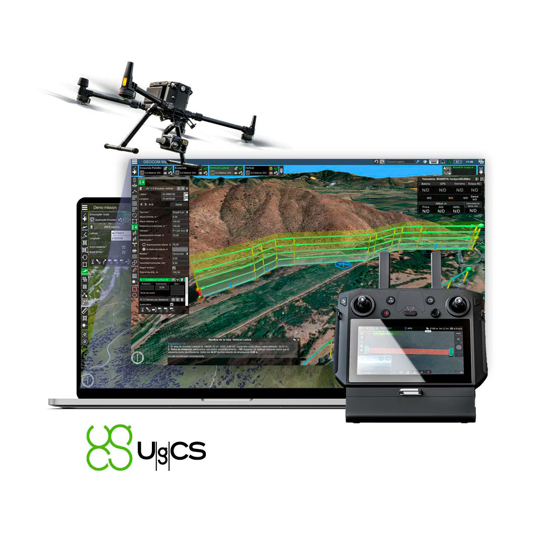
UgCS Software
![]()
DRONE FLIGHT PLANNING AND CONTROL SOFTWARE
DJI, Autel, MAVLink, Freefly, among others.
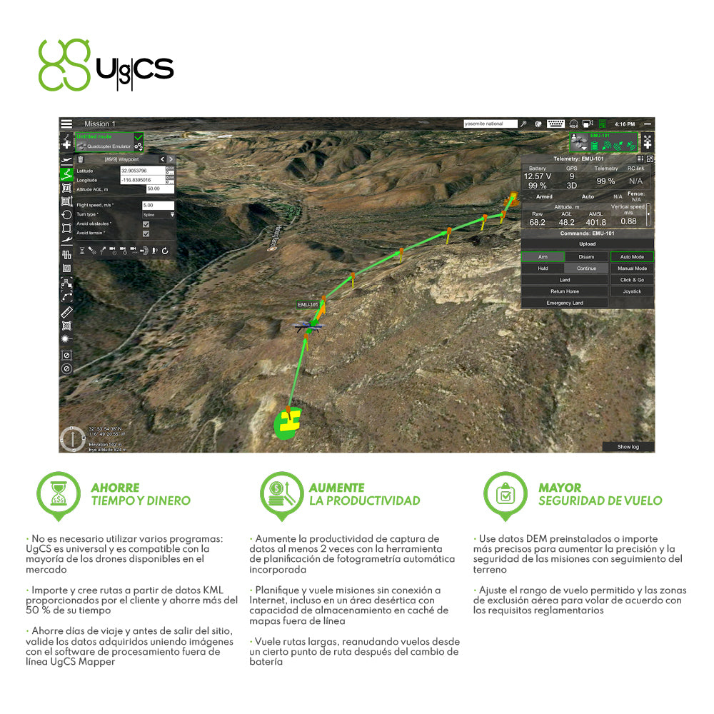
An acronym for Universal Ground Control Software, UgCS is a cross-platform software developed by SPH Engineering designed to plan and control flight missions conducted with drones of various brands. Currently, UgCS is compatible with DJI, Autel, MAVLink, Freefly, among other brands.
Licensing works through an activation code. There are currently 4 different types of licenses:
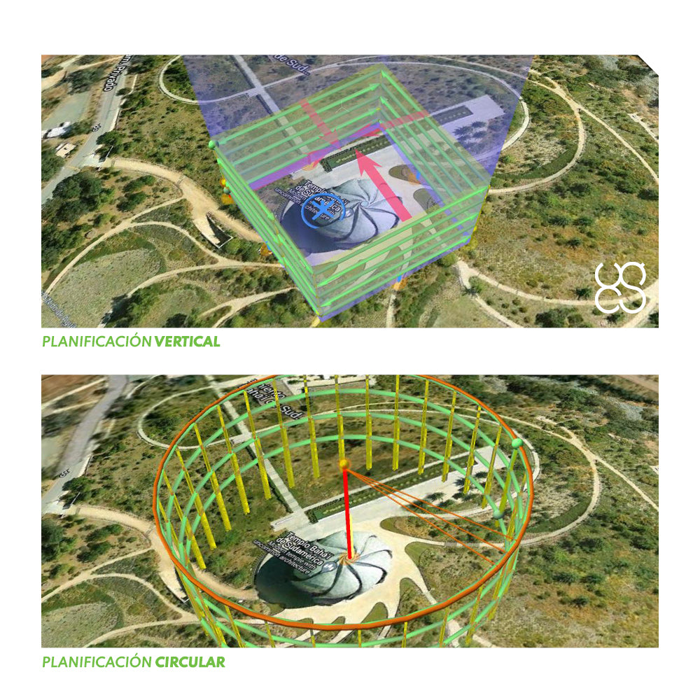
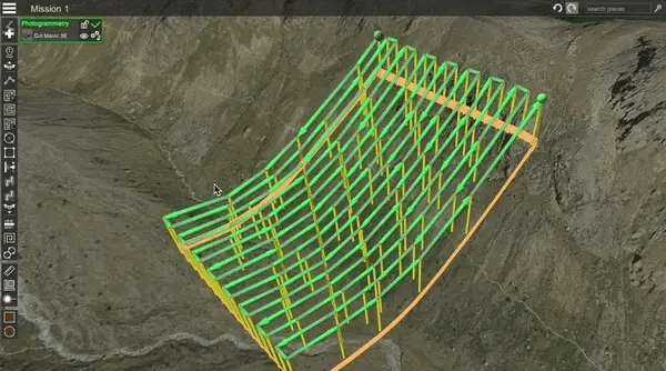
1. UgCS Pro: Includes necessary functions for photogrammetric flight planning (conventional, linear, circular, vertical, waypoint, and perimeter mapping). Its licensing via activation code can be perpetual or subscription-based.
2. UgCS Expert: Includes LiDAR mapping and linear planning with their respective IMU calibration maneuvers (it also has the functions described for the Pro license). Its licensing via activation code can be perpetual or subscription-based.
3. UgCS Enterprise: Includes functions for video surveillance via live video streaming (it also has the functions of the Expert license). Its licensing via activation code can be perpetual or subscription-based.
4. UgCS Commander: This is a license designed to simultaneously manage multiple drones in automated missions (it also has all the functions of UgCS Enterprise).
⨭DJI Phantom 4 RTK
* Only with the SDK Remote Controller version, i.e., with the RC that does not have an integrated screen
⨭DJI Mavic 3 Enterprise
⨭DJI Matrice 30 Series
⨭DJI Matrice 300 RTK
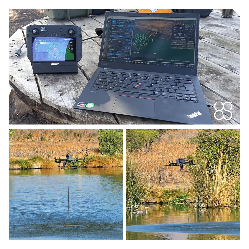
What is required to run UgCS with our DJI Enterprise drone?
A computer will be needed where the desktop version of UgCS will be installed, as well as a remote controller that allows the program to be installed on it. Currently, UgCS is compatible with DJI Smart Controller (for Matrice 300 RTK), DJI RC Plus (for Matrice 30), and DJI RC Pro Enterprise (for Mavic 3 Enterprise) remote controllers.
What are UgCS's strengths over DJI Pilot 2?
Recall that DJI Pilot 2 is the software used to plan/fly with our Mavic 3 Enterprise, Matrice 30, and Matrice 300 RTK drones.
UgCS stands out from this software by offering a greater diversity of flight planning strategies: Conventional, linear, circular, vertical, waypoint, perimeter mapping, and LiDAR scanning.


Characteristics
Which DJI drones are compatible with UGCS?
Video
Includes:

He also takes
-
Consulting
Our team is ready to help you overcome any challenge in your projects. We have specialists with real technical training, who will guide you to integrate the exact solution your operation needs. Get advice from us via WhatsApp here
-
After-sales (Support and Technical Service)
We provide immediate technical support through our engineers to advise you on using your equipment to its maximum potential. Contact us to schedule your Technical Support via WhatsApp, or visit our Specialized Support portal to resolve operational queries.
-
News
Always stay one step ahead with the latest innovations in geospatial technology. Learn about new product launches, exclusive events, and technical talks designed to optimize your solutions. Discover all our news on the GEOCOM Blog