Skip to content
  • Facebook
  • Instagram
  • YouTube
  • TikTok
  • LinkedIn

Welcome to our new website

October 8, 2026. Geospatial Seminar. Visit us!

Contact us via WhatsApp here

  • Products
  • Areas
  • We
  • News
  • Contact
Login
  • Facebook
  • Instagram
  • YouTube
  • TikTok
  • LinkedIn
Search
Geocom
  • Products Products
  • Areas Areas
  • WeWe
  • NewsNews
  • ContactContact
Search Login Cart 0
Cart

Your cart is currently empty.

  • Continue shopping
    Tax included and shipping calculated at checkout
    Subtotal
    0 CLP
    View cart
    Search

    Usamos cookies

    El sitio de GEOCOM utiliza cookies para ofrecer una mejor experiencia de usuario y realizar análisis.

    Home Search Store 0 Cart Login
    DJI Terra Software
    DJI Terra Software
    DJI Terra Software
    DJI Terra Software
    DJI Terra Software
    DJI Terra Software
    DJI Terra Software

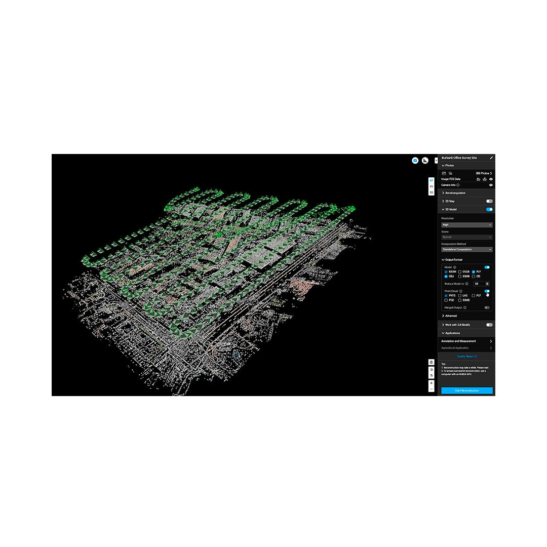
    Accurate, smart, and efficient 3D reconstruction software

    DJI Terra Software

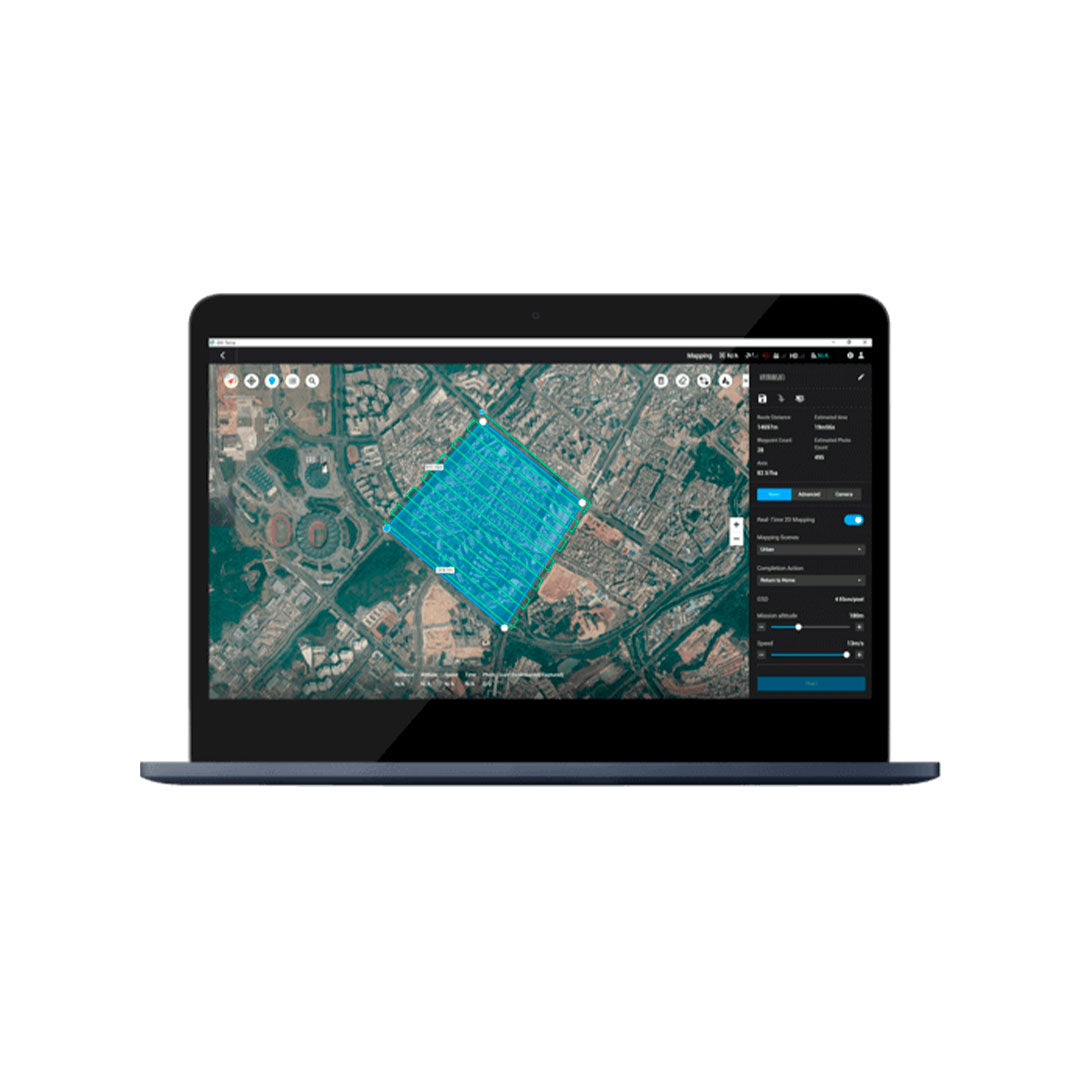
    Mapping and processing platform

    DJI TERRA will allow easy and intuitive capture, analysis and visualization, providing great support to professional users in the industry who need to obtain quality products in a short time.

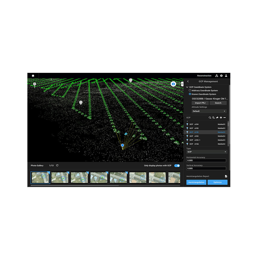
    This mapping solution is based on artificial intelligence to take your projects to the next level, whether it's object classification, site inspections, and more.


    More information

    Formulario de cotización

    ¿Necesitas más información de un producto? ¿Quieres solicitar una demo? Completa el formulario con tus datos y nos pondremos en contacto.

    Characteristics

    DJI Terra es un software de modelado 3D equipado con tecnologías avanzadas de reconstrucción, incluyendo la dispersión gaussiana 3D. Permite reconstrucciones de luz visible en 2D y 3D precisas y eficientes, y procesamiento de datos a través de DJI LiDAR. Cuando se integra con los drones DJI, Terra ofrece una solución unificada de hardware y software que abarca desde la recopilación de datos hasta el procesamiento y laaplicación de los mismos, haciendo que el trabajo de topografía aérea sea más sencillo, eficiente y preciso.


    Dispersión gaussiana fotorrealista:
    ● Modelos 3D realistas de calidad fotográfica
    ● Doblemente eficiente para el modelado de escenas a gran escala
    ● Reconstrucción detallada de grandes y complejos escenarios urbanos
    ● Operación sencilla con hardware común
    ● Formatos de datos universales para una mayor flexibilidad


    Fotogrametría con precisión confiable
    ● Modelos 2D/3D de alta fidelidad
    ● Cartografía de alta precisión 1:500
    ● Resultados rápidos in situ

    Reconstrucción LiDAR con amplias aplicaciones
    ● Modelado basado en fusión de datos 2D/3D
    ● Precisión centimétrica
    ● Escenarios de usos variados
    ● Reconstrucción a gran escala

    Reconstrucción en clúster con alta eficiencia
    ● Capacidad a gran escala
    ● Rendimiento ultrarrápido

    Levantamiento aéreo integrado (Hardware + Software)
    ● Sinergia de hardware para reconocimiento aéreo en múltiples escenas
    ● Flujo de trabajo sin interrupciones entre DJI Terra y DJI Modify

    Specifications

    Annotation and Measurement:
    DJI Terra offers PPK capabilities that ensure highly accurate aerial surveys. It supports local PPK for normal images and local or cloud PPK for LiDAR, achieving centimeter-level accuracy even without a network connection or RTK.

    Comprehensive Coordinate System Compatibility:
    Terra includes over 8500 coordinate systems and allows for local configurations, transformations, and PRJ file imports. It automatically suggests the optimal system based on your location, facilitating integration with local standards and custom exports.

    Control Points and Checkpoints:
    Users can import and mark control points and checkpoints to adjust models and point clouds. Terra allows semi-automatic selection with sub-pixel precision, improving the efficiency of GCP marking and reducing manual labor. It allows for accuracy verification at any time.

    Video
    Download Datasheet

    He also takes


    Do you need help?
    • Consulting

      Our team is ready to help you overcome any challenge in your projects. We have specialists with real technical training, who will guide you to integrate the exact solution your operation needs. Get advice from us via WhatsApp here

    • After-sales (Support and Technical Service)

      We provide immediate technical support through our engineers to advise you on using your equipment to its maximum potential. Contact us to schedule your Technical Support via WhatsApp, or visit our Specialized Support portal to resolve operational queries.

    • News

      Always stay one step ahead with the latest innovations in geospatial technology. Learn about new product launches, exclusive events, and technical talks designed to optimize your solutions. Discover all our news on the GEOCOM Blog

    view more products from DJI
    WE
    • About us
    • Shipping and Warranties
    • Exchanges and Returns
    • Terms and Conditions
    • Whistleblowing Channel
    CONTACT

    Address | Av. Salvador 1105, Providencia.
    Phone | +562 2480 3600
    Email | ventas@geocom.cl

    GNSS and Optics Support | Whatsapp
    UAS Support |
    Whatsapp

    Geocom

    Subscribe to our newsletter

    • Facebook
    • Instagram
    • YouTube
    • TikTok
    • LinkedIn
    • Choosing a selection results in a full page refresh.
    • Opens in a new window.
    ¡Gracias por contactarte con nosotros! Soon an executive will contact you