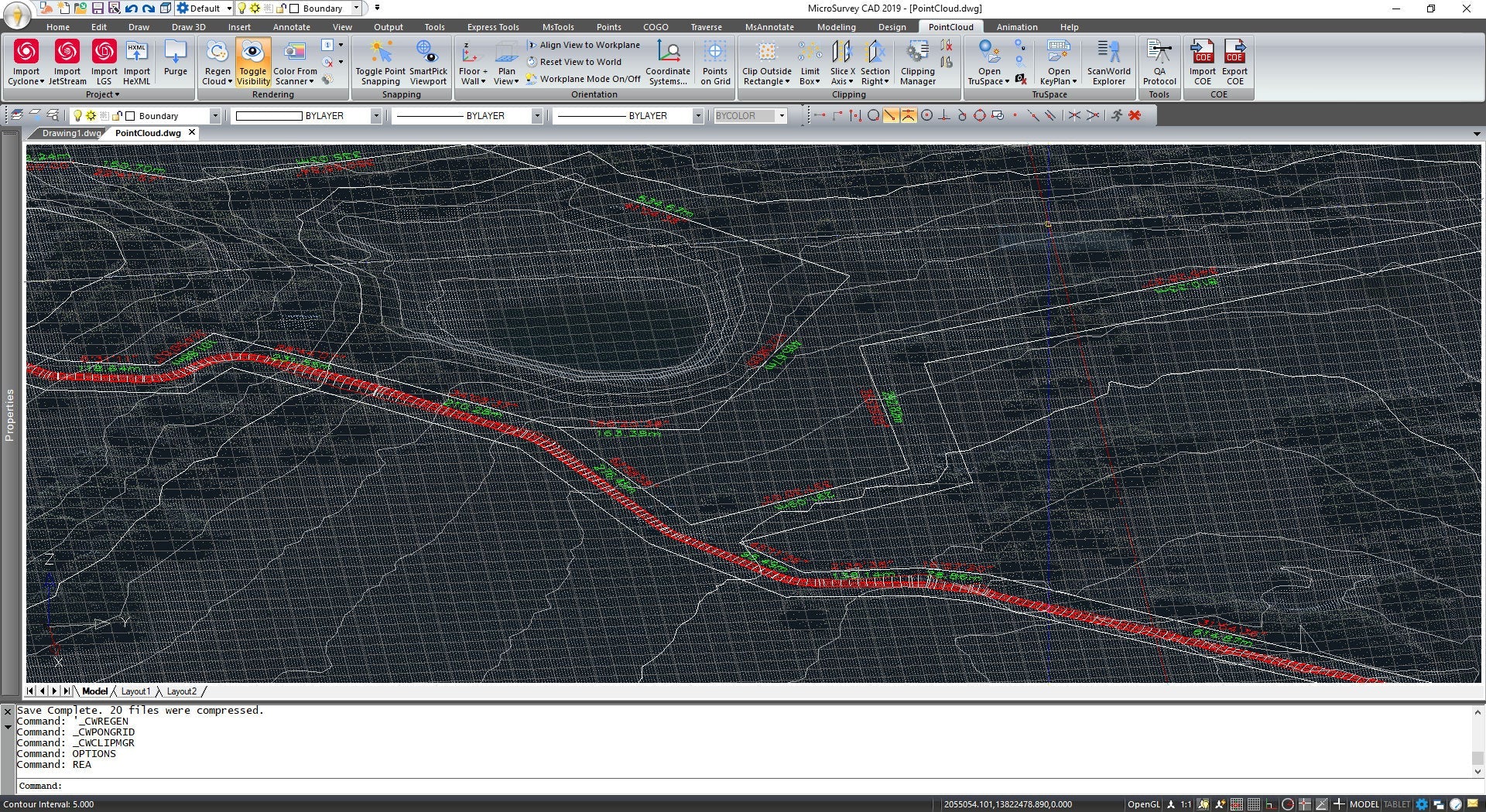
Visualize, process, and analyze 3D laser scan datasets

Microsurvey Point Cloud Software
Description
Powerful Rendering Engine Built on the successful MicroSurvey CAD 2010 Premium platform, PointCloud CAD includes the same rendering engine that is used in products such as 3DStudio, Solidworks, Pro Engineer, and Microstation.
This allows you to view and work with your data in ways you never thought possible. In addition to automatic roadway line extraction (from your point cloud data), our rendering capabilities give you the tools you need to analyze, edit, and build surfaces, drawings, and animations with ease.
Specifications
• Automatic roadway line extraction
• Powerful point cloud engine makes working with hundreds of millions of points a breeze
• Quickly generate line work, surface models, and contour lines directly from the point cloud
• Generate animations over the point cloud with a few clicks • Visualize & animate CAD objects in the Point Cloud
• MicroSurvey CAD Premium INCLUDED
Video
Characteristics
Specifications
Video
He also takes
-
Consulting
Our team is ready to help you overcome any challenge in your projects. We have specialists with real technical training, who will guide you to integrate the exact solution your operation needs. Get advice from us via WhatsApp here
-
After-sales (Support and Technical Service)
We provide immediate technical support through our engineers to advise you on using your equipment to its maximum potential. Contact us to schedule your Technical Support via WhatsApp, or visit our Specialized Support portal to resolve operational queries.
-
News
Always stay one step ahead with the latest innovations in geospatial technology. Learn about new product launches, exclusive events, and technical talks designed to optimize your solutions. Discover all our news on the GEOCOM Blog