Skip to content
  • Facebook
  • Instagram
  • YouTube
  • TikTok
  • LinkedIn

Welcome to our new website

October 8, 2026. Geospatial Seminar. Visit us!

Contact us via WhatsApp here

  • Products
  • Areas
  • We
  • News
  • Contact
Login
  • Facebook
  • Instagram
  • YouTube
  • TikTok
  • LinkedIn
Search
Geocom
  • Products Products
  • Areas Areas
  • WeWe
  • NewsNews
  • ContactContact
Search Login Cart 0
Cart

Your cart is currently empty.

  • Continue shopping
    Tax included and shipping calculated at checkout
    Subtotal
    0 CLP
    View cart
    Search

    Usamos cookies

    El sitio de GEOCOM utiliza cookies para ofrecer una mejor experiencia de usuario y realizar análisis.

    Home Search Store 0 Cart Login
    Quantum Trinity Pro VTOL
    Quantum Trinity Pro VTOL
    Quantum Trinity Pro VTOL
    Quantum Trinity Pro VTOL
    Quantum Trinity Pro VTOL
    Quantum Trinity Pro VTOL

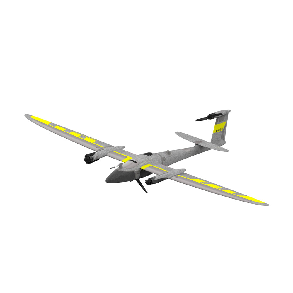
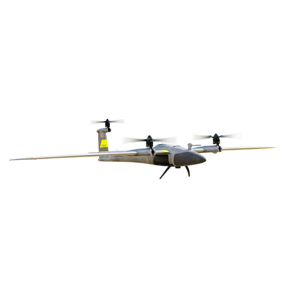
    El estándar definitivo en mapeo aéreo: rendimiento eVTOL inigualable, integración de sensores plug-and-play y máxima seguridad operativa.

    Quantum Trinity Pro VTOL

    VTOL EVOLUTION

    Quantum-Skynode Autopilot with integrated AI

    Interchangeable sensors in a matter of seconds.

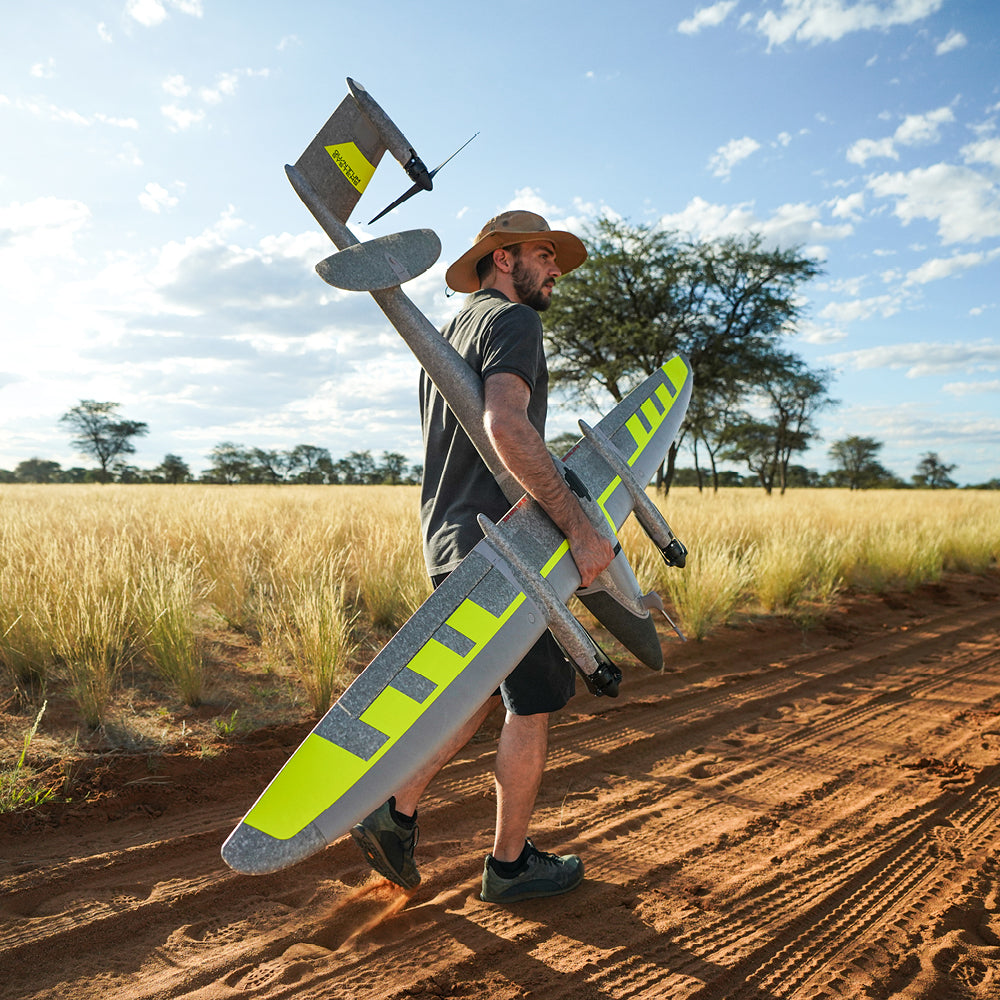
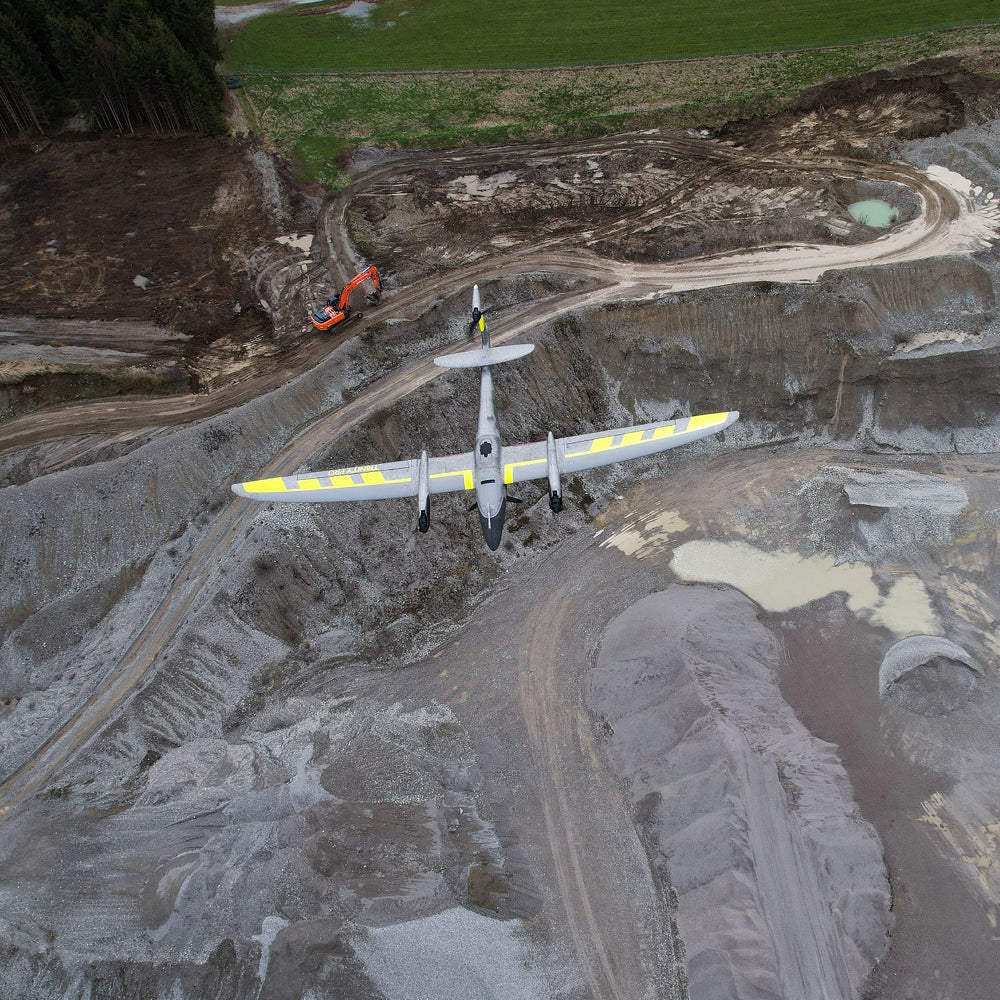
    Trinity Pro is an aerial mapping solution designed in Germany with a futuristic approach, based on a reliable, easy-to-use, productive and safe platform.

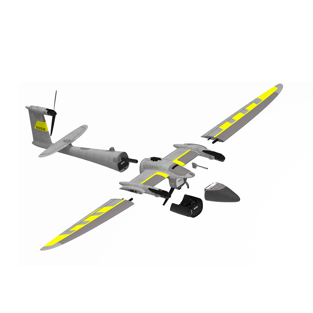
    Its design allows for easy sensor interchangeability to adapt to constantly evolving requirements, accelerating decision-making through aerial data. As technology evolves, so will Trinity Pro.

    Trinity Pro integrates the latest Quantum-Skynode autopilot with an onboard Linux mission computer. These high-performance components provide greater processing power and internal storage, as well as connectivity, enabling the integration of next-generation cameras, as well as logging, simulation, and AI. These integrations will change how you interact with your data, reducing processing steps and office time.

    Cameras can be easily swapped in a matter of seconds. They are securely integrated into the payload bay that connects to the UAS using a quick-locking mechanism. No tools are required.

    Accessing captured data is straightforward. SD or microSD cards are accessible via internal or external card slots.

    All cameras are vibration-dampened during flight to ensure expected image quality. The UAV's eVTOL capability allows for soft landings, which ultimately extends the cameras' lifespan.

    - Sony RX1 RII (RGB)

    - Oblique D2M (Five-lens RGB)

    - MicaSense RedEdge-P (Multispectral and RGB)

    - MicaSense Altum-PT (Multispectral, RGB, and Thermal)

    - Qube 240 (LiDAR Sensor)

    ⨭Compatible Sensors: Sony RX1 RII, Oblique D2M Camera, Qube 240 LiDAR, MicaSense RedEdge-P, MicaSense Altum-PT

    ⨭Maximum Takeoff Weight: 5.75 kg

    ⨭Maximum Payload Weight: 1 kg

    ⨭Wingspan: 2.394 m

    ⨭Transport Case Dimensions (LxWxH): 1002x 830 x 270 mm

    ⨭Maximum Flight Time: 90 min

    ⨭Linear Coverage: 100 km

    ⨭Area Coverage: 700 ha

    ⨭Maximum Takeoff Altitude: 4800 m/ asl

    ⨭Maximum Flight Altitude: 5500 m/asl

    ⨭Cruising Speed: 61.2 km/h

    ⨭Wind Resistance: up to 64.8 km/h

    ⨭IP55 Protection

    ⨭Temperature Range: -12 to +50°C

    DOWNLOAD DATASHEET


    Formulario de cotización

    ¿Necesitas más información de un producto? ¿Quieres solicitar una demo? Completa el formulario con tus datos y nos pondremos en contacto.

    Characteristics

    Autonomía Excepcional: Su diseño aerodinámico permite un tiempo de vuelo máximo de 90 minutos, cubriendo hasta 700 hectáreas (100 km lineales) en una sola misión.

    Piloto Automático Quantum-Skynode: Incorpora tecnología de vuelo avanzada con rutinas de autodiagnóstico, evasión de terreno (Terrain Awareness) y retorno a casa (RTH) impulsado por IA.

    Integración de Sensores Versátil: Compatible con la mayor gama de sensores de la industria bajo formato "plug and play", incluyendo el sistema LiDAR Qube 640 y cámaras RGB/Oblicuas de alta resolución.

    Planificación Avanzada (QBase 3D): Permite configurar hasta 300 waypoints, simular condiciones de viento automáticamente y ejecutar misiones A/B (despegue y aterrizaje en puntos distintos) para mapeo de corredores.

    LiDAR de Aterrizaje Integrado: Cuenta con un sensor LiDAR orientado hacia abajo que garantiza aterrizajes seguros mediante la evasión de obstáculos en tierra.

    Alta Tolerancia Ambiental: Posee certificación IP55 para operar bajo condiciones climáticas adversas y soporta ráfagas de viento de hasta 18 m/s (35 nudos) en fase de crucero.

    Specifications

    El diseño estructural del Quantum Systems Trinity Pro cuenta con una envergadura de 2.394 m y un peso máximo de despegue de 5.75 kg, permitiendo cargar sensores de hasta 1 kg de peso. Su rendimiento de vuelo es sobresaliente: opera a una velocidad de crucero óptima de 17 m/s (33 nudos) y puede alcanzar una altitud de vuelo máxima de 5500 m (MSL), con un límite de altitud de despegue de 4800 m.

    El sistema de comunicación opera en la frecuencia de 2.4 GHz, con una potencia de salida ajustable (100-1,000 mW) que asegura un rango de comando y control de 5 a 7.5 km. En cuanto a su tolerancia al viento, soporta vientos continuos de hasta 14 m/s (27.2 nudos) en velocidad de crucero y hasta 11 m/s (21.4 nudos) durante las fases críticas de vuelo estacionario (despegue/aterrizaje).

    Pensado para las duras condiciones de trabajo en terreno, el Trinity Pro opera eficientemente en un rango térmico que va desde los -12 °C hasta los +50 °C. Además, todo el ecosistema está respaldado por el Quantum Systems Customer Portal, que brinda herramientas de capacitación, monitoreo predictivo de mantenimiento y soporte técnico de clase mundial. Su empaque de transporte (1002 × 830 × 270 mm) y la opción de adquirir una mochila de transporte, aseguran una logística cómoda y segura hacia cualquier proyecto.

    Video
    Download Datasheet

    He also takes


    Do you need help?
    • Consulting

      Our team is ready to help you overcome any challenge in your projects. We have specialists with real technical training, who will guide you to integrate the exact solution your operation needs. Get advice from us via WhatsApp here

    • After-sales (Support and Technical Service)

      We provide immediate technical support through our engineers to advise you on using your equipment to its maximum potential. Contact us to schedule your Technical Support via WhatsApp, or visit our Specialized Support portal to resolve operational queries.

    • News

      Always stay one step ahead with the latest innovations in geospatial technology. Learn about new product launches, exclusive events, and technical talks designed to optimize your solutions. Discover all our news on the GEOCOM Blog
    view more products from Quantum Systems
    WE
    • About us
    • Shipping and Warranties
    • Exchanges and Returns
    • Terms and Conditions
    • Whistleblowing Channel
    CONTACT

    Address | Av. Salvador 1105, Providencia.
    Phone | +562 2480 3600
    Email | ventas@geocom.cl

    GNSS and Optics Support | Whatsapp
    UAS Support |
    Whatsapp

    Geocom

    Subscribe to our newsletter

    • Facebook
    • Instagram
    • YouTube
    • TikTok
    • LinkedIn
    • Choosing a selection results in a full page refresh.
    • Opens in a new window.
    ¡Gracias por contactarte con nosotros! Soon an executive will contact you