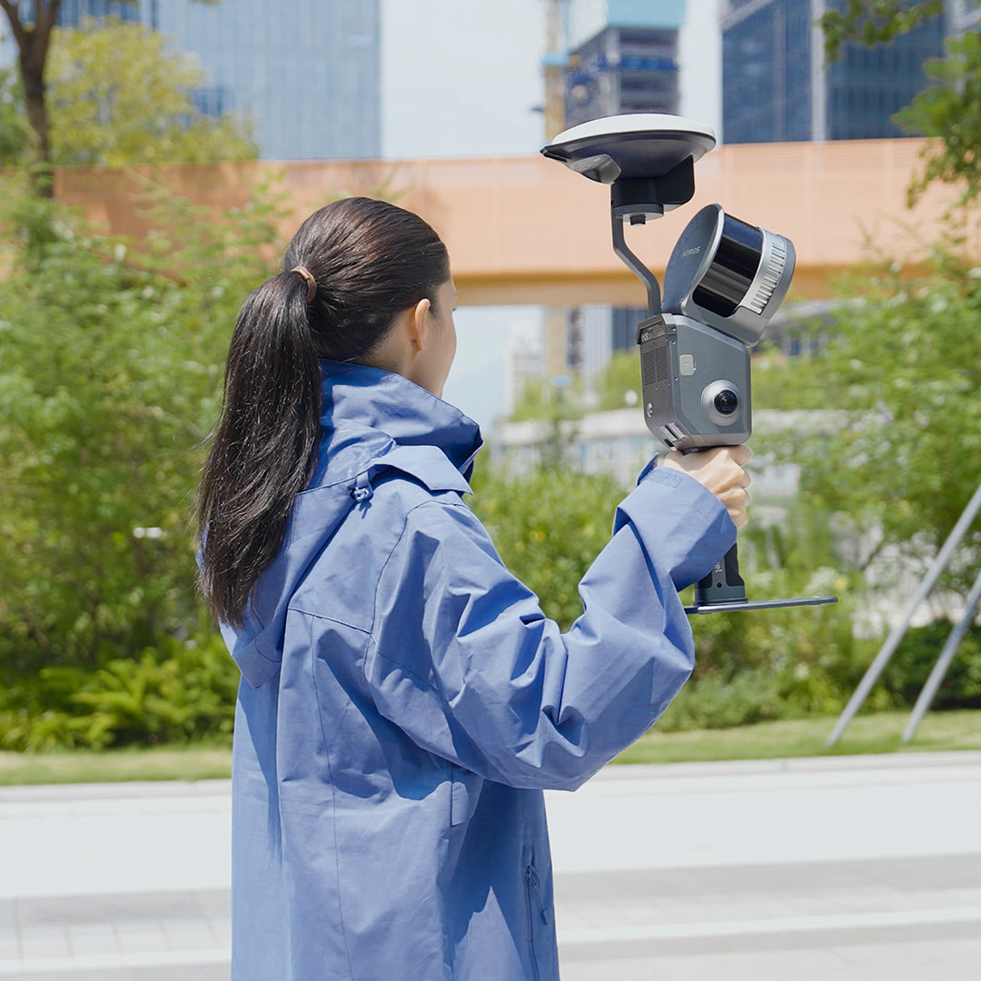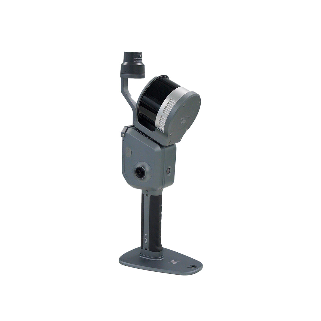
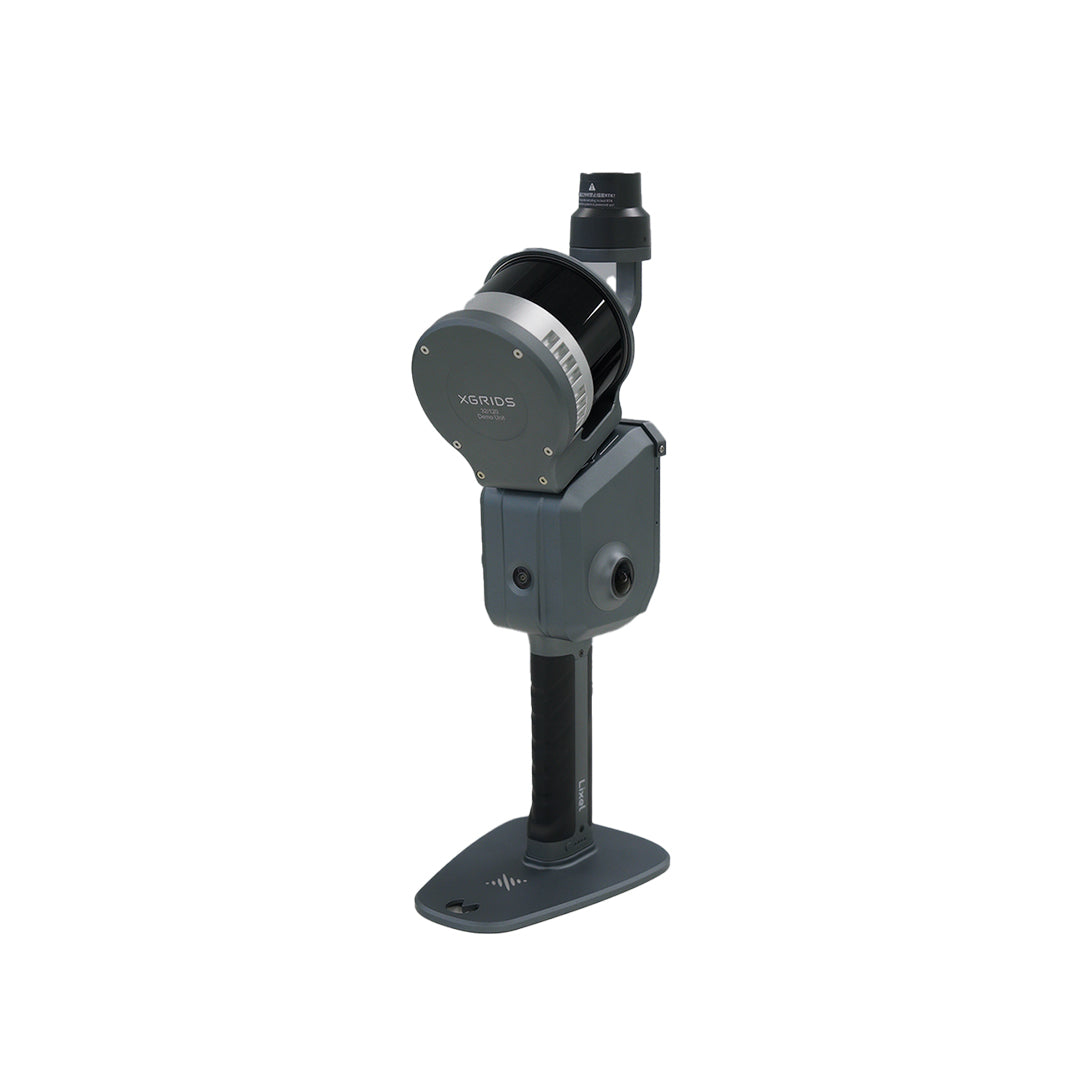

Real-time scanning and modeling device

XGRIDS Lixel L2 Pro Multi-SLAM
PROFESSIONAL MULTI-SLAM
Lixel L2 Pro represents the most advanced solution in portable 3D scanning technology based on MULTI-SLAM technology. This device combines high precision, portability, and an all-in-one integrated design, offering an efficient workflow, from data capture to real-time 3D point cloud reconstruction.
MULTI-SLAM
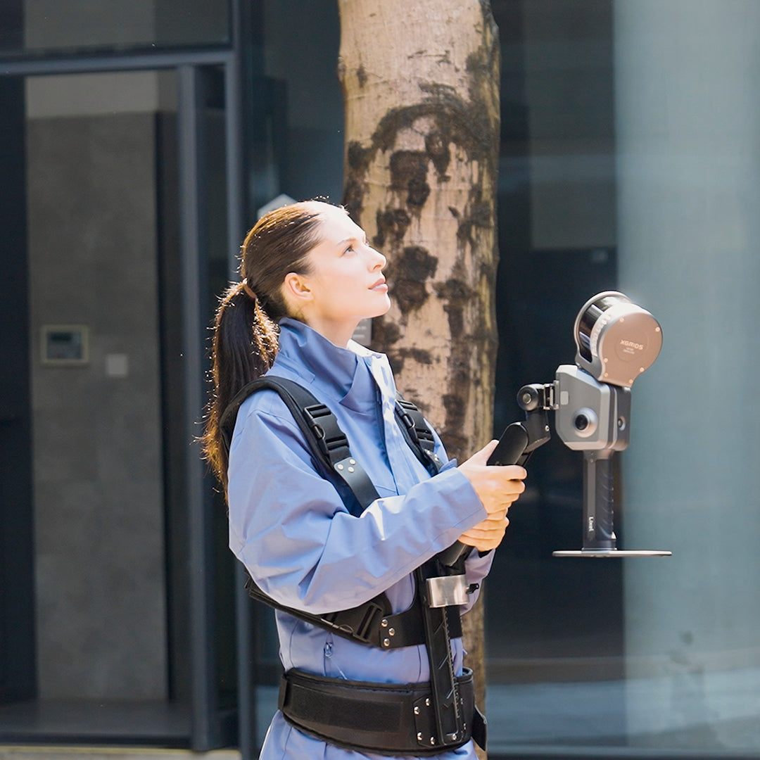
Lixel L2 Pro revolutionizes SLAM captures by integrating LiDAR information, visual data, and inertial sensor information with advanced artificial intelligence algorithms. This innovative processing technique, called MULTI-SLAM, allows the Lixel L2 PRO to take surveying to a higher level, creating realistic and dimensional scenes. Thanks to its adaptability, the equipment operates reliably even in challenging environments, such as underground spaces and tunnels, generating real-time data with exceptional quality and accuracy.
ZERO OFFICE PROCESSING
Lixel L2 Pro not only offers high-precision data through traditional post-processing but also revolutionizes field efficiency by delivering real-time results, ready for export and analysis. Noteworthy for its compact, user-friendly, and highly optimized design, Lixel L2 Pro is a great tool for professionals seeking reliability and productivity in a single device. georeference cloud
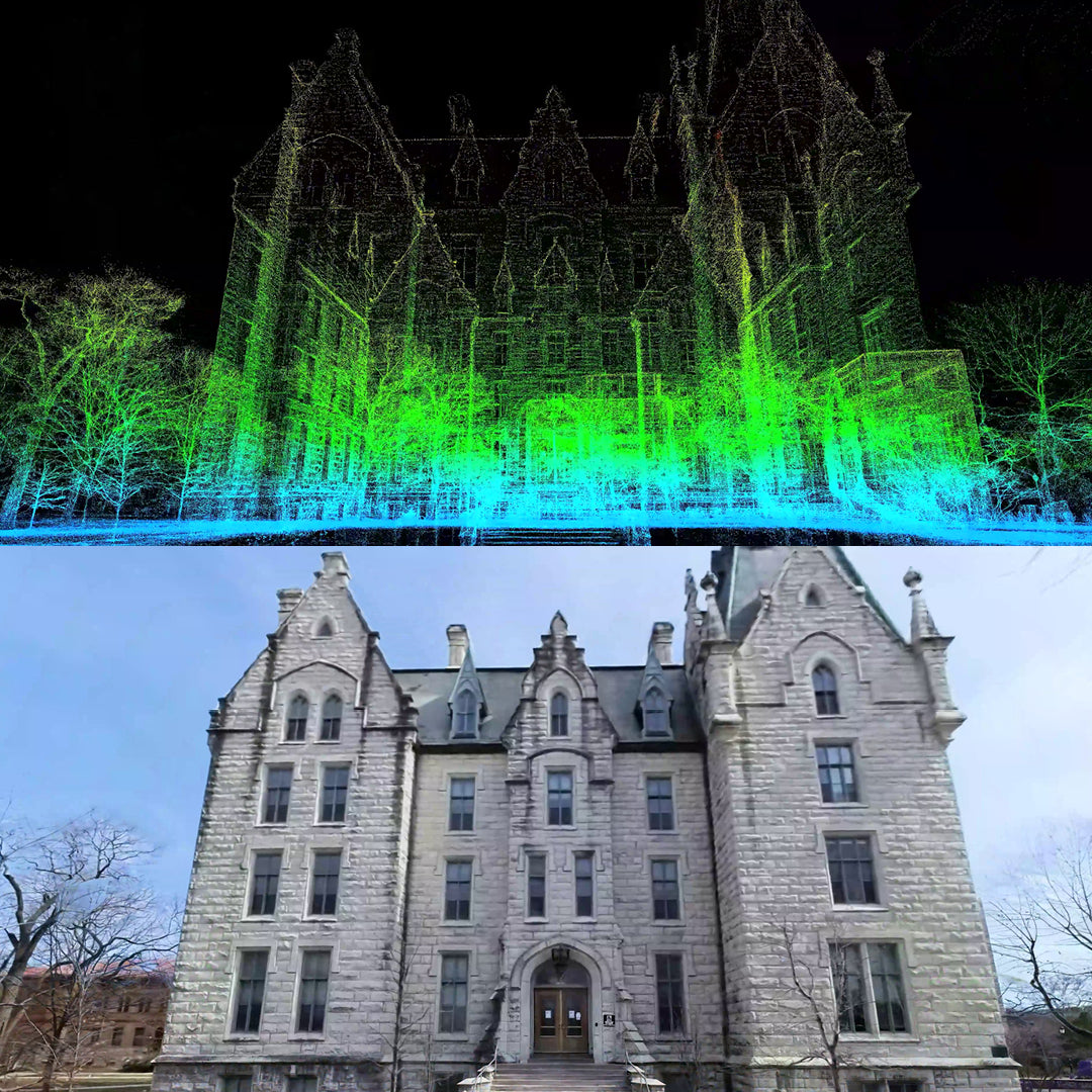
PHOTO-QUALITY POINT CLOUD
Thanks to the exclusive LixelUpSampleTM algorithm developed by Xgrids, the resulting point cloud is significantly optimized, reducing noise to approximately 5 mm after post-processing. Furthermore, the distribution matrix of the points is uniformly organized, ensuring a more precise and homogeneous representation.
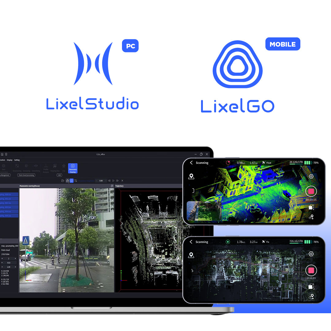
LIXELSTUDIO
LixelStudio is advanced point cloud processing software, powered by cutting-edge SLAM algorithms. It offers 3D point cloud reconstructions with a high level of precision and quality. Additionally, it provides comprehensive tools for visualizing, editing, and processing LiDAR point clouds, integrating specific add-ons tailored to various industries.
With advanced artificial intelligence capabilities, LixelStudio optimizes data processing efficiency and significantly improves productivity, providing innovative solutions to spatial analysis challenges.
LIXELGO
The Lixel Go field application stands out for its intuitive and highly efficient workflow. Designed to control the Xgrids equipment series from a single interface, it allows for one-click operations. With this tool, it is possible to configure workflows, manage scans, monitor battery status, connectivity, and memory capacity, as well as accurately manage captured data using GNSS.
Visualize captured data in real-time, including LiDAR information, images, and true-color point clouds. Everything is designed to maximize performance and accuracy in your field projects.
⨭MULTI-SLAM System
⨭Zero office processing
⨭Dual 48 MP Camera
⨭High-precision inertial sensor
⨭On-site Georeferencing
⨭Integration with GNSS for outdoors


Characteristics
Specifications
Software
Video
Includes:


He also takes
-
GEOCOM Support
Our support team is made up of geomatics engineers specializing in different technologies, with the training and technical experience necessary to advise clients on the use of their products. Visit our support page for more information here.
-
Instrument Rental
Lorem ipsum dolor sit amet, consectetur adipiscing elit, sed do eiusmod tempor incididunt ut labore et dolore magna aliqua. Ut enim ad minim veniam, quis nostrud exercitation ullamco laboris nisi ut aliquip ex ea commodo consequat.
-
Offices
Lorem ipsum dolor sit amet, consectetur adipiscing elit, sed do eiusmod tempor incididunt ut labore et dolore magna aliqua. Ut enim ad minim veniam, quis nostrud exercitation ullamco laboris nisi ut aliquip ex ea commodo consequat.
-
Guarantees
Lorem ipsum dolor sit amet, consectetur adipiscing elit, sed do eiusmod tempor incididunt ut labore et dolore magna aliqua. Ut enim ad minim veniam, quis nostrud exercitation ullamco laboris nisi ut aliquip ex ea commodo consequat.
ZERO OFFICE PROCESSING
MULTI-SLAM
Real-time scanning and modeling device