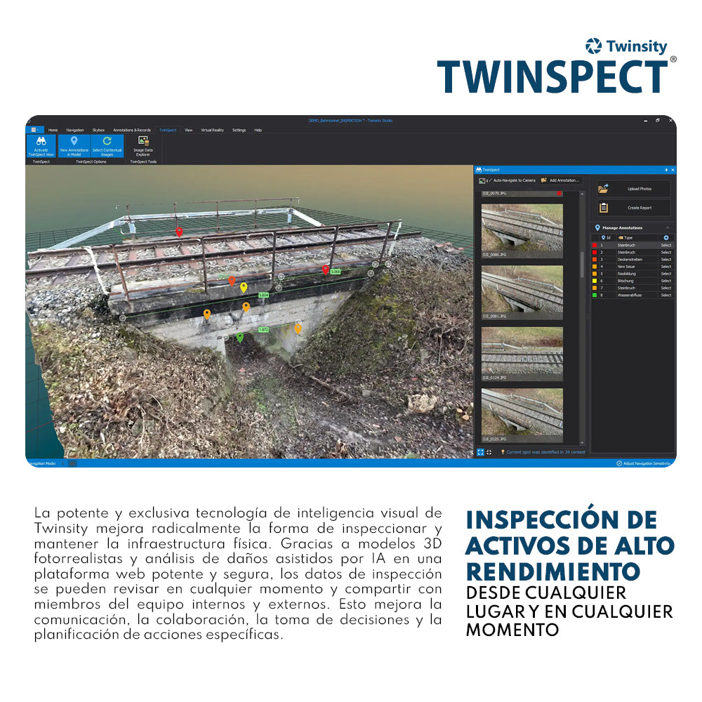
High-performance asset inspection platform

Twinsity Twinspect
High-performance asset inspection platform
From anywhere, at any time
Twinsity's powerful and unique visual intelligence technology radically improves the way physical infrastructure is inspected and maintained. Thanks to photorealistic 3D models and AI-assisted damage analysis on a powerful and secure web platform, inspection data can be reviewed at any time and shared with internal and external team members. This improves communication, collaboration, decision-making, and targeted action planning.
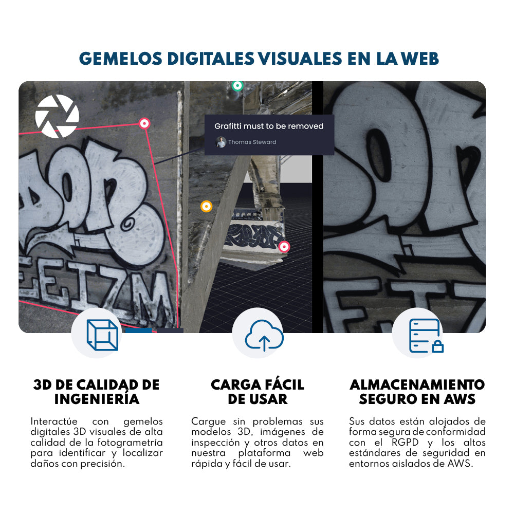
Visual Digital Twins on the Web
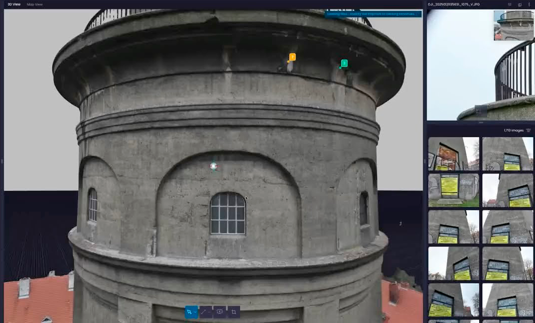
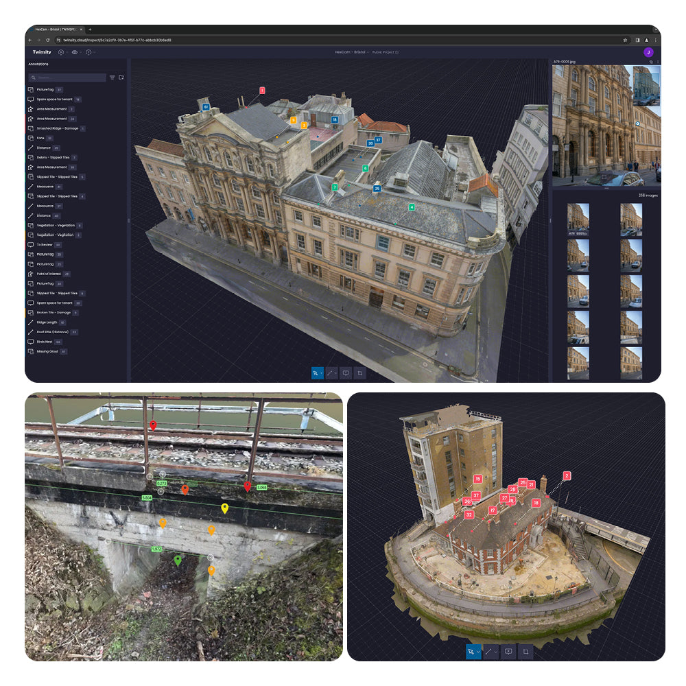
Twinsity allows expert teams to interactively access, inspect, and analyze high-fidelity 3D asset models and high-quality drone inspection images. This means maximum quality and no detail will be overlooked. Complex and massive assets are its strong suit.
• Photorealistic 3D models
Visualize, share, and analyze highly detailed 3D photogrammetry models from leading brands like Metashape, ContextCapture, Reality Capture, and DJI Terra, with no loss of quality and maximum resolution.
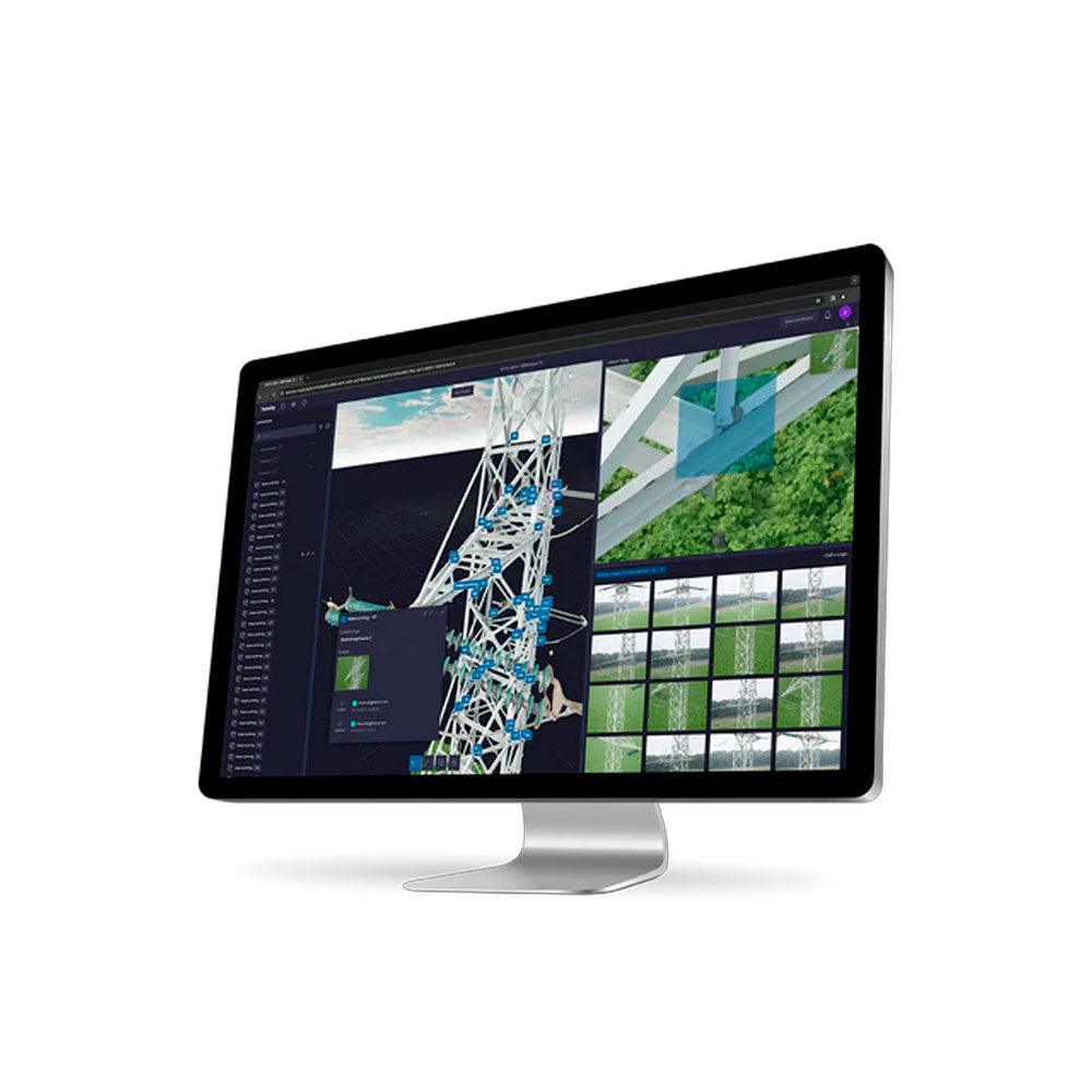
• Georeferenced 3D Models
Upload models with exact spatial information for precise alignment and the ability to view your model's location, related images, annotations, and AI detections in the project map space.
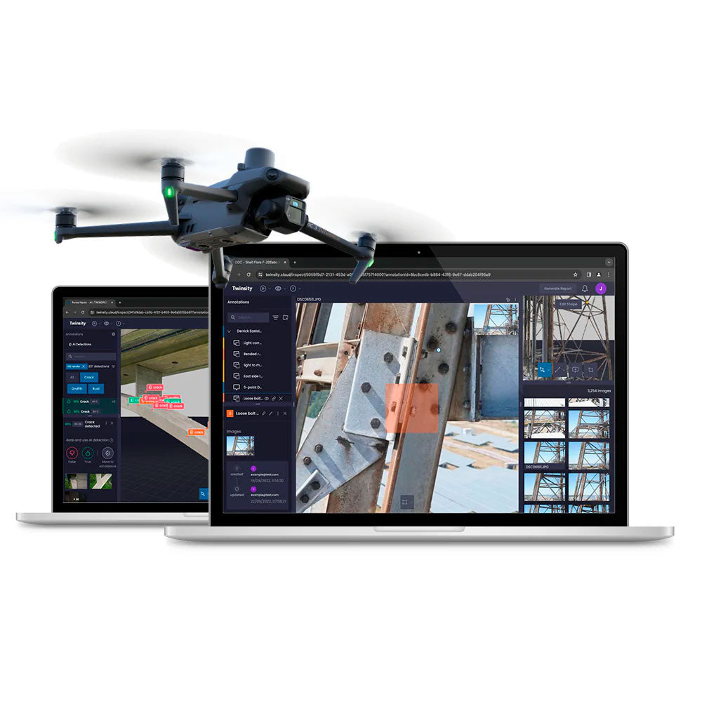
• AI-assisted defect detection
Powerful deep learning models of state-of-the-art artificial intelligence help experts analyze RGB images and 3D reality models to create their own AI model based on their detection needs.
• High-resolution drone inspection images
Manage, store, and analyze high-resolution inspection images in sync with 3D reality models. This way, we help expert technicians maintain their current workflows.
• Customizable annotations
Inspection teams can define custom annotation templates with their own attributes, fields, and records to support diverse logging formats and inspection standards.
• Detailed inspection reports
Automatic generation of inspection reports in various formats, including all relevant annotations and measurements, as well as high-resolution images and summaries.
• Annotation and measurement tools
Tag and measure defects and other records directly on the 3D reality model or in the original images. All records will be synchronized and tagged across all images and 3D models.

Characteristics
Specifications
Video
Includes:

He also takes
-
Consulting
Our team is ready to help you overcome any challenge in your projects. We have specialists with real technical training, who will guide you to integrate the exact solution your operation needs. Get advice from us via WhatsApp here
-
After-sales (Support and Technical Service)
We provide immediate technical support through our engineers to advise you on using your equipment to its maximum potential. Contact us to schedule your Technical Support via WhatsApp, or visit our Specialized Support portal to resolve operational queries.
-
News
Always stay one step ahead with the latest innovations in geospatial technology. Learn about new product launches, exclusive events, and technical talks designed to optimize your solutions. Discover all our news on the GEOCOM Blog